At my lovely Colorado cabin @ 8,500 feet
At my lovely Colorado cabin @ 8,500 feet

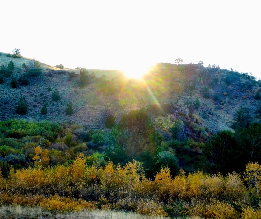
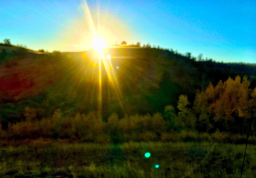
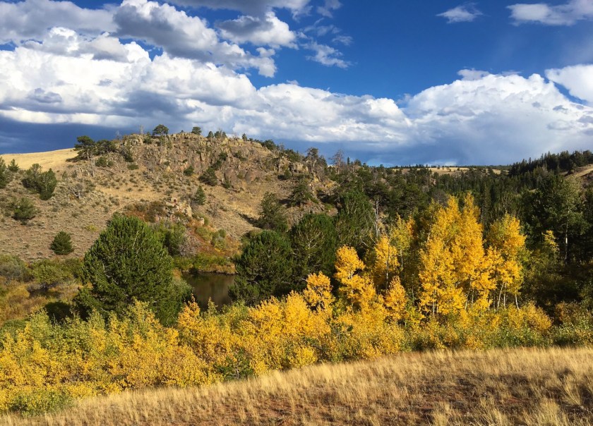
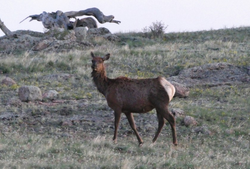
Autumn at the cabin. Elk are bugling and aspens are beginning to turn golden.
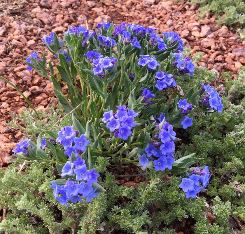
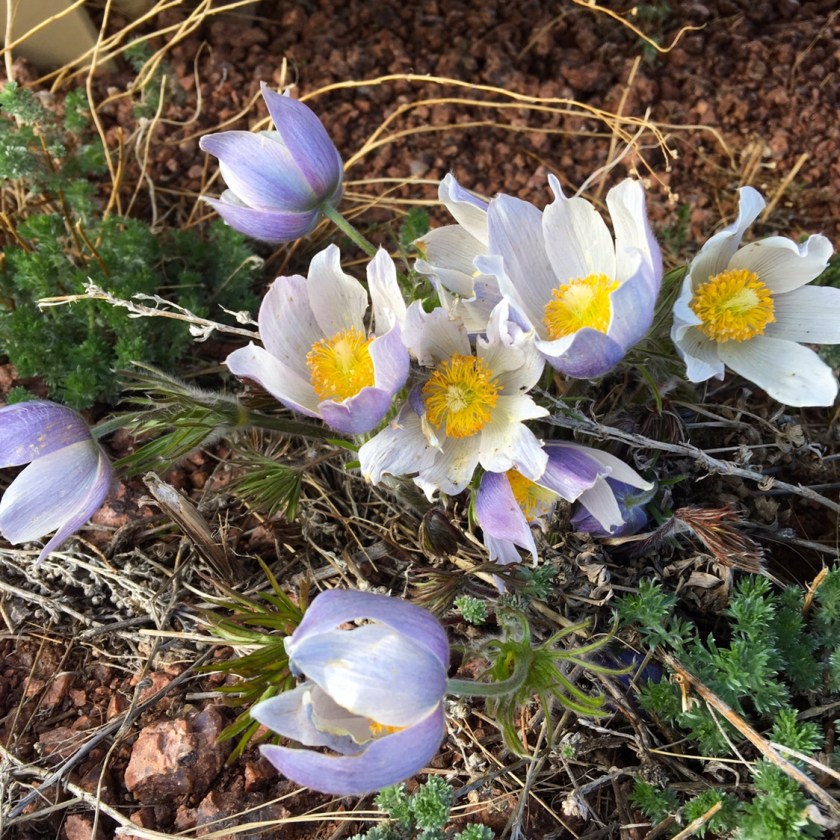
It is now officially spring at 8,500 feet in Colorado.
I saw lots of American Pronghorn antelope and a golden eagle on the drive in to my cabin. Four elk and two antelope met me in the front yard as I arrived. Two geese appear to be nesting at the beaver pond, and I’m hoping for a new crop of “young ‘uns”.
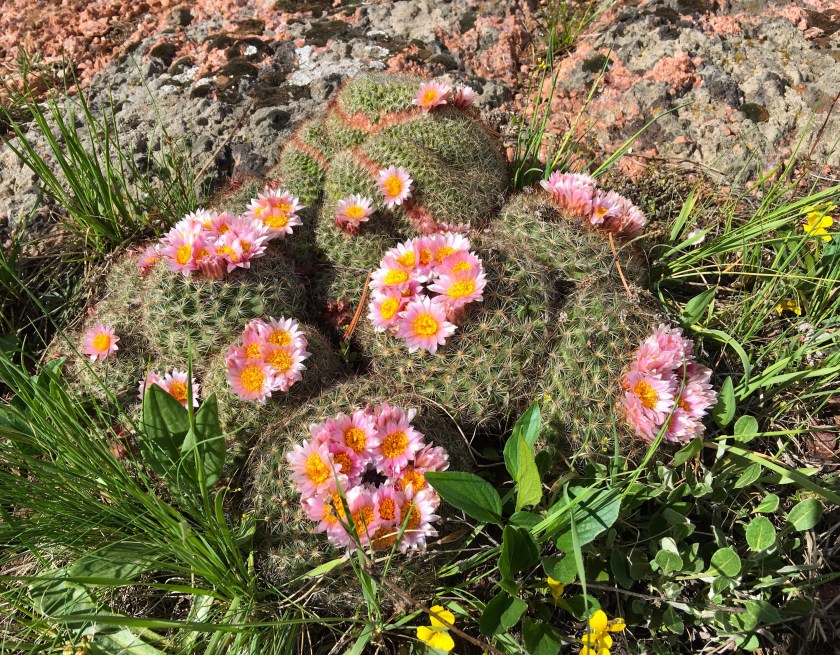
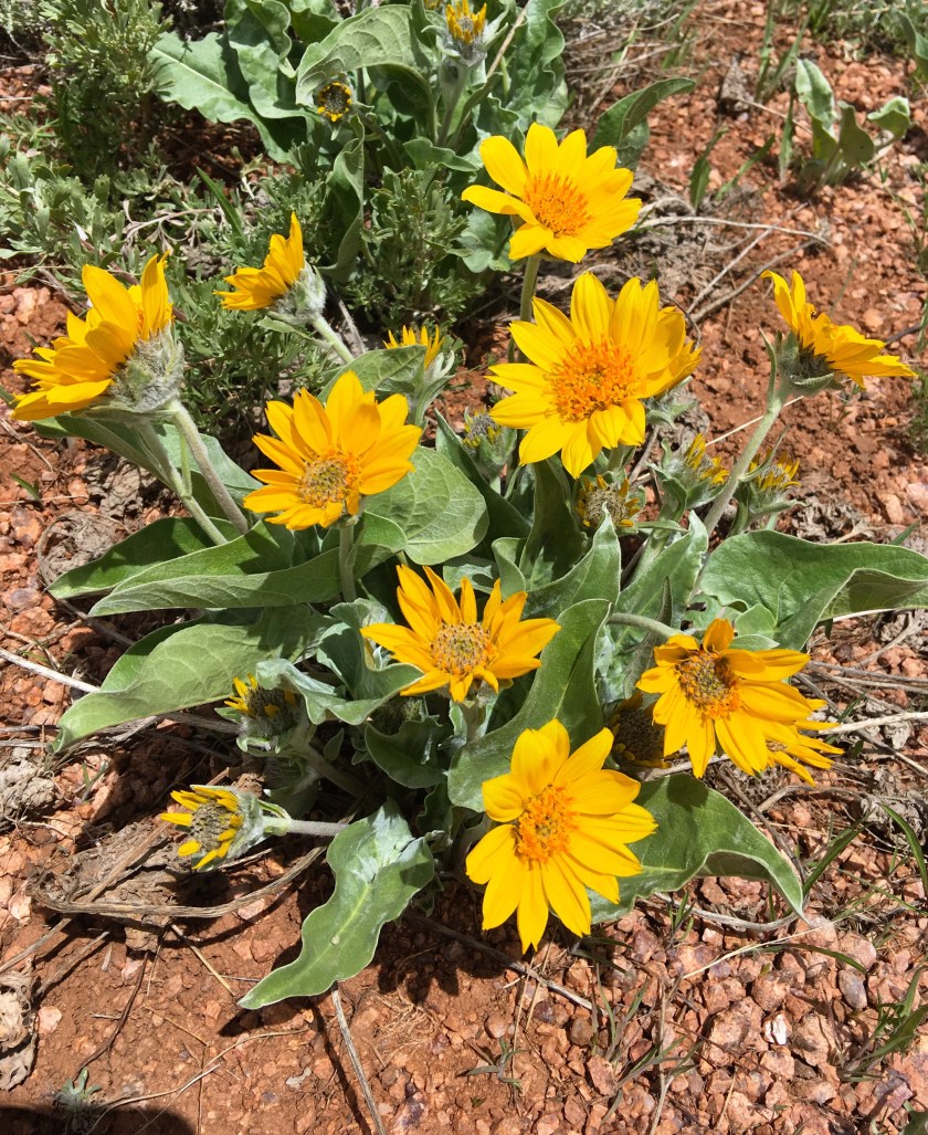
Alpine Forget-Me-Nots, Hedgehog Cactus, Arrow-leaf Balsam Root and Western Pasque Flower are in bloom. Broad Tail Hummingbirds and Mountain Blue Birds have returned – the hills are alive!
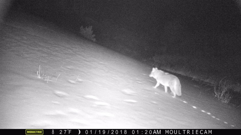
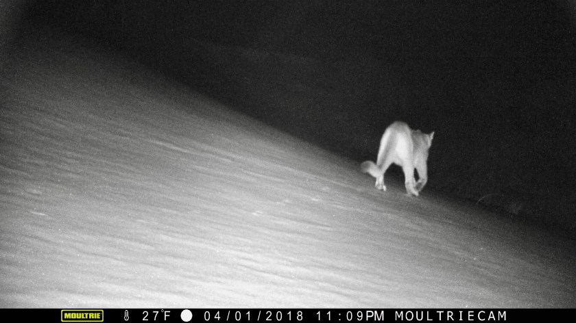
Some surprises in the game camera keep things interesting 🦁
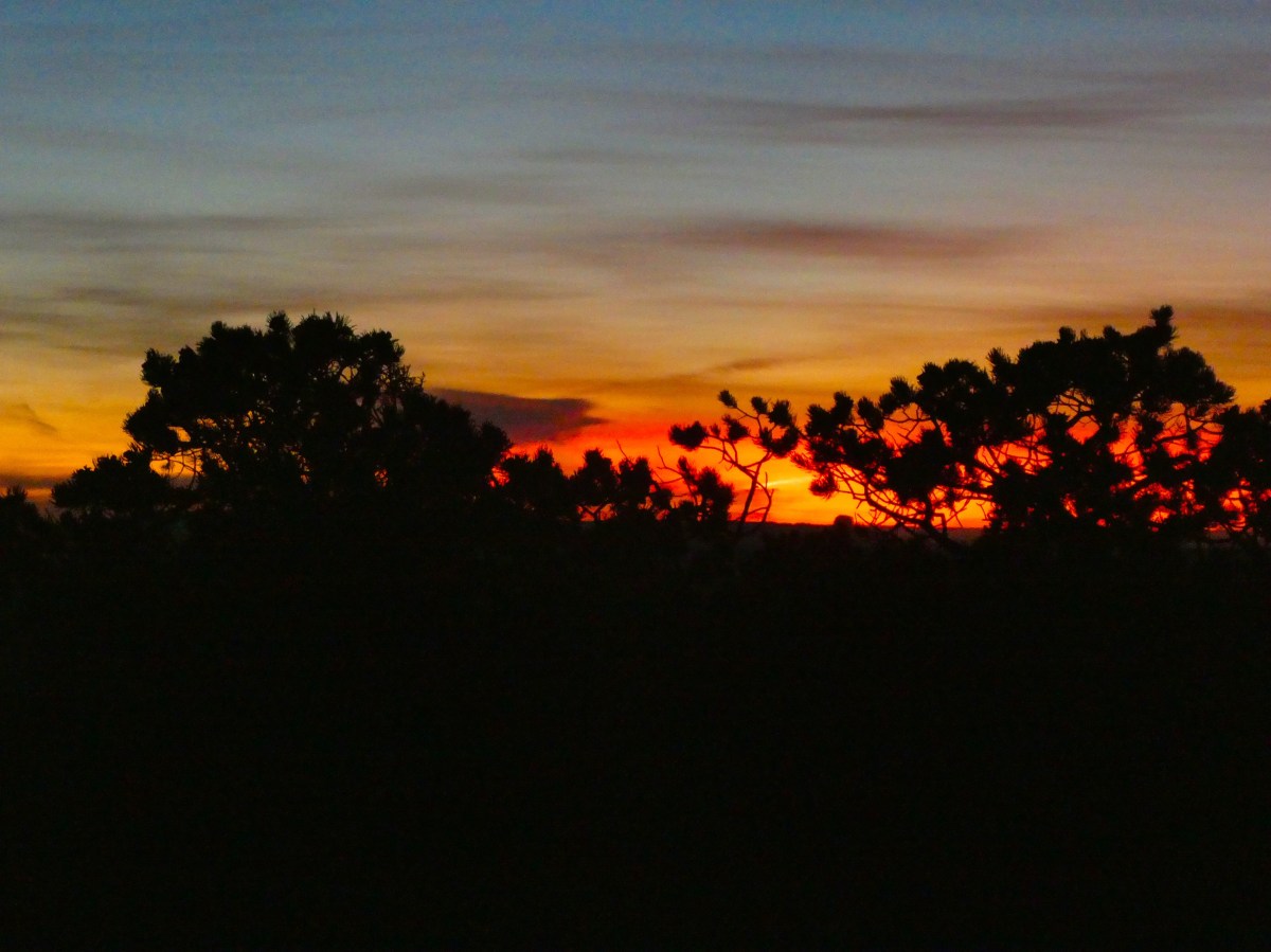
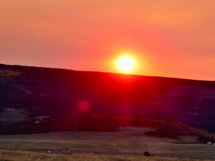
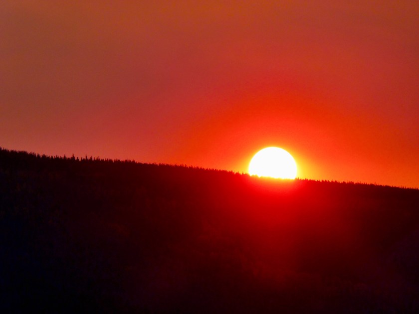
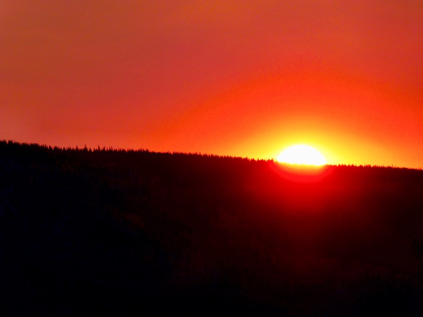
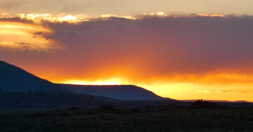
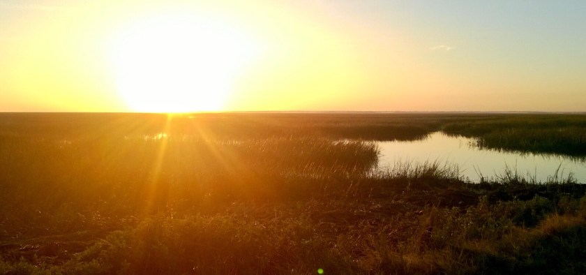
Lovely sunsets each evening . Wish you were here !

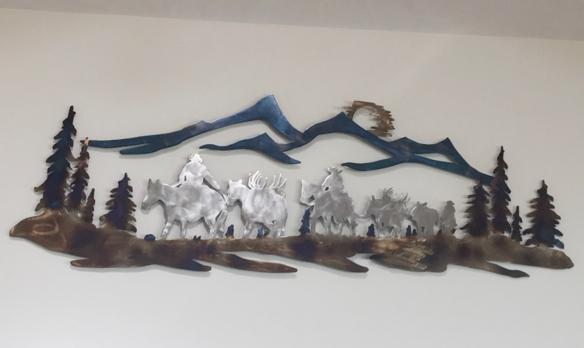
Installing new art at our cabin


Oh what fun it is to ride…🎶
 Since our grandson’s family would not be with us during this Christmas holiday, Sally proposed a road trip to celebrate her birthday and Christmas with her twin sister Julie in Savannah, Georgia. When older sister Jo disclosed her intention to also join us in Savannah, the trip plan was locked in.
Deciding to take our camper to make a grand sight-seeing / camping tour, we determined to stop in St Louis to visit friend Doris, re-explore the Great Smoky Mountains National Park, the Blue Ridge Parkway and visit cousin Jackie in Tennessee. On the return from Savannah, we planned to bask in the sunshine throughout the warm sunny south, touring the Natchez Trace, antebellum mansions in Natchez itself and finally do some camping and hiking on the Ozark Mountains of Missouri and Arkansas.
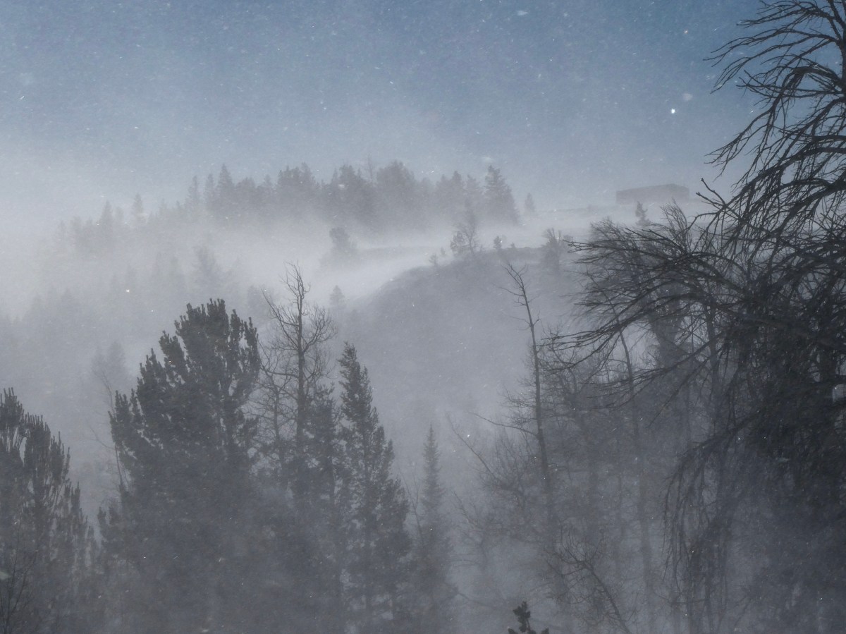
Most of our plans came to fruition however, due to unseasonable cold weather bringing snow and ice to portions of our intended route, we had to make some changes and regrettably our shorts and sandals never were unpacked.


Driving across Kansas and stopping in Saint louis, we spent a couple of nights with our friend Doris who lived across the hall from us in Shanghai, China.
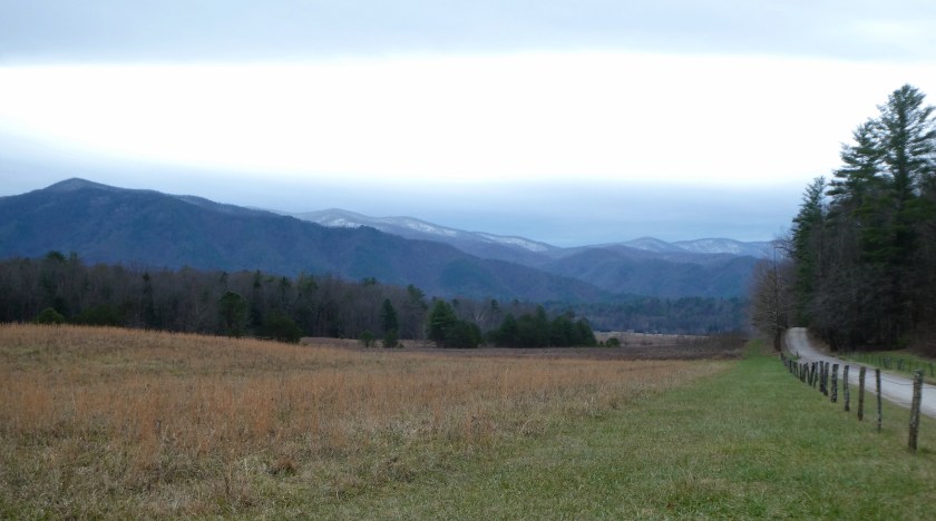
Continuing on, we arrived in the Great Smoky Mountains National Park as the temperatures began to drop and the clouds rolled in.


Grizzlies and Wolves and Elk, Oh My!
My son-in-law, Ben, and I recently returned from a guided horseback elk hunt with Lynn Madsen, at Yellowstone Outfitters, Afton, Wyoming. It was incredible!
Here’s what Lynn has to say about his outfit:
“Our Hawks Rest Camp is located in the Teton Wilderness northeast of Jackson…It sets off the southeast corner of Yellowstone Park between the Yellowstone and Thorofare Rivers (Area 60 on a Game & Fish map). It is one day-pack 28 miles, from our base camp at Turpin Meadows…The Hawks Rest camp holds the reputation of being the furthest spot in the continental United States from a road in any direction. Not only will you be hunting in one of the best trophy elk camps in the United States but you will also be hunting in country that looks the same as it did 100 years ago.
Our fully equipped camp consists of a large cook tent, shower tent, sleeping tents with cots, foam mattresses, and wood burning stoves along with plenty of fire wood. We are proud to say that our camps hold an excellent reputation earned by hiring reputable licensed guides, maintaining a clean comfortable camp, serving good food and supplying both good horses and mules and equipment.”
Well, our experience lived up to Lynn’s promotional material and then some. We had a “once in a lifetime” experience. Read on, if you are interested in the details.
Ben flew in from California and the following day we made the 8 hour drive from Fort Collins, Colorado to Jackson, Wyoming, where we spent the night. You can fly into Jackson’s small airport, but it’s kinda expensive and you have to pay hundreds of dollars to ship your elk meat back home, so driving seemed like the frugal option. Besides we were able to enjoy each other’s company and the lovely Wyoming scenery as we motored along.
On Monday morning October 9th we rose early, ate breakfast and made the 1 hour drive north and East to Turpin Meadows where we met Lynn, our guide, four other hunters and were introduced to our horses who would become our new and closest friends for almost 10 hours today.
Lynn provided quality, well cared for horses that are a cross between big, strong draught horses (for strength and stamina) and quarter horses (to reduce the size). They are still really big, tall horses and getting a leg up into the stirrup was my yoga/stretching challenge each time we mounted. Getting off was no issue, but is was a long way down.

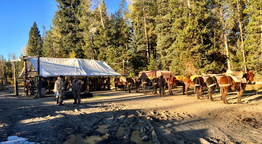
Heading up the mountain, we were passed by Lynn’s string of mules bringing our gear and replenishing needed supplies. On the way in we passed several sets of grizzly and wolf tracks.


Continue reading “An “Old-Fashioned” Wyoming Horseback Elk Hunt”

Antelope Canyon is located near Page on Navajo Nation land, just outside Glen Canyon National Recreation Area. Antelope is the most visited slot canyon in the Southwest, partly because it is easily accessible and by far the most publicized, and also since it is extremely beautiful, with just the right combination of depth, width, length, rock color and ambient light; many other slot canyons are deeper, narrower or longer, and some have rock that is even more colorful and sculptured, but here conditions are ideal.”


“Antelope Canyon was formed by erosion of Navajo Sandstone, primarily due to flash flooding and secondarily due to other sub-aerial processes. Rainwater, especially during monsoon season, runs into the extensive basin above the slot canyon sections, picking up speed and sand as it rushes into the narrow passageways. Over time the passageways eroded away, making the corridors deeper and smoothing hard edges in such a way as to form characteristic “flowing” shapes in the rock.”


Navajo National Monument is a National Monumentlocated within the northwest portion of the Navajo Nation territory in northern Arizona, which was established to preserve three well-preserved cliff dwellings of the Ancestral Puebloan People: Broken Pottery (Kitsʼiil), Ledge House (Bitátʼahkin), and Inscription House (Tsʼah Biiʼ Kin). The monument is high on the Shonto plateau, overlooking the Tsegi Canyon system, west of Kayenta, Arizona. It features a visitor center with a museum, two short self-guided mesa top trails, two small campgrounds, and a picnic area. Rangers guide visitors on free tours of the Keet Seel and Betatakin cliff dwellings.“

After a short hike to view the Betatakin cliff dwelling, we settled into our lovely campsite for the evening. This time of year, the campground was nearly empty and is always free of charge!


Sedona is an Arizona desert town near Flagstaff that’s surrounded by red-rock buttes, steep canyon walls and pine forests. It’s noted for its mild climate and vibrant arts community. Uptown Sedona is dense with New Age shops, spas and art galleries. On the town’s outskirts, numerous trailheads access Red Rock State Park, which offers bird-watching, hiking and picnicking spots.
Dramatic sandstone formations such as Cathedral Rock and Bell Rock appeal to photographers and enlightenment-seekers, as does the modernist Chapel of the Holy Cross, built into rust-colored rocks. Oak Creek Canyon has trails for hiking and mountain biking, plus sites for camping and fishing. Part of the canyon is home to Slide Rock State Park, named for its natural water chutes, popular for swimming. Native American petroglyphs can be seen in the Coconino National Forest heritage sites V Bar V, Palatki and Honanki (the latter 2 also feature cliff dwellings).


After visiting one of the four famous Sedona vortexes, we enjoyed a beautiful 4.5 mile sunset hike around Tabletop Mesa.

There is no other hike in the Sedona area that offers such awe-inspiring views as the Sedona Airport Mesa Loop Trail. It offers hikers a 360-degree panorama with views of almost every major red-rock landmark along the perimeter at an elevation of 4,500 feet.


With 3 million acres of wilderness, Death Valley is the largest national park outside Alaska. Elevations in the park range from -282 feet below sea level at Bad Water (the lowest point in North America), to 11,049 feet at Telescope Peak. The park encompasses 3.3 million acres and normally enjoys summer temperatures in the 110’s and 120’s, but also experienced a record temperature of 134 degrees Fahrenheit. It is considered the hottest place on earth and the driest place in the United States.
Of the more than 900 plant species found, 19 are unique to this area.
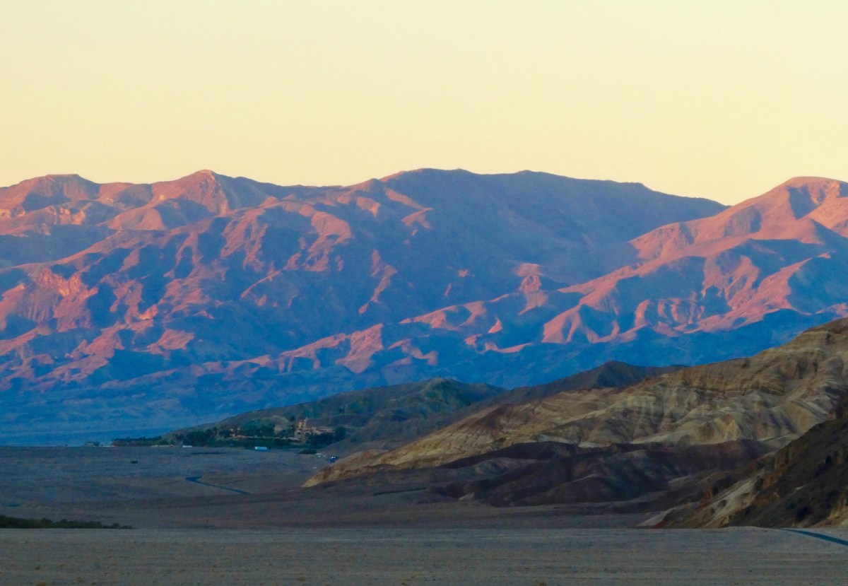
Driving in from the south as the sun sets, we make our way up a narrow winding road to the Wildrose Campground at 4,100 ft elevation. The mountains being much cooler than the surrounding desert, the temperature dropped quickly from 72 degrees, down to a low of 31 degrees in the early morning.

Up early at Wildrose Campground, we drove the dirt road up Wildrose Canyon toward the Charcoal Kilns and Mahogany Flats.
The 25’ high Charcoal Kilns were used to produce charcoal to smelt lead and silver from local ore mined beginning in 1877, and ceased operations shortly afterward.


After the Kilns, the 4WD Road gets a bit rough, climbing to the Mahogany Flats Campground and the road’s end at 8,133 ft.


Returning the way we came, we head for the Visitor’s Center to view the exhibits and plan a sunset photo tour of the park.
On the way, we encounter a small herd of feral donkeys, turned loose after mining operations ceased in the late 19th century.


From the Visitor’s Center we set out for Bad Water Basin and Artists Drive before the sunset. On the way we pause at the Harmony Borax Works and an example of the “20 Mule Team” borax mining transportation and extraction methods.

Next stop: Badwater Basin
Badwater Basin is an endorheic basin in Death Valley National Park, noted as the lowest point in North America, with a depth of 282 ft (86 m) below sea level. Mount Whitney, the highest point in the contiguous 48 United States, is only 84.6 miles (136 km) to the northwest.
The site itself consists of a small spring-fed pool of “bad water” next to the road in a sink; the accumulated salts of the surrounding basin make it undrinkable, thus giving it the name.


From Bad Water we quickly travel to Artists Drive to attempt to capture the beautiful mineral colors in the hot light of sunset.
Artist’s Drive rises up to the top of an alluvial fan fed by a deep canyon cut into the Black Mountains. Artist’s Palette is an area on the face of the Black Mountains noted for a variety of rock colors. These colors are caused by the oxidation of different metals (iron compounds produce red, pink and yellow, decomposition of tuff-derived mica produces green, and manganese produces purple).
Called the Artist Drive Formation, the rock unit provides evidence for one of the Death Valley area’s most violently explosive volcanic periods. The Miocene-aged formation is made up of cemented gravel, playa deposits, and volcanic debris, perhaps 5,000 feet (1500 m) thick. Chemical weathering and hydrothermal alteration cause the oxidation and other chemical reactions that produce the variety of colors displayed in the Artist Drive Formation and nearby exposures of the Furnace Creek Formation.

Artists Palette


Artists Drive is a very narrow one-way road restricted to vehicles less than 25 feet in length.

Alas, dusk put an end to our photographic endeavors, but a sunset dinner back at our campsite provided more than adequate recompense.

There is so much to experience in Death Valley and we have barely scratched the surface. We will undoubtedly return!
Tomorrow, on to Flagstaff and Sedona Arizona.