“Chicken is a community founded on gold mining and is one of the few surviving gold rush towns in Alaska. The population was 7 at the time of the 2010 Census, down from 17 in 2000. However, usually year round, there are 17 inhabitants. Due to mining, Chicken’s population peaks during the summer. It has frequently been noted on lists of unusual place names.
Chicken was settled by gold miners in the late 19th-century and in 1902 the local post office was established requiring a community name. Due to the prevalence of ptarmigan in the area that name was suggested as the official name for the new community. However, the spelling could not be agreed on and Chicken was used to avoid embarrassment. “
The Chicken Annual Music Festival was happening in Chicken, otherwise not much to see other than Chicken jokes and costumes
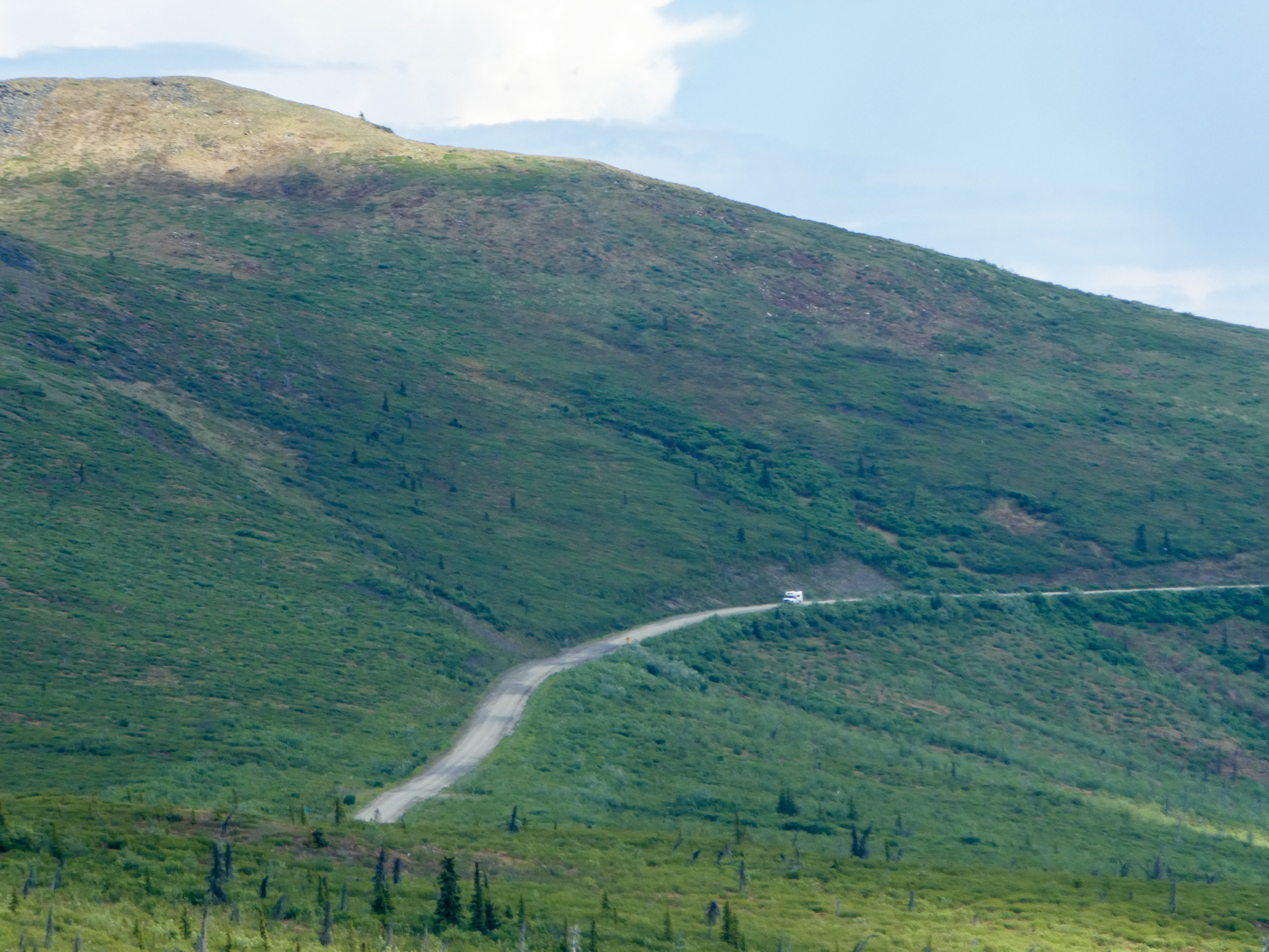
“Between Chicken and Eagle, the Taylor Highway is narrow, winding, gravel road with many steep hills and some hairpin curves. The road from Jack Wade Junction to Eagle is not recommended for RVers. “
We reached Chicken via the Taylor Highway, shortly thereafter, turned onto the Top Of The World Highway, then turned north to check out Eagle,
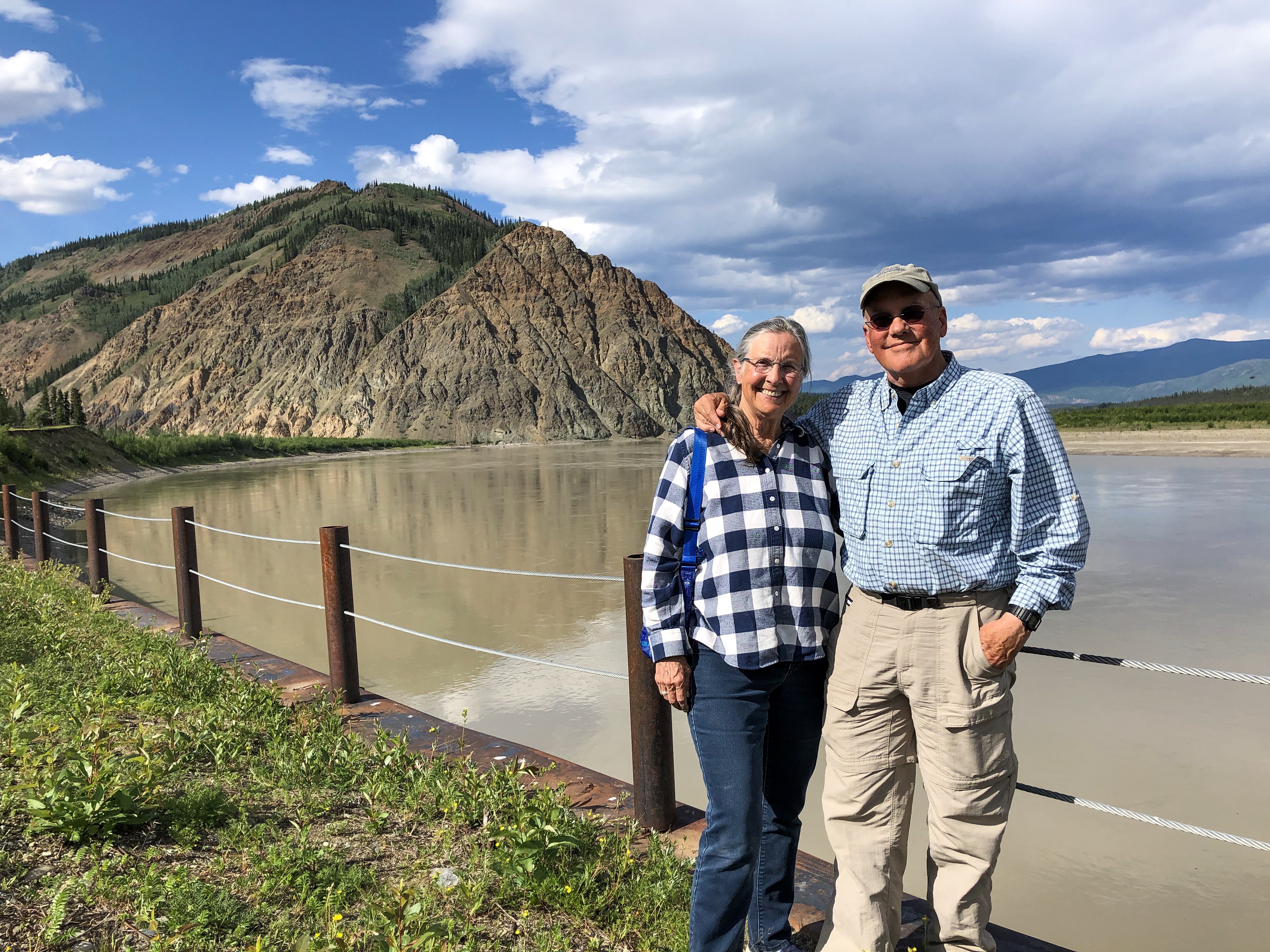
“From Chicken, it’s just another 90 miles of driving to one of Alaska’s oldest towns, Eagle; but the drive usually takes at least three hours, thanks to the rough road”. (It took us 3.75 hours).
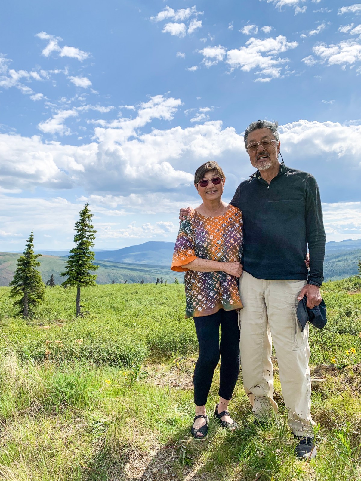
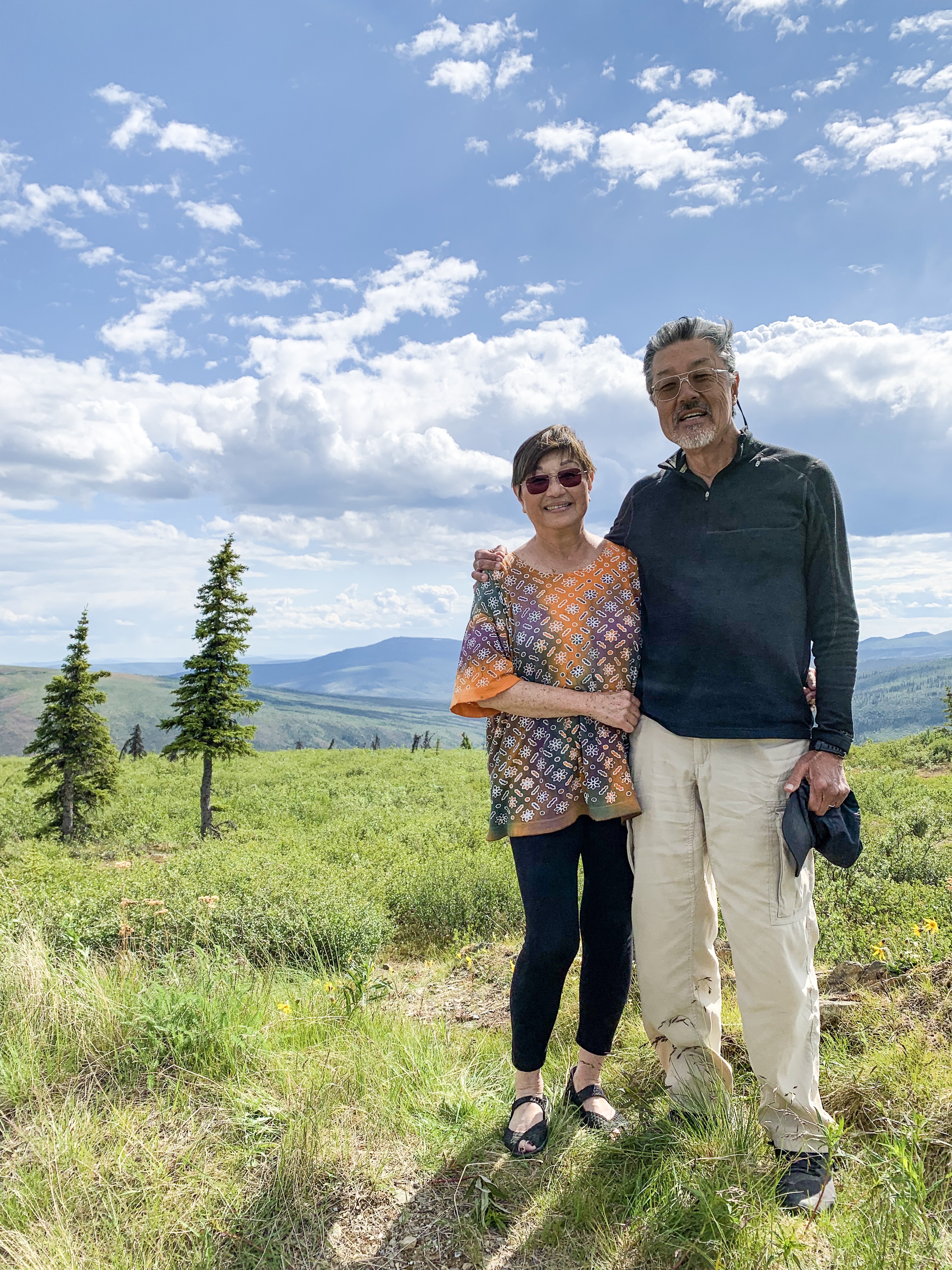
Top of the World Highway We can see for miles and miles….Sally on top of the world
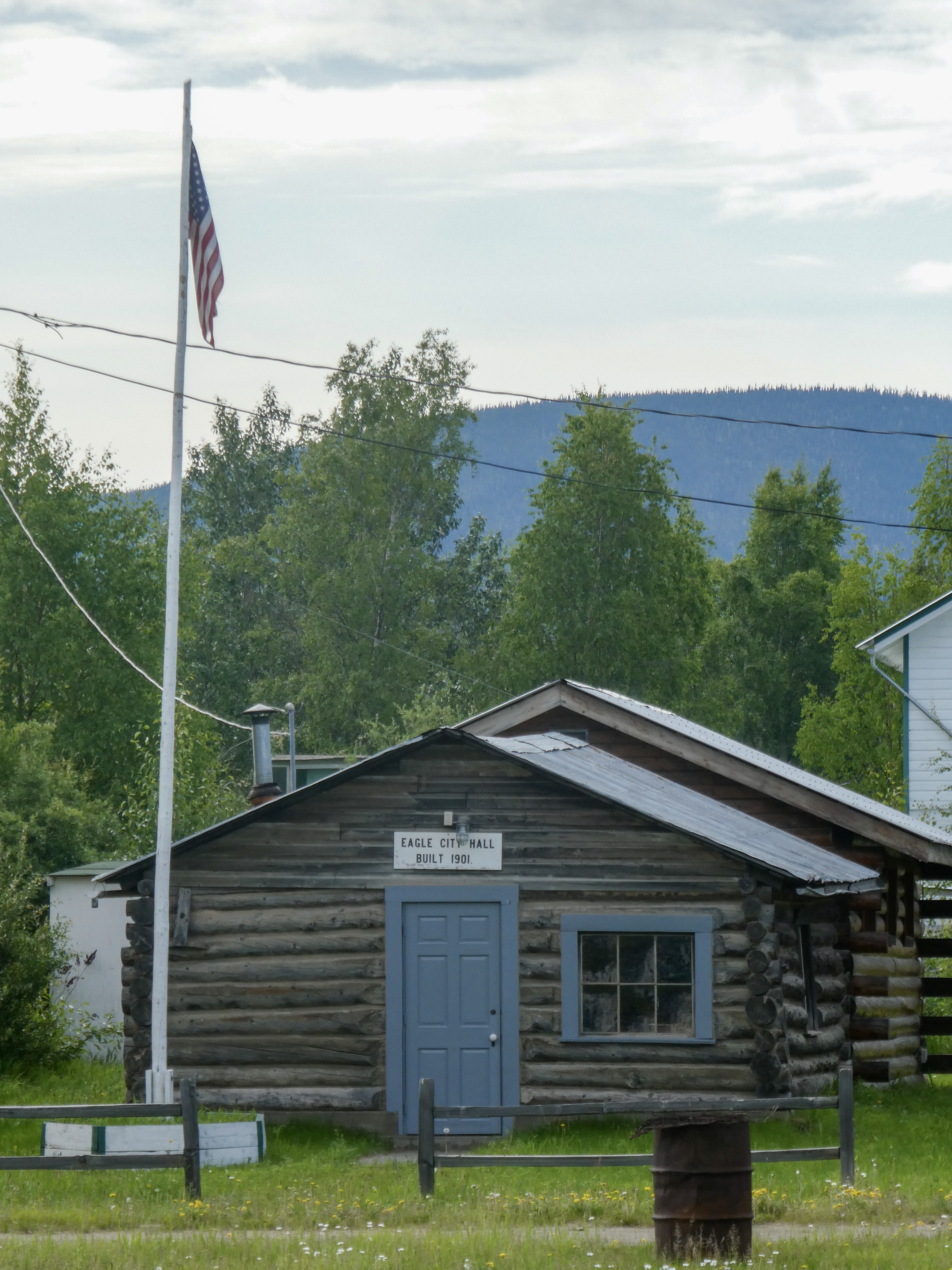
“Eagle is a city on the south bank of the Yukon River near the Canada–US border in the Southeast Fairbanks Census Area, Alaska, United States. It includes the Eagle Historic District, a U.S. National Historic Landmark. The population was 86 at the 2010 census. Every February, Eagle hosts a checkpoint for the long-distance Yukon Quest sled dog race.”
“The first permanent American-built structure in present-day Eagle was a log trading post called “Belle Isle”, built around 1874. In the late 1800s, Eagle became a supply and trading center for miners working the upper Yukon River and its tributaries. By 1898, its population had exceeded 1,700, as people were coming into the area because of the Klondike Gold Rush.
In 1901 Eagle became the first incorporated city in the Alaska Interior. It was named for the many eagles that nested on nearby Eagle Bluff. A United States Army camp, Fort Egbert, was built at Eagle in 1900. A telegraph line between Eagle and Valdez was completed in 1903. In 1905, Roald Amundsen arrived in Eagle and telegraphed the news of the Northwest Passage to the rest of the world. The gold rushes in Nome and Fairbanks lured people away from Eagle.“
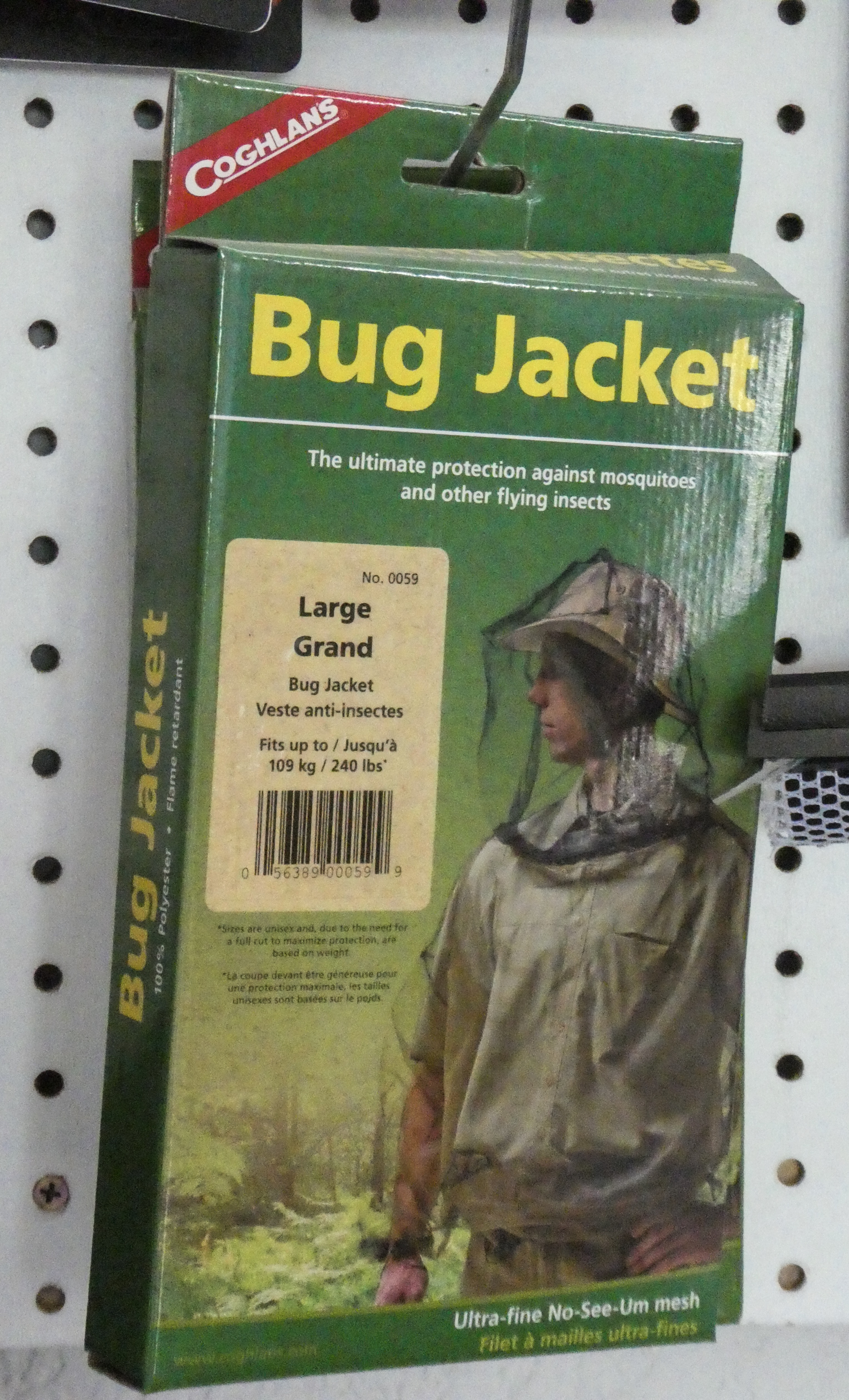
Before exploring Eagle, we found campsites in a BLM campground. Immediately after opening the car door, the mosquitoes descended upon us. Only a couple other places in Alaska were as mosquito infested as Eagle.
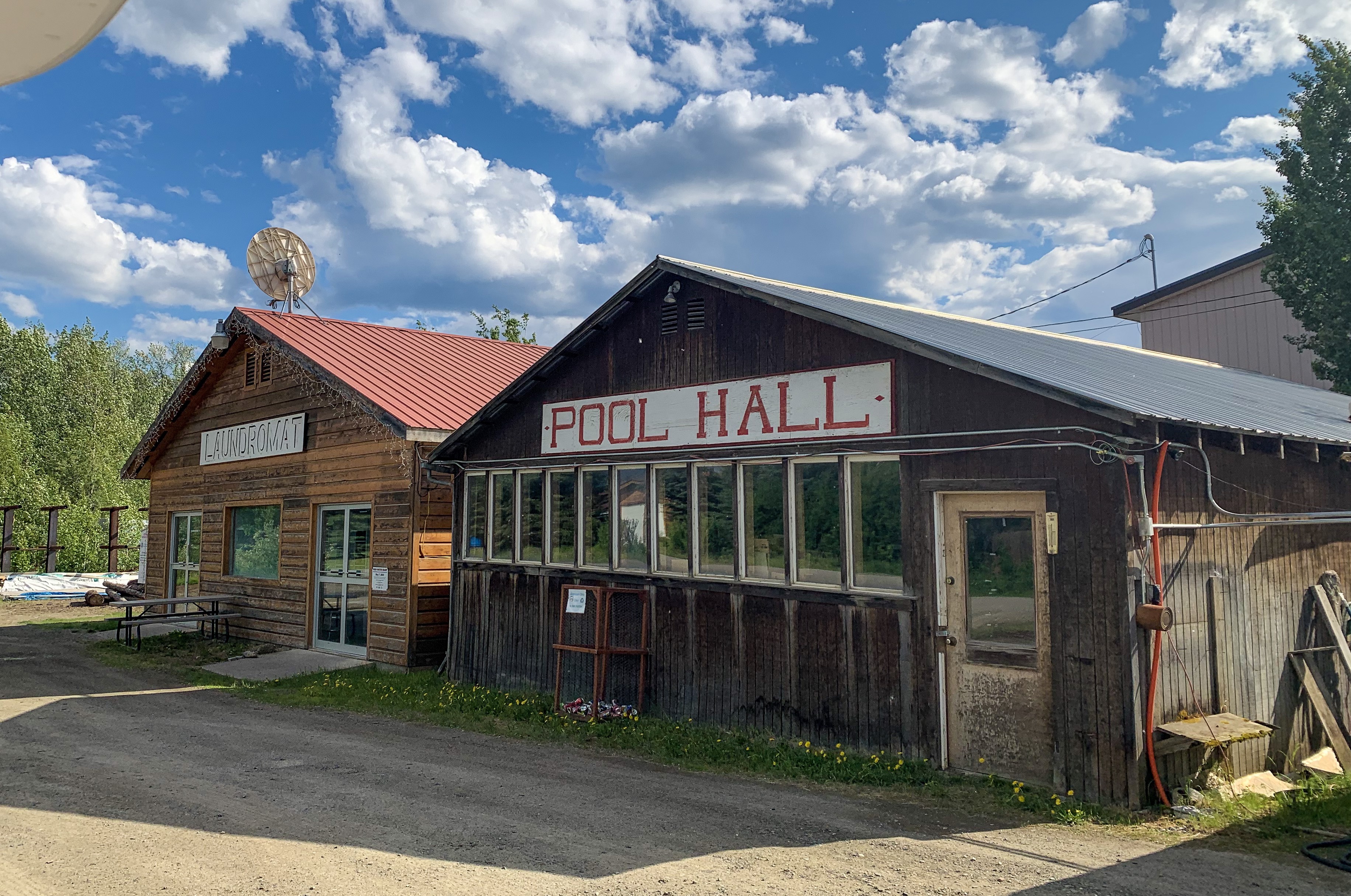
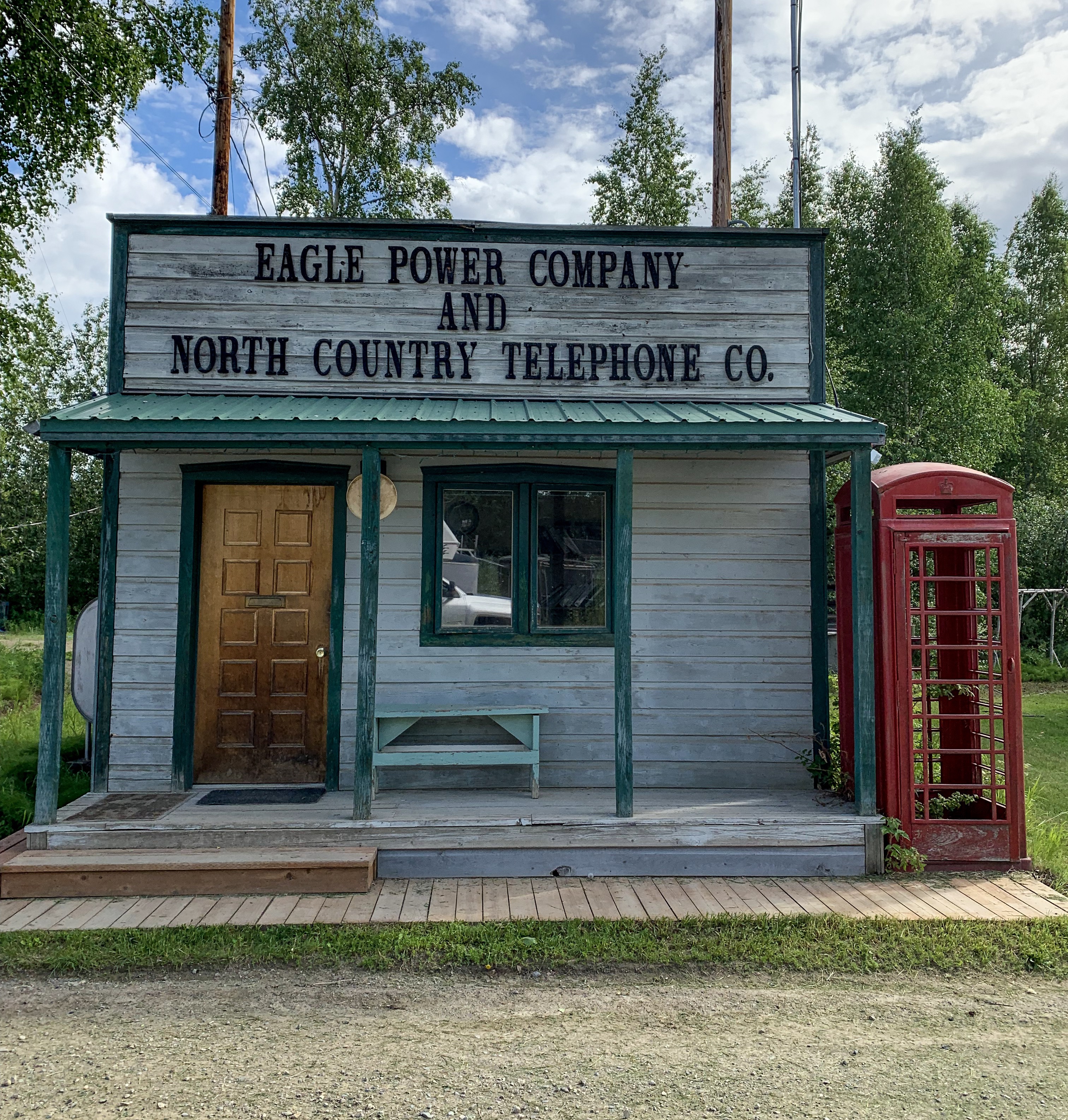
Critical gear sold at the Eagle Mercantile The mighty Yukon RiverA road through town doubles as part of the landing stripOnly 86 people, but we have a pool hall!Power and telephone company- actually, no phone or internet in townCity Hall
After 90 miles back down the rough and windy road, we rejoined the Top of the World Highway for Dawson City, Yukon, Canada
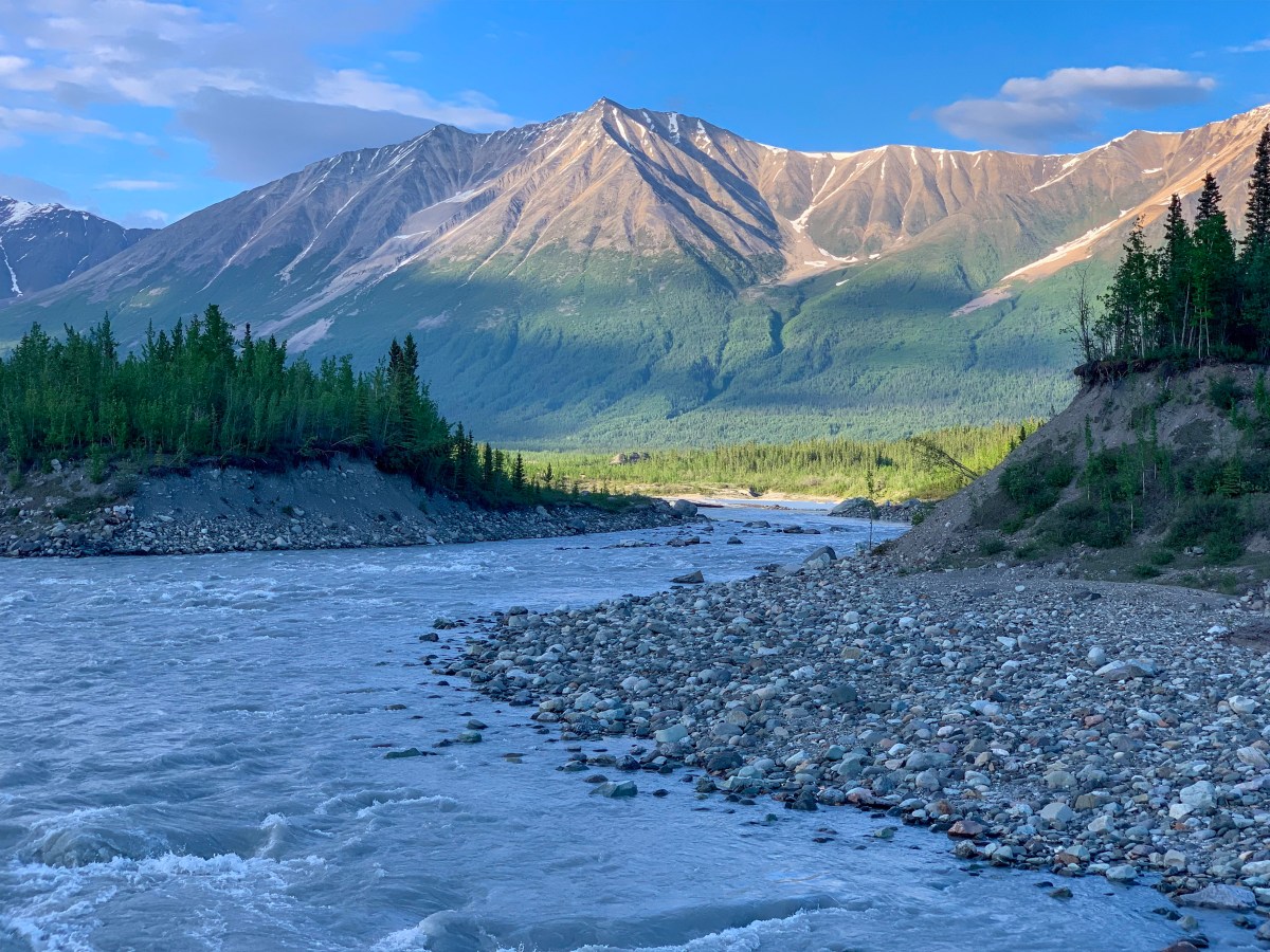
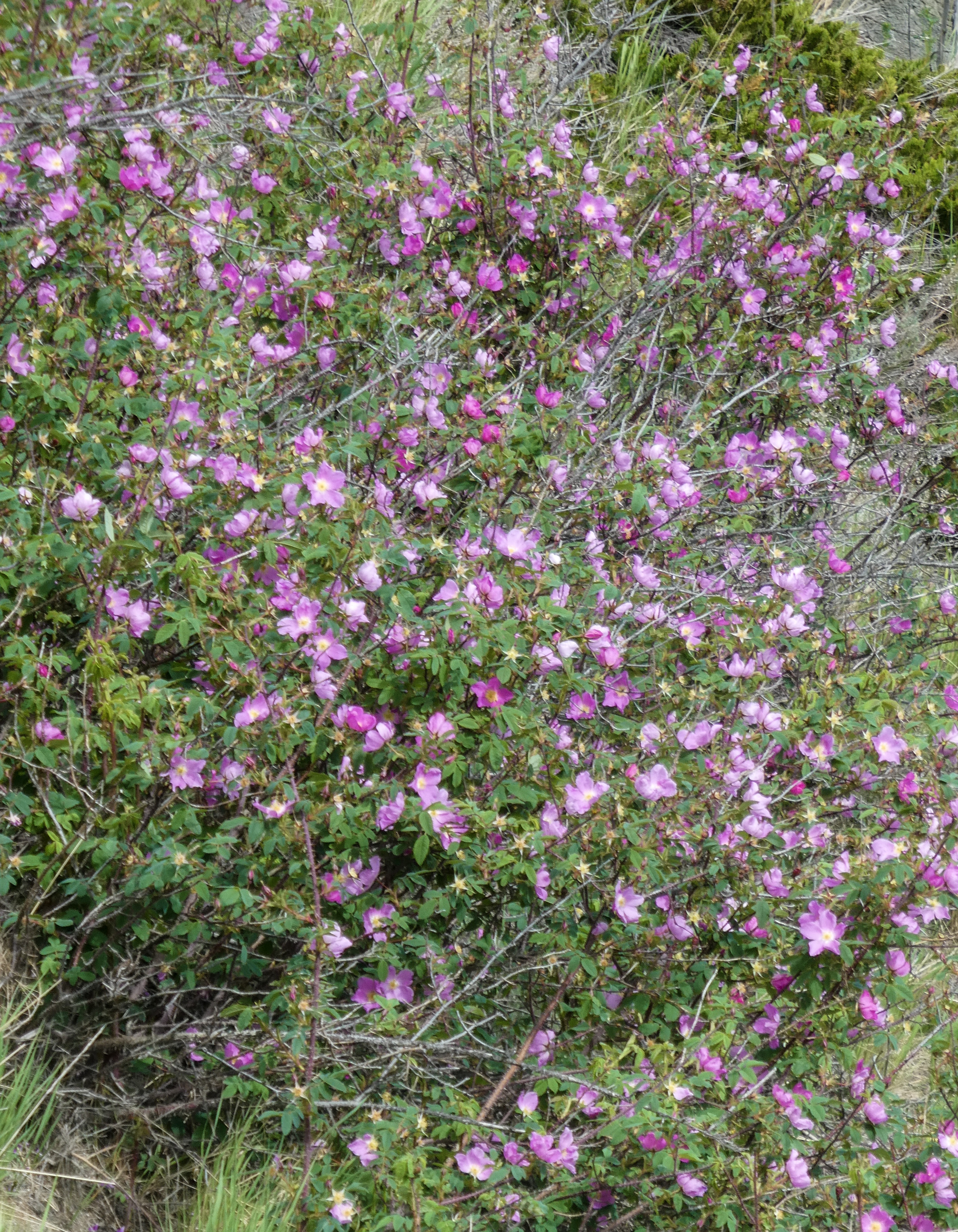
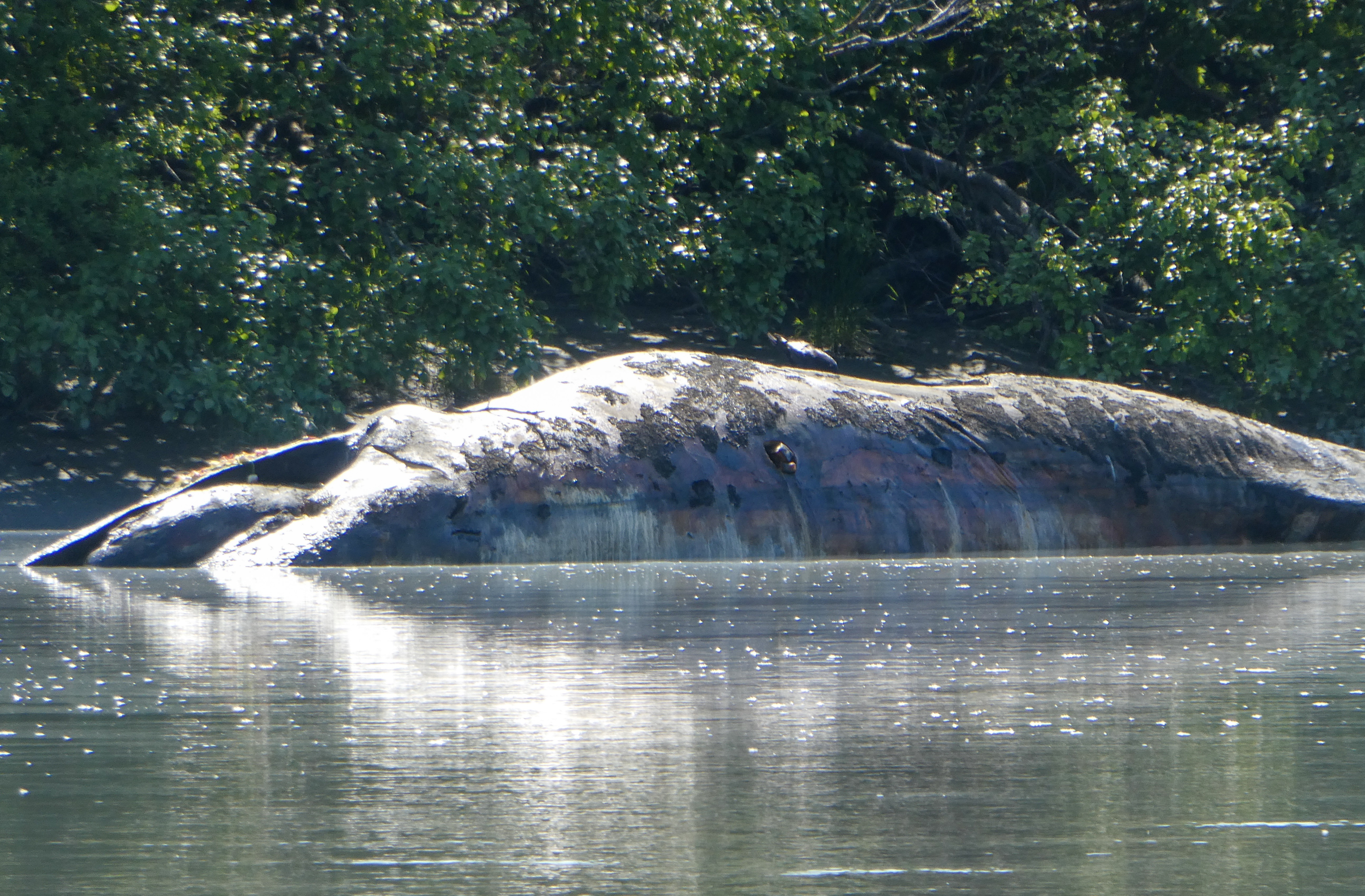
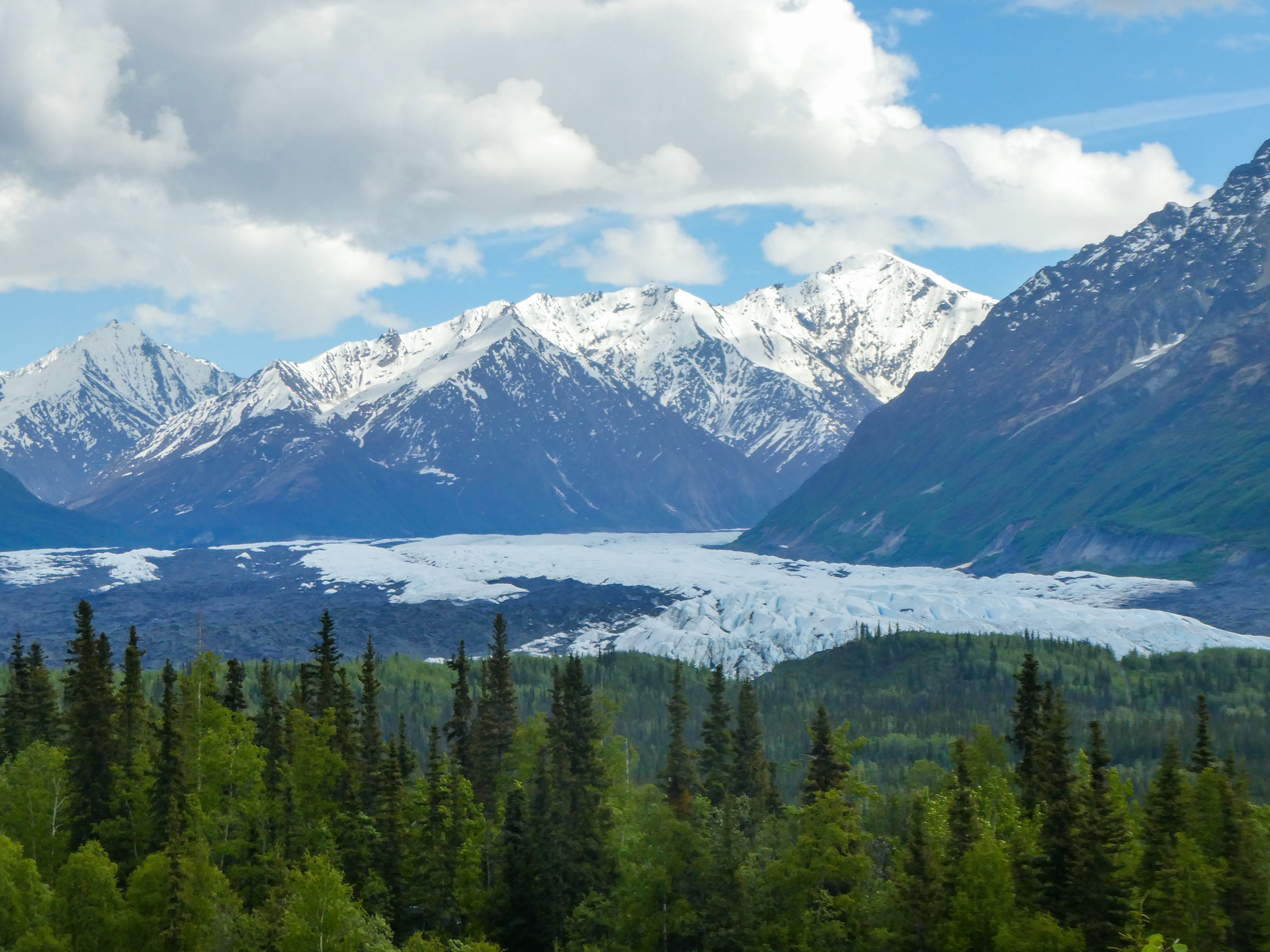
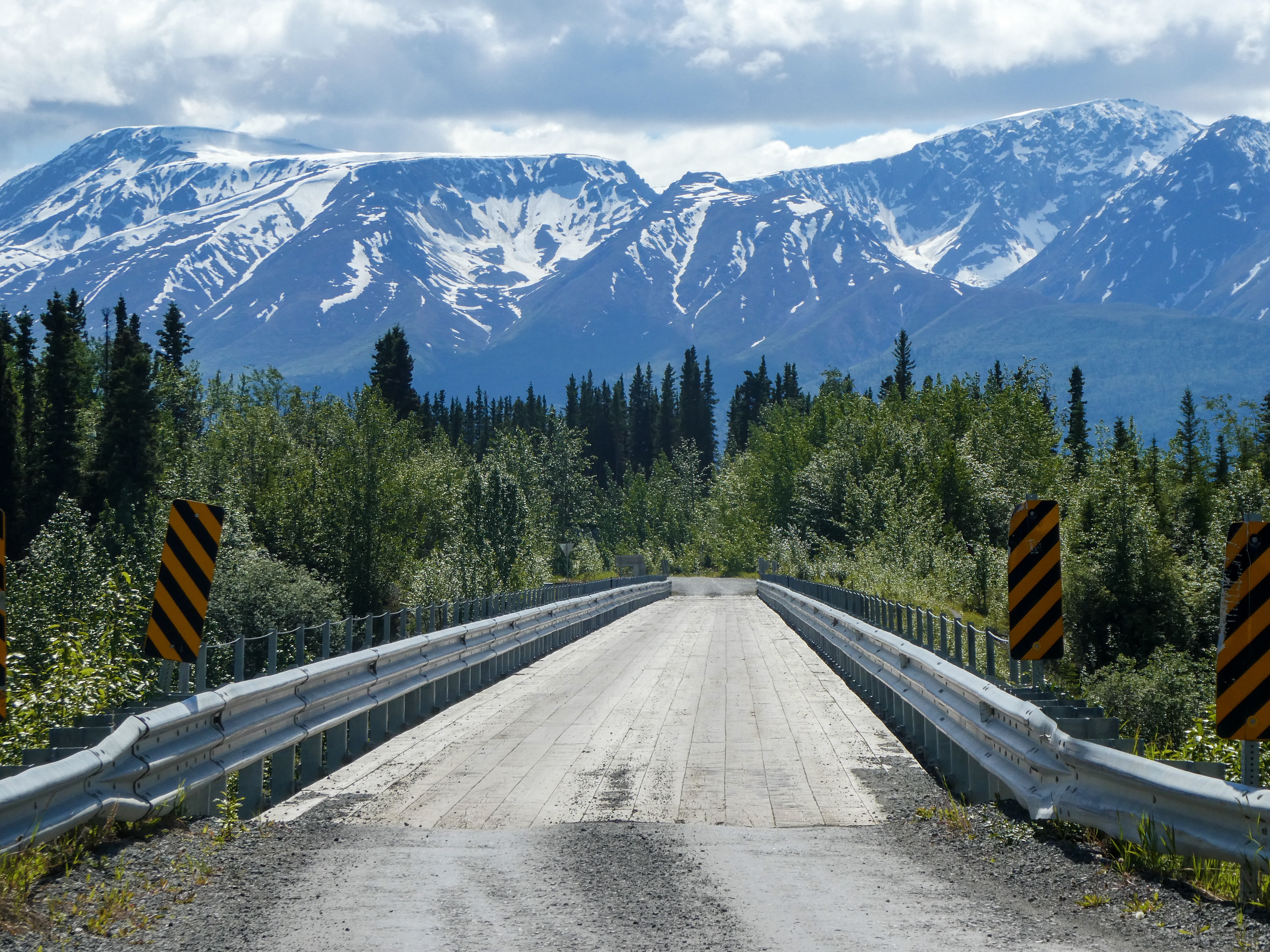
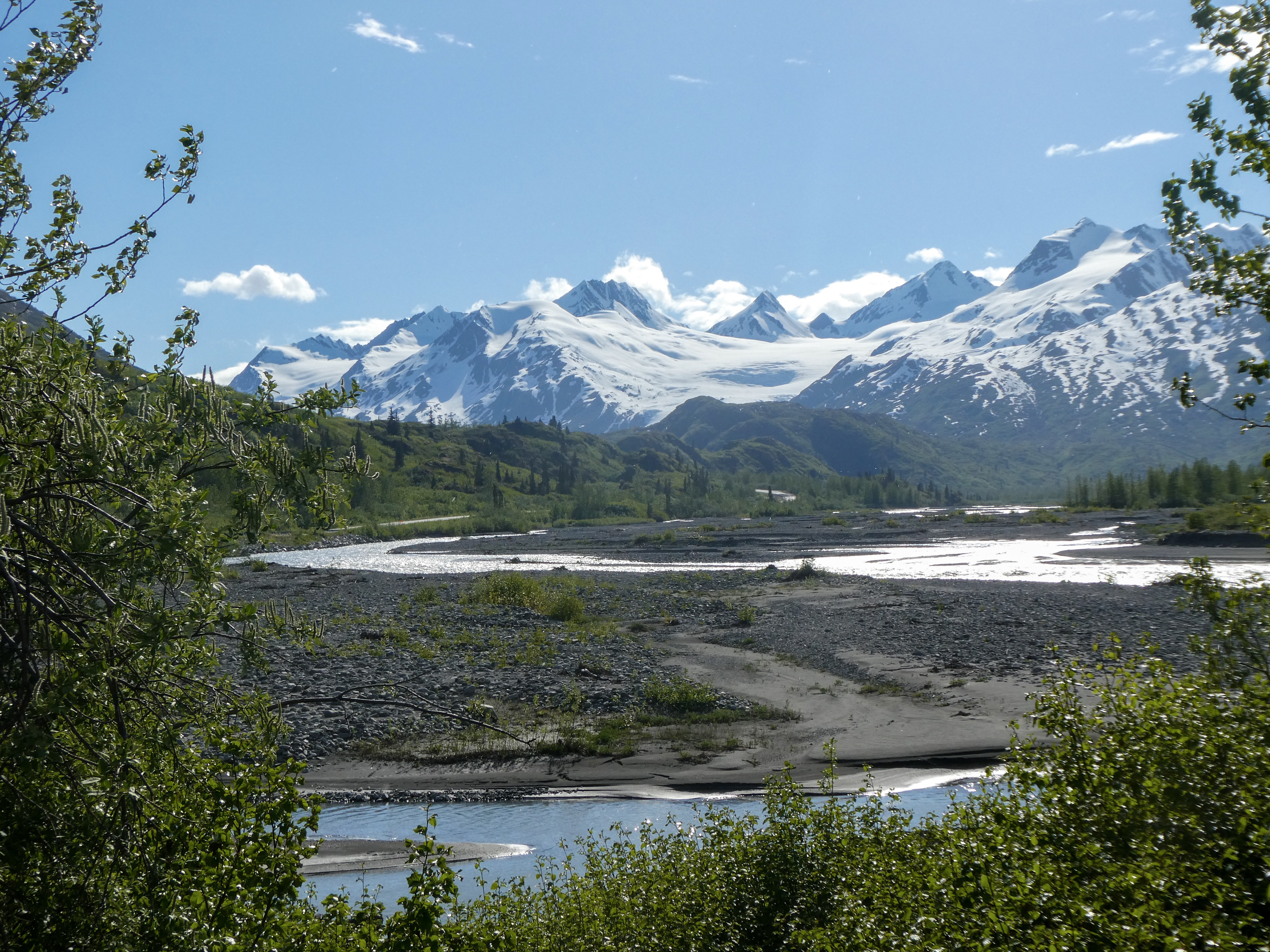
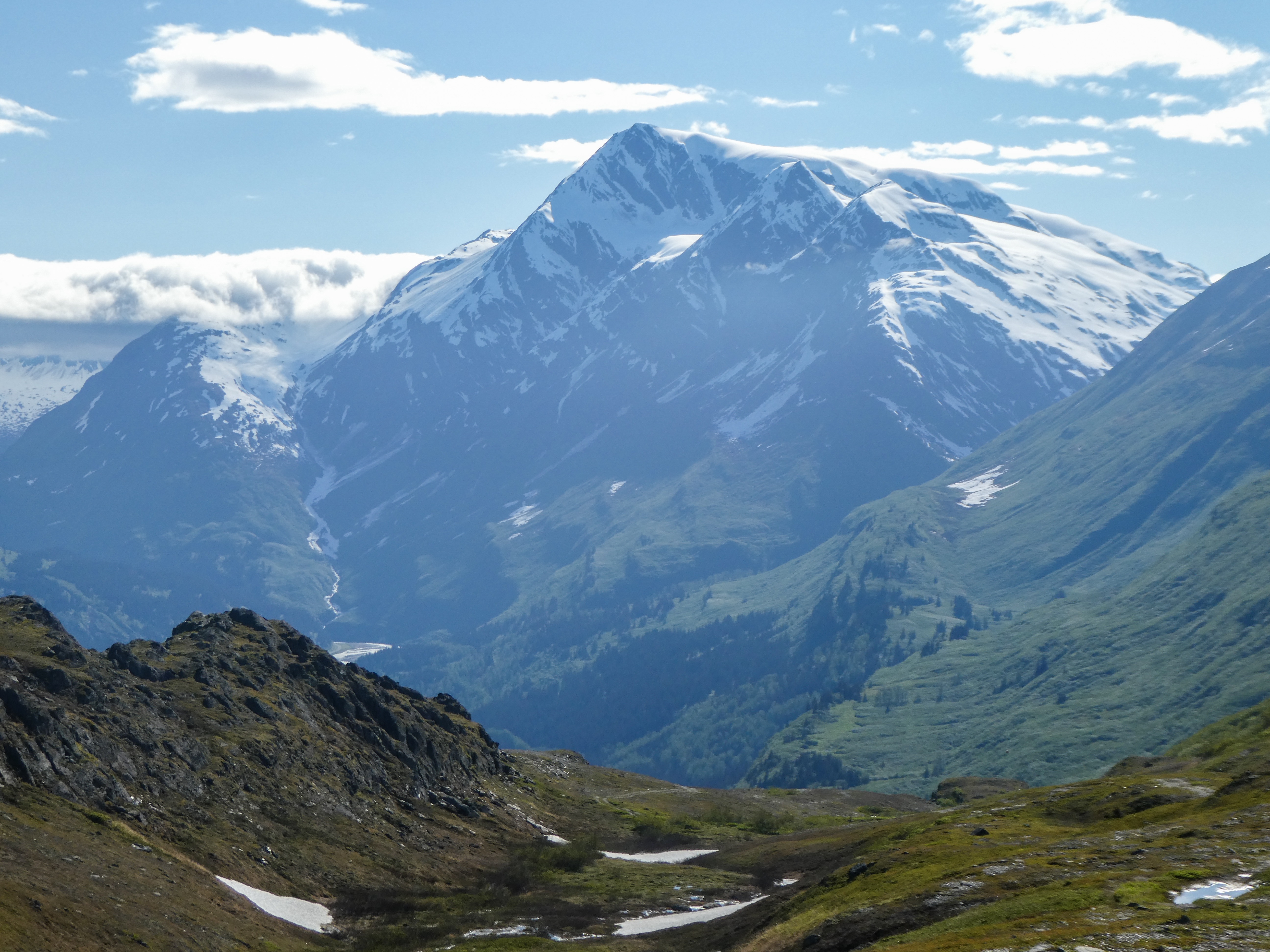
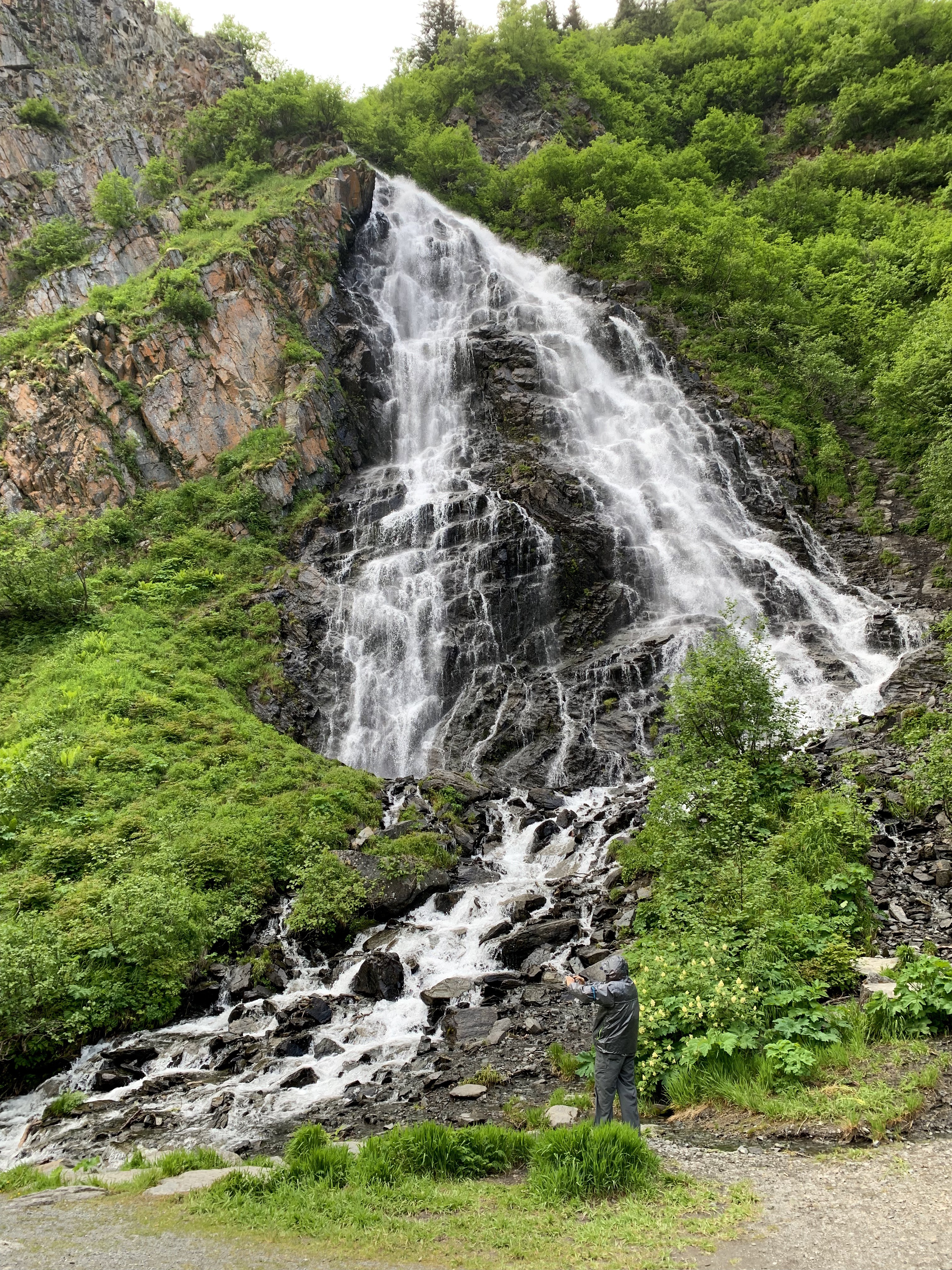
Driving east from Anchorage Wild roses, so fragrant, we smelled them before spotting them. A dead whale up the Matanuska River. How did it get so far inland?Views from the Glenn HighwayThe Matanuska Glacier
“Whats So Special about Wrangell-St. Elias?”
“Incredible. You must see Wrangell-St. Elias National Park and Preserve to believe it. Number and scale loom large here, magnified by splendid isolation. The largest U.S. national park, it equals six Yellowstones, with peaks upon peaks and glaciers after glaciers. Follow any braided river or stream to its source and you will find either a receding, advancing, or tidewater glacier. The park lets you sample representative Alaska wildlife as well as historic mining sites.
The peaks’ sheer numbers quickly quell your urge to learn their names. That roads are few means many travelers will not enter the park itself, but major peaks –Blackburn, Sanford, Drum, and Wrangell –are seen from nearby highways.
Four major mountain ranges meet in the park, which include nine of the 16 highest peaks in the United States. The Wrangells huddle in the northern interior. The Chugach guard the southern coast. The Saint Elias Mountains rise abruptly from the Gulf of Alaska to thrust northward past the Chugach on toward the Wrangells. The eastern end of the Alaska Range-mapped as the Nutzotin and Mentasta mountains-forms part of the preserve’s northern boundary.The Wrangells are volcanic in origin, but only Mount Wrangell remains active (last report erupting in 1900) with vents of steam near its summit.
With adjoining Kluane National Park in Canada, all these ranges form North America ’s premier mountain wilderness. Covered year-round with snow, the high-country stands cloaked with icefields and glaciers. Near the coast, North America ’s largest subpolar icefield, Bagley Icefield, spawns giant glaciers, the Tana, Miles, Hubbard,and Guyot.The Malaspina Glacier flows out of the St. Elias Range between Icy and Yakutat bays in a mass larger than the state of Rhode Island. So much glacial silt rides it that plants and trees take hold on the glacier’s extremities and grow to maturity only to topple over the edge when it melts.
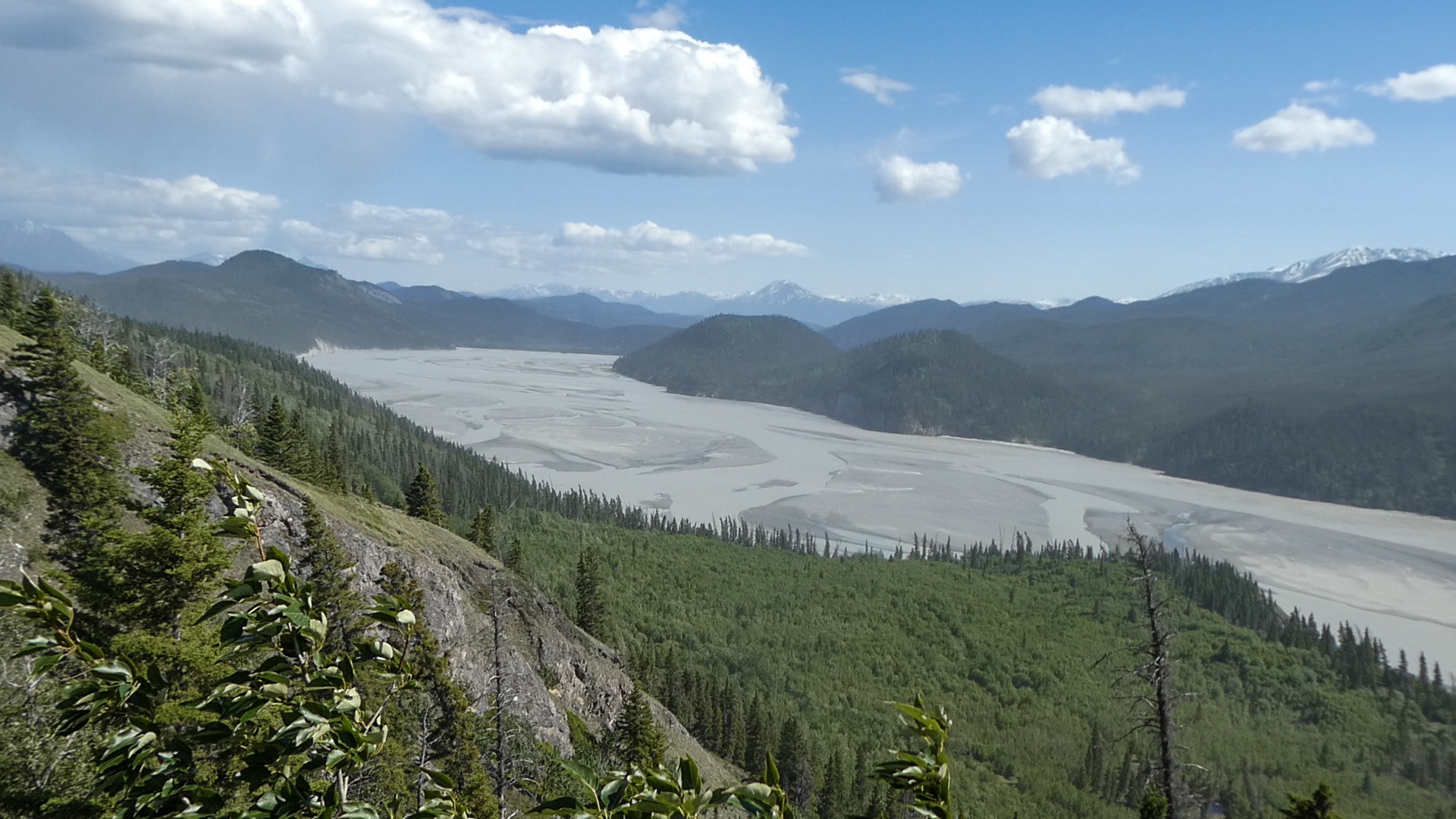
Flowing from glaciers are multitudes of meandering rivers and braided streams. Largest is the Copper River, forming the park’s western boundary. The Copper rises in the Wrangells and empties into the Gulf of Alaska in the Chugach National Forest. In the early 1900s the Kennecott Mining Co. transported copper from its mines near McCarthy by railroad along the Chitina and Copper rivers to ships at Cordova. Ore was extracted from these productive mines between 1911 and 1938 and lured many people to the area. Gold was extracted from the Nabesna area, then too. Mining still takes place on private lands in the park, and evidence of earlier mining includes ruins of the Kennecott mines, now listed on the National Register of Historic Places. In mining’s heyday the Indian villages expanded and several new towns sprang up. Copper Center, Chitina, Gulkana, and Chistochina are among the old Athabascan settlements. The town of Yakutat is a traditional Tlingit fishing village.
While vegetation may appear sparse, especially in the interior, the park is home to a variety of plants and wildlife. Mountain slopes have a diversity of plants, dwarf shrubs, and grasses where dall sheep and mountain goats patrol the craggy peaks. Interior and coastal spruce forests are home to shrubs, such as blueberry and prickly rose. Caribou feed on lichens and sedges on the slopes of the Wrangells. Moose browse in the sloughs and bogs of the forested lowlands, while bears roam throughout the park. Many rivers, streams, and lakes provide spawning grounds for salmon and other fish. The Copper River drainage marks major flyways for migratory birds and provides nesting sites for trumpeter swans. Coastal areas are habitat for marine mammals, including sea lions and harbor seal”
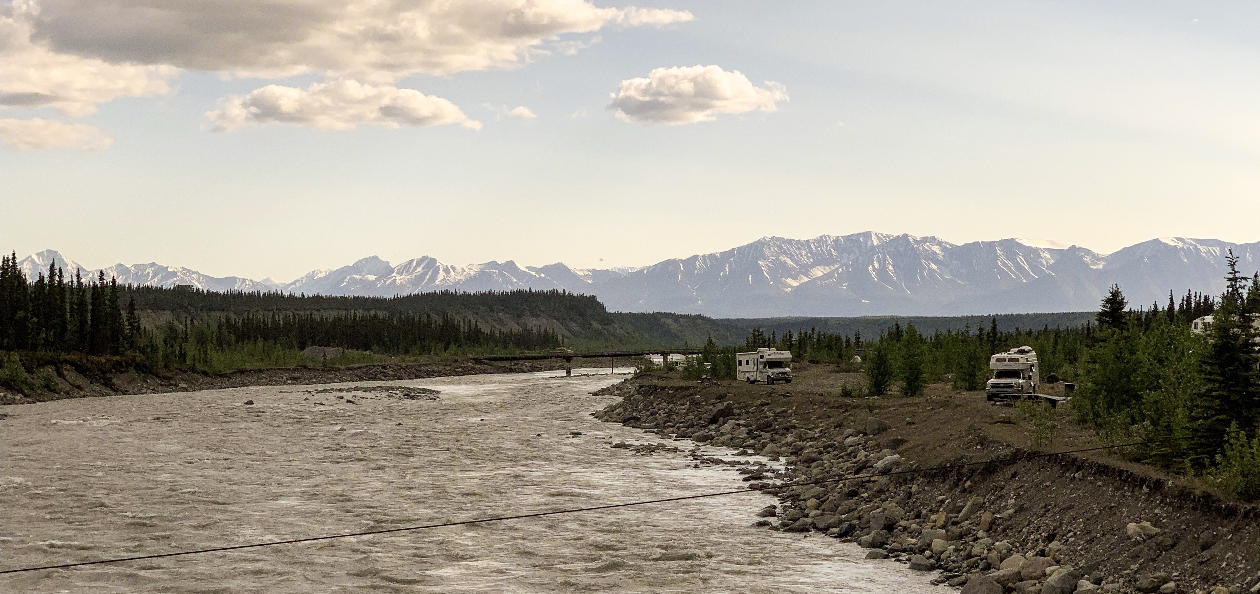
The McCarthy Road
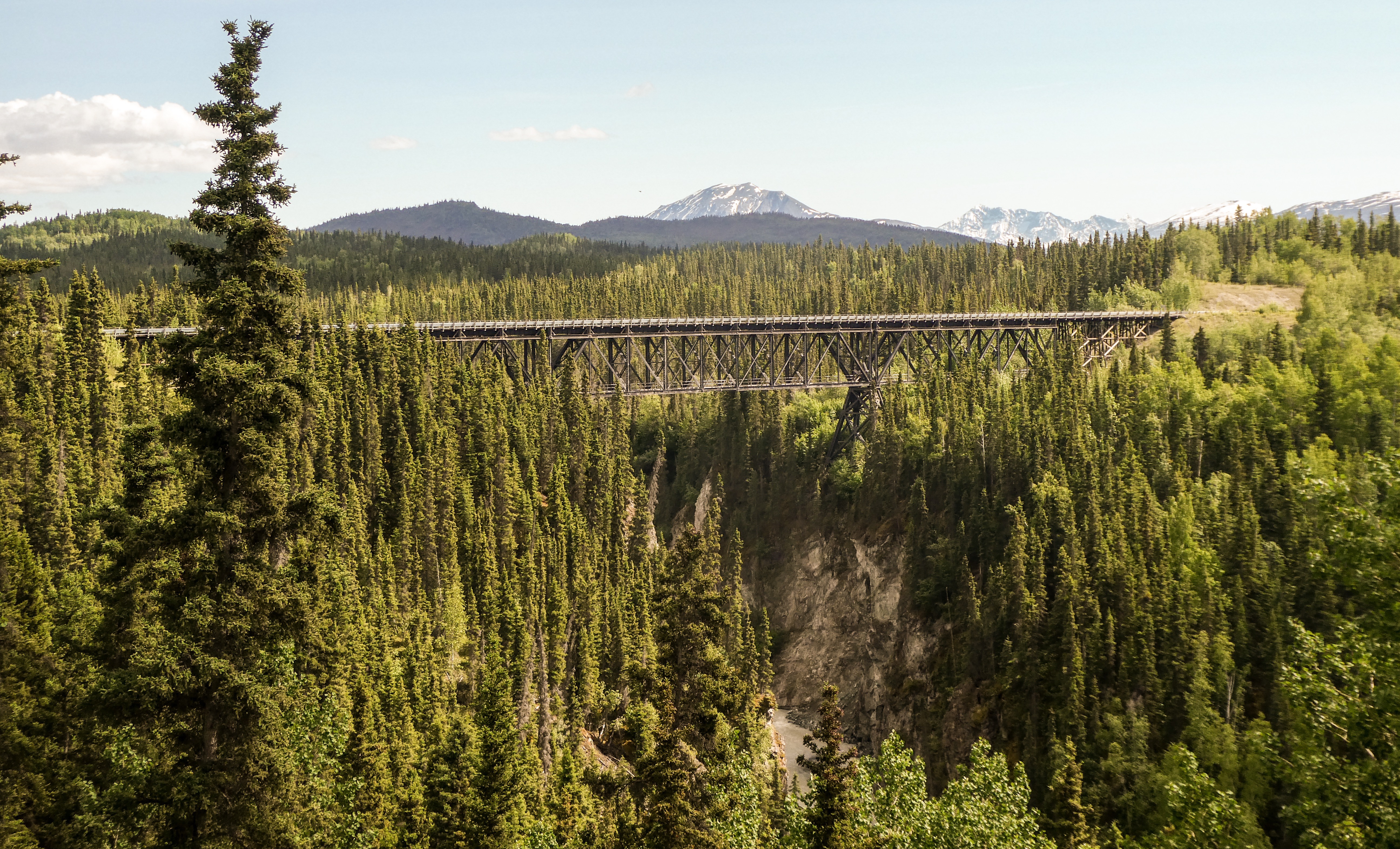
“The 60- mile McCarthy Road winds deep into the heart of Wrangell- St. Elias National Park & Preserve. Once the gateway to tremendous fortunes, it is now your gateway to spectacular scenery and vast wilderness. For those willing to leave the pavement behind and brave the ruts and dust, this road provides access to the many natural and historic wonders of our largest National Park.Today’s McCarthy Road originated in 1909 as a railway constructed to support the Kennecott Copper Mines. Over 200 million dollars worth of ore was hauled from the Kennecott mill 196 miles to the port of Cordova. The railway operated successfully until abandoned in 1938 when large scale mining ended. Most of the rails were salvaged for scrap iron, and no longer maintained, the Copper River Bridge was soon destroyed by flooding.”
The Chitna River. Salmon are running now. Dip netters were catching hundreds just over one weekend. One lane Kuskalana Bridge 200-some feet above the river. Don’t look down!Kuskalana Bridge
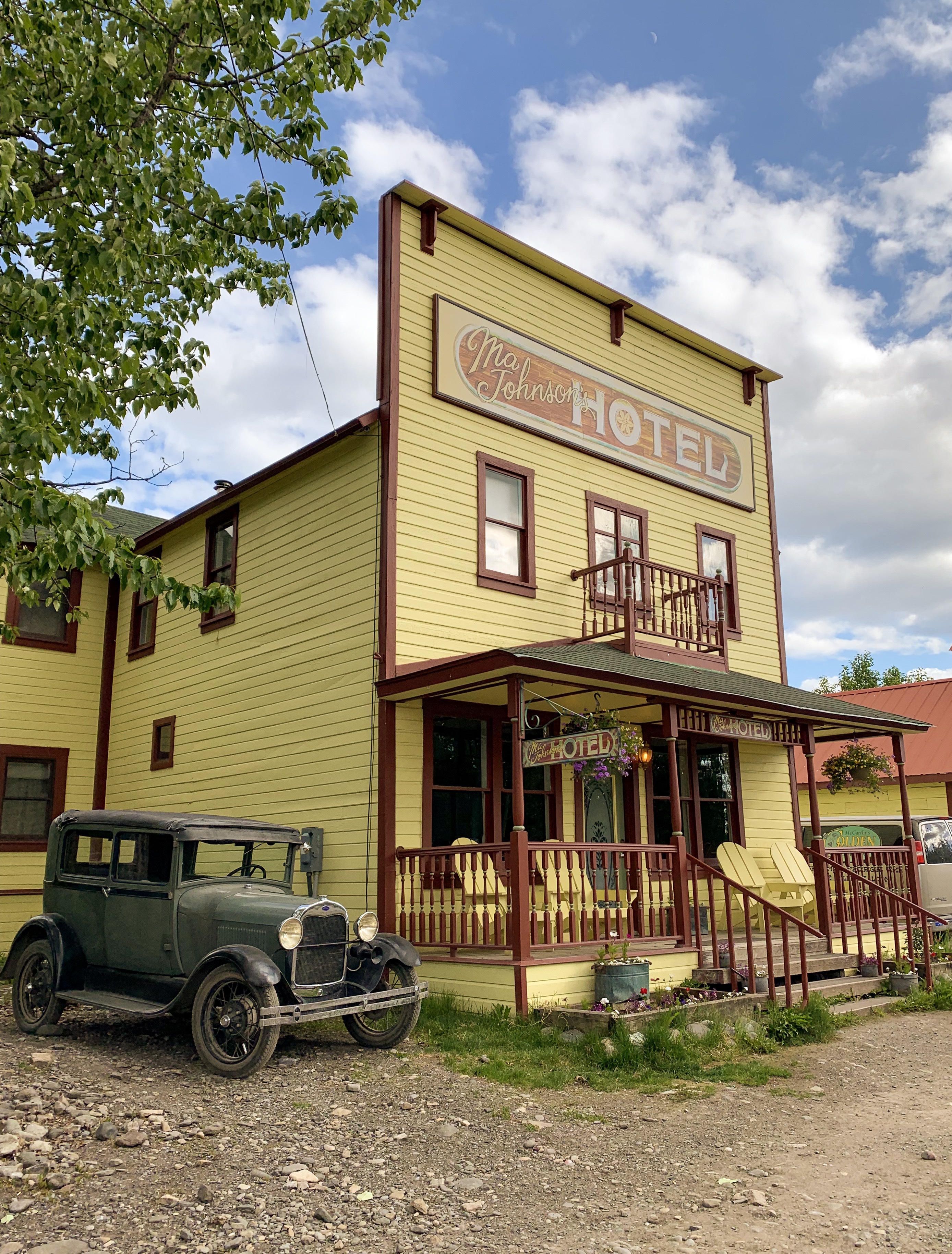
McCarthy and Kennecott
Partly because alcoholic beverages and prostitution were forbidden in Kennecott, McCarthy grew as an area to provide illicit services not available in the company town. It grew quickly into a major town with a gymnasium, a hospital, a school, a bar and a brothel. The Copper River and Northwestern Railway reached McCarthy in 1911.
In 1938, the copper deposits were mostly gone and the town was mostly abandoned. The railroad discontinued service that year. Over its 30-year operation, U.S. $200 million in ore was extracted from the mine, making it the richest concentration of copper ore in the world.
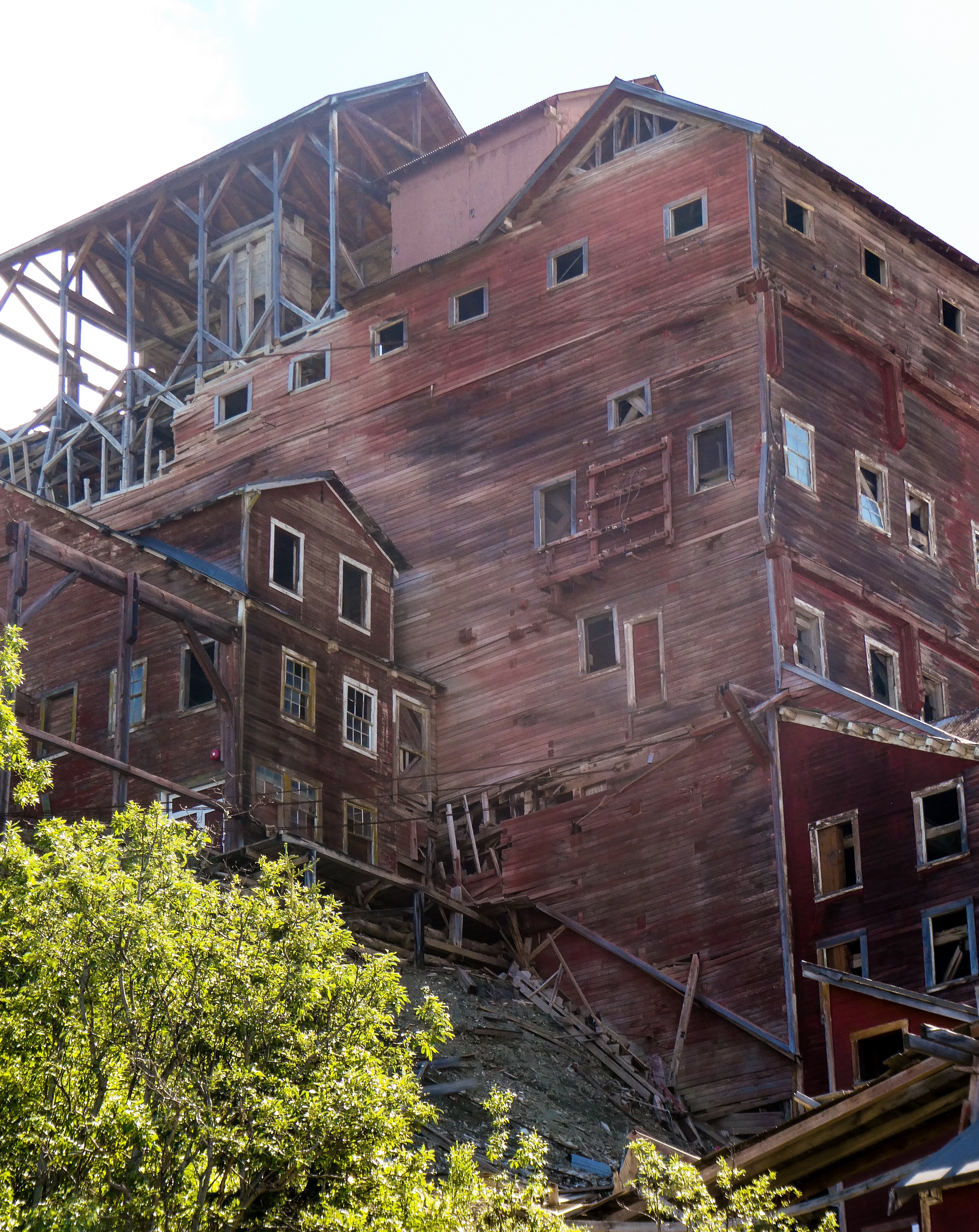
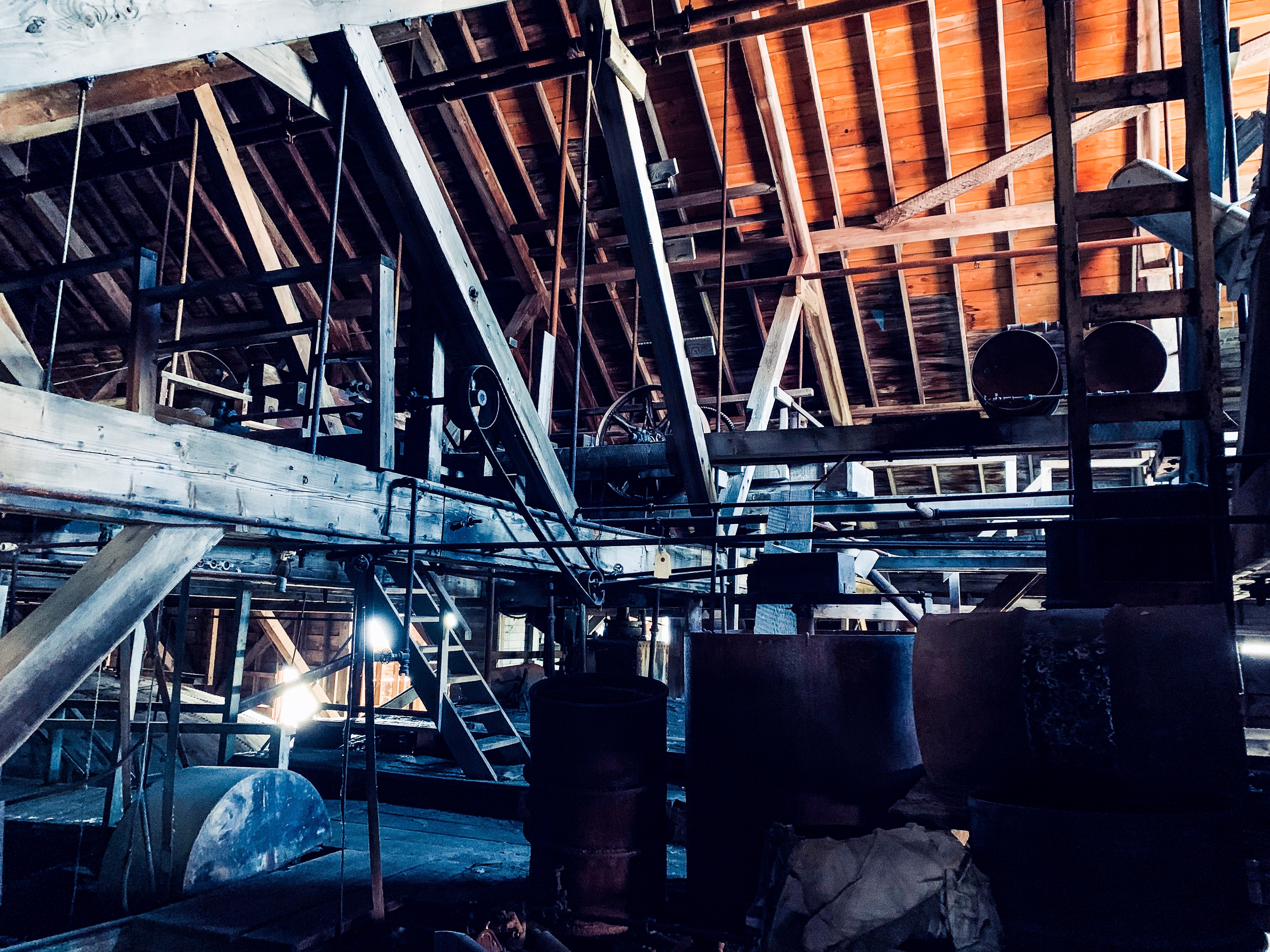
The old mine buildings, artifacts, and colorful history attract visitors during the summer months. The Kennecott and McCarthy area ranks as one of the United States’ most endangered landmarks by the National Trust for Historic Places. Emergency stabilization of the old buildings has been done and more will be required.
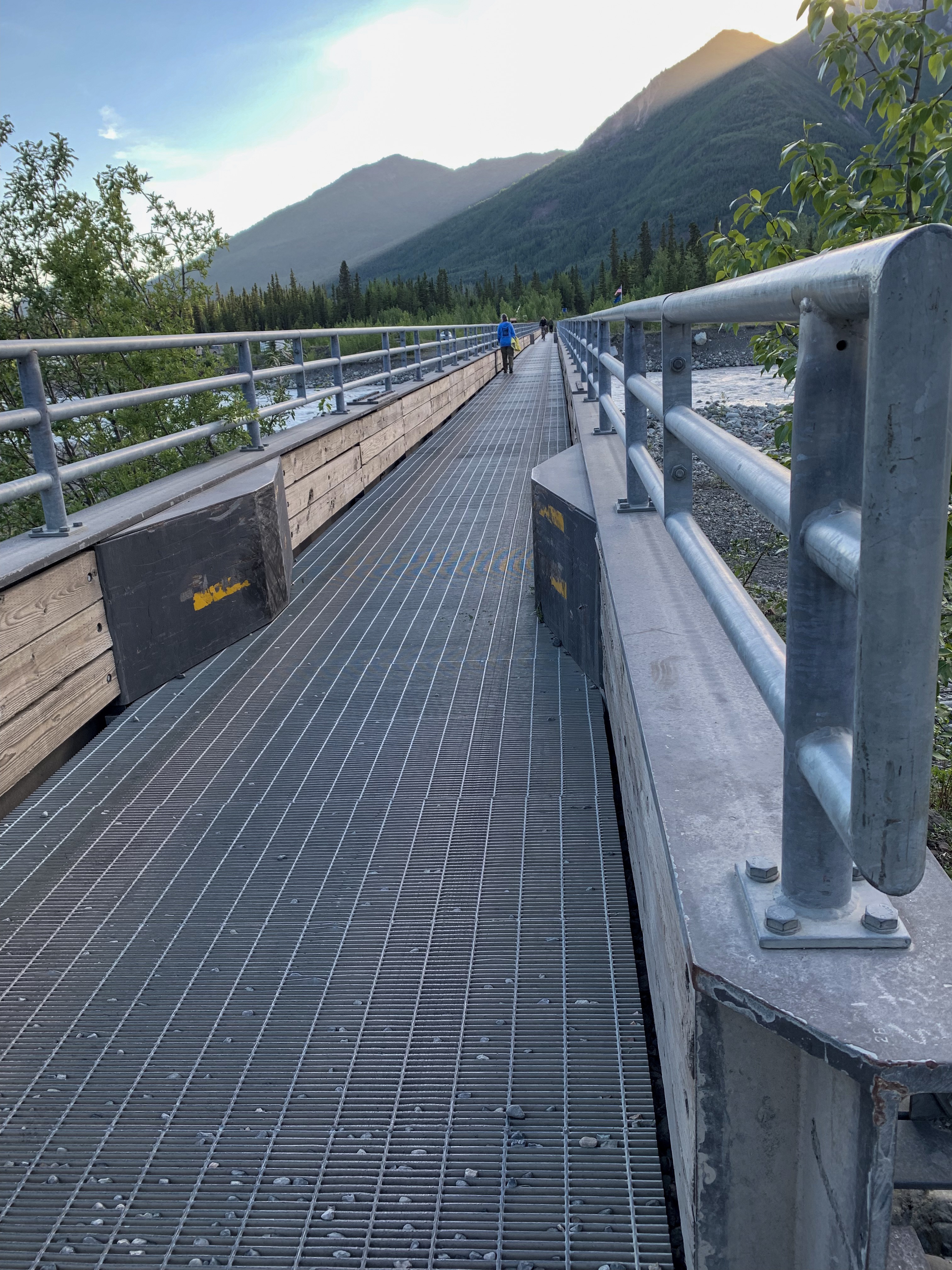
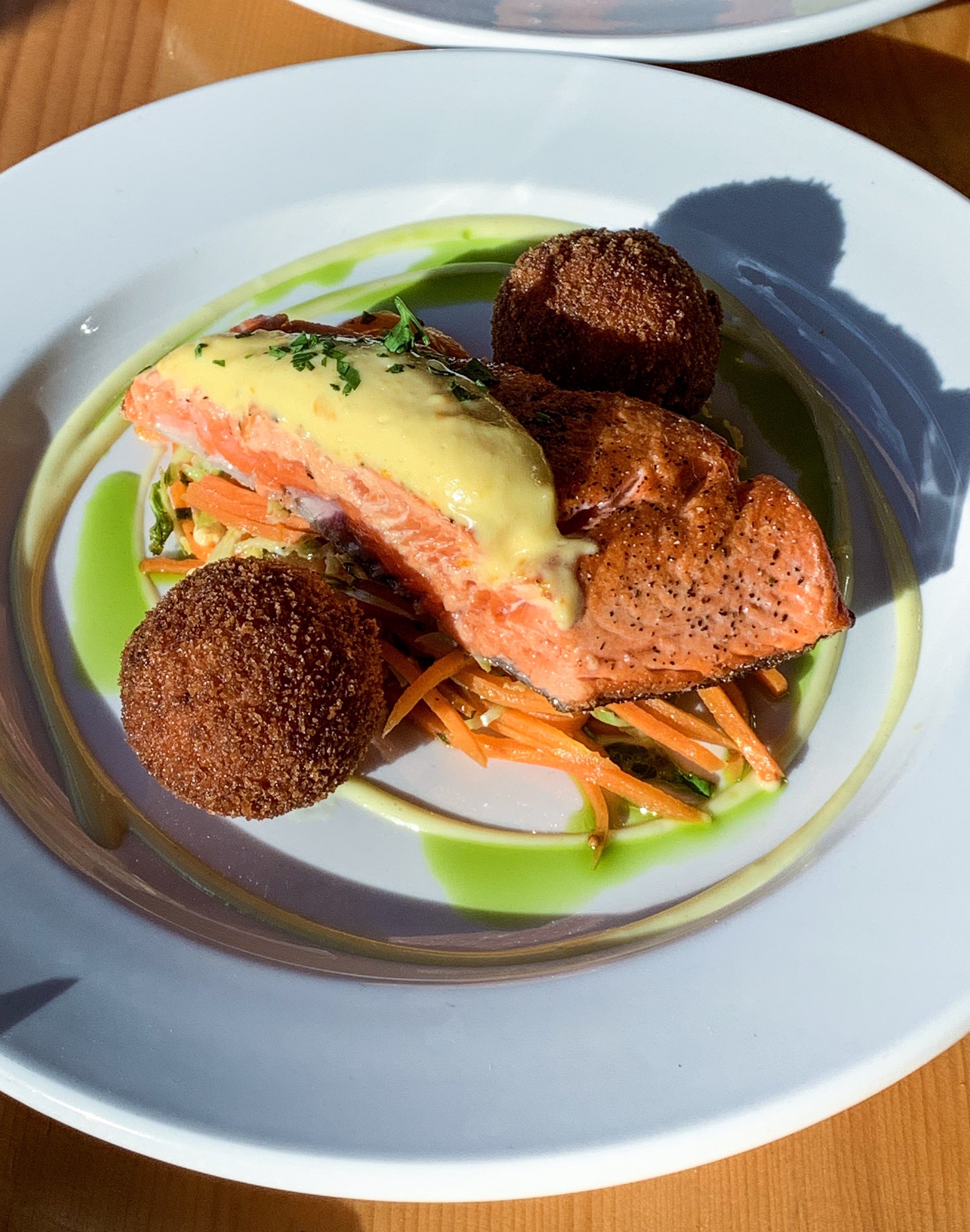
Camping on the Kennicott RiverVisitors must park outside town and walk across a footbridge 1/2 mile to townDowntown McCarthyFresh caught Copper River Sockeye Great view from campground outhouse Sunset on the Kennicott RiverWalking tour of Kennicott The old copper concentrator on the hillAbandoned mill equipment
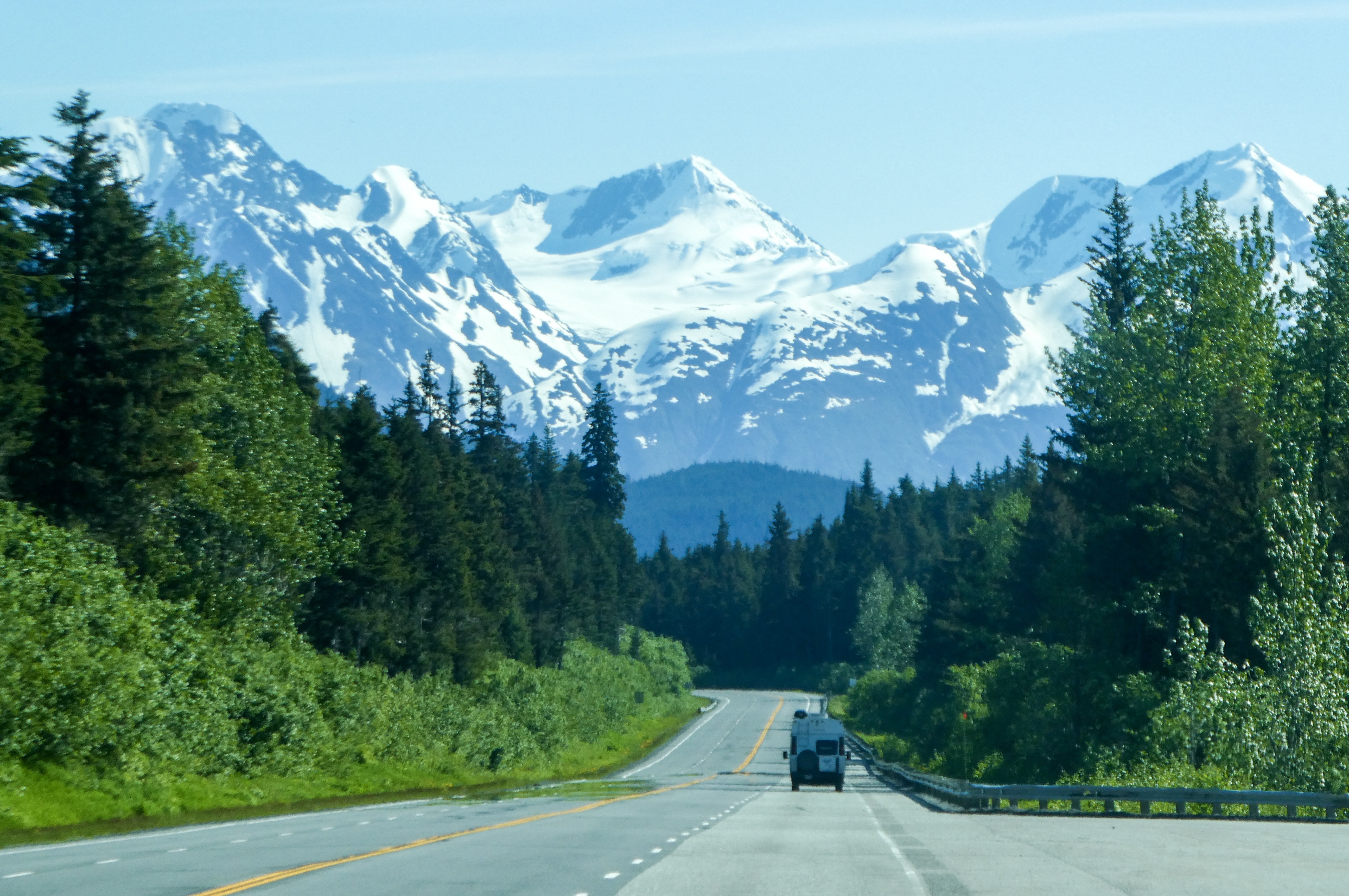
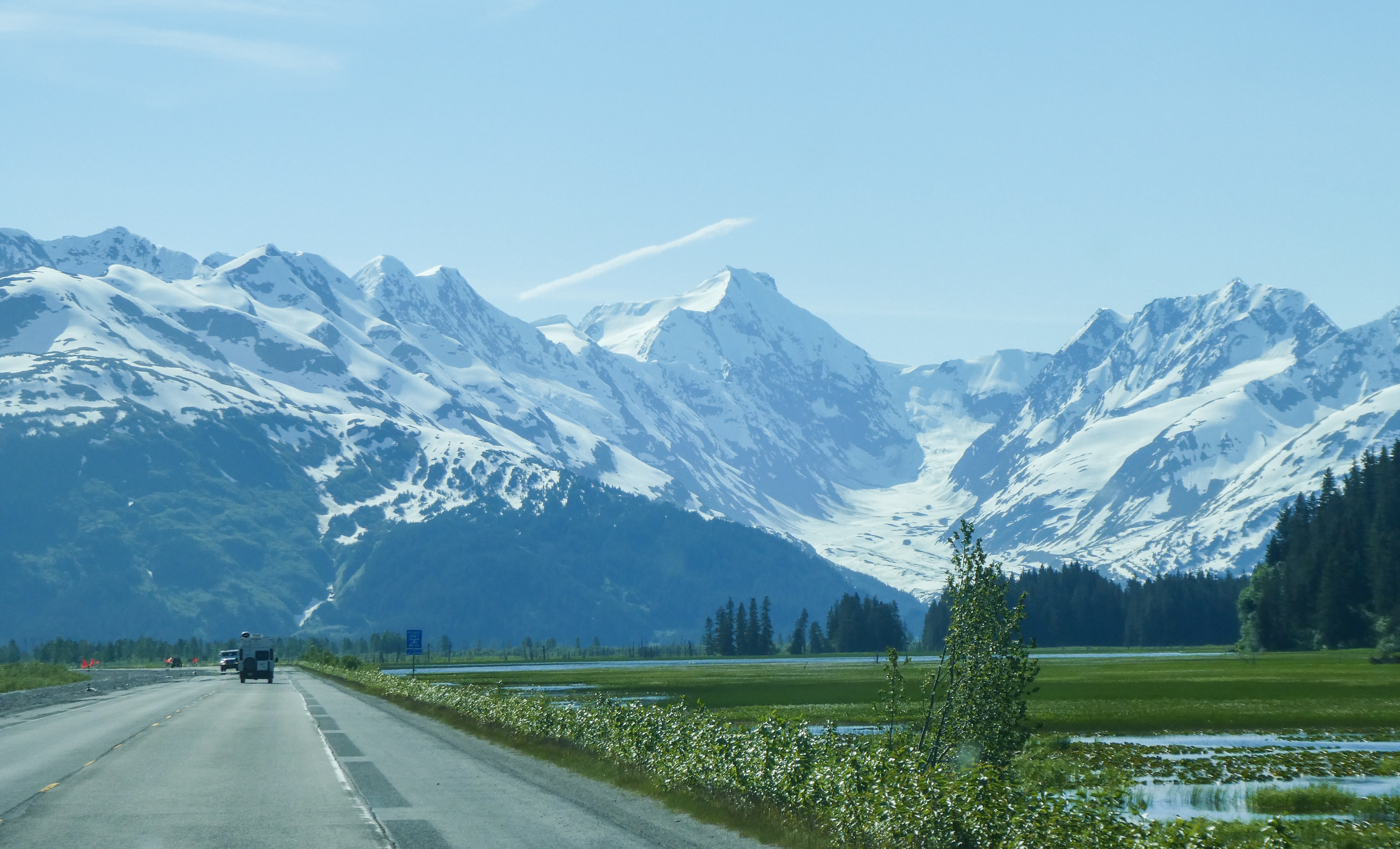
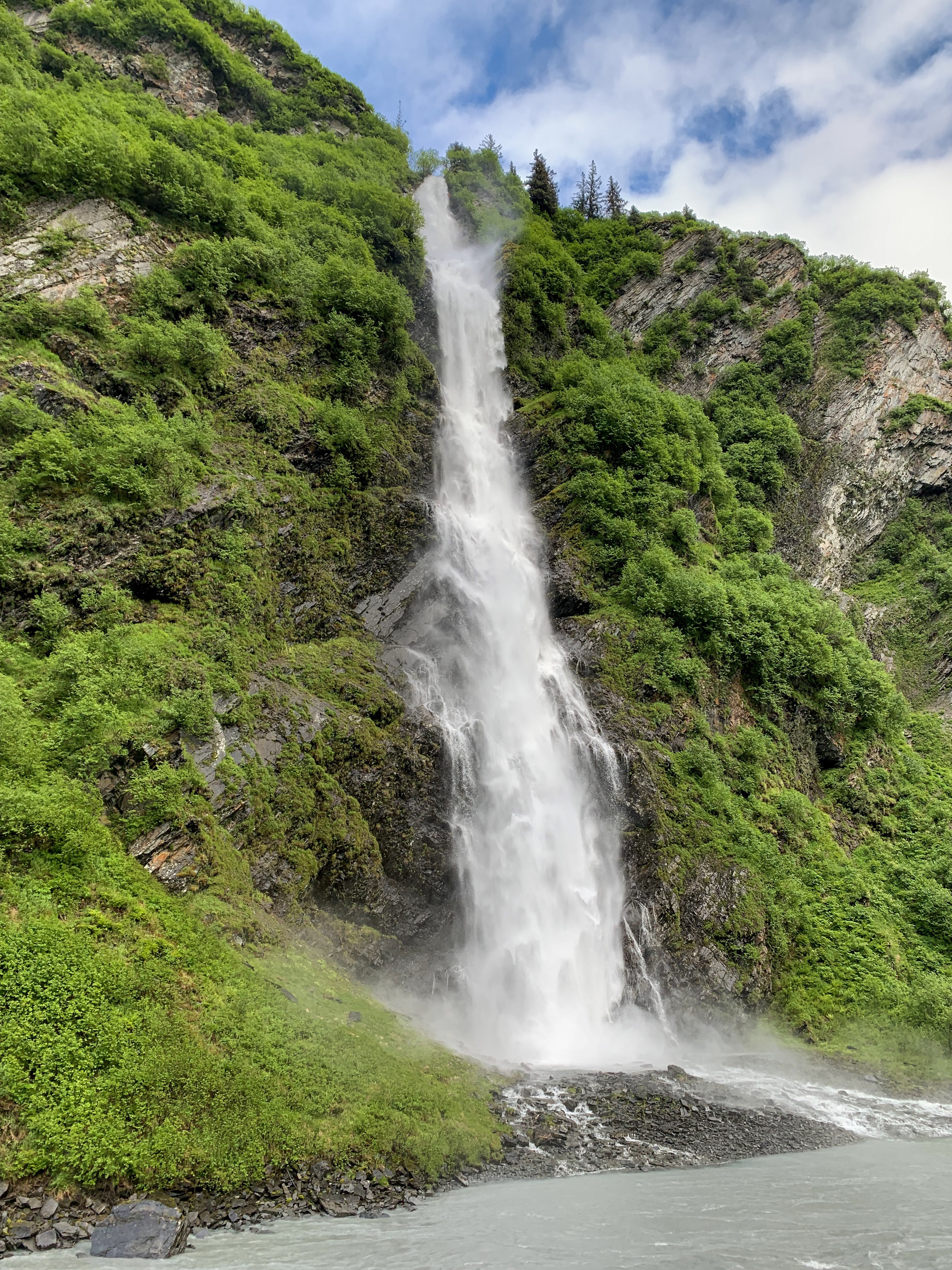
Photos from the drive to Valdez – absolutely breathtaking!
“Twenty years from now you will be more disappointed by the things that you didn’t do than by the ones you did do. So throw off the bowlines. Sail away from the safe harbor. Catch the trade winds in your sails. Explore. Dream. Discover.”
MARK TWAIN
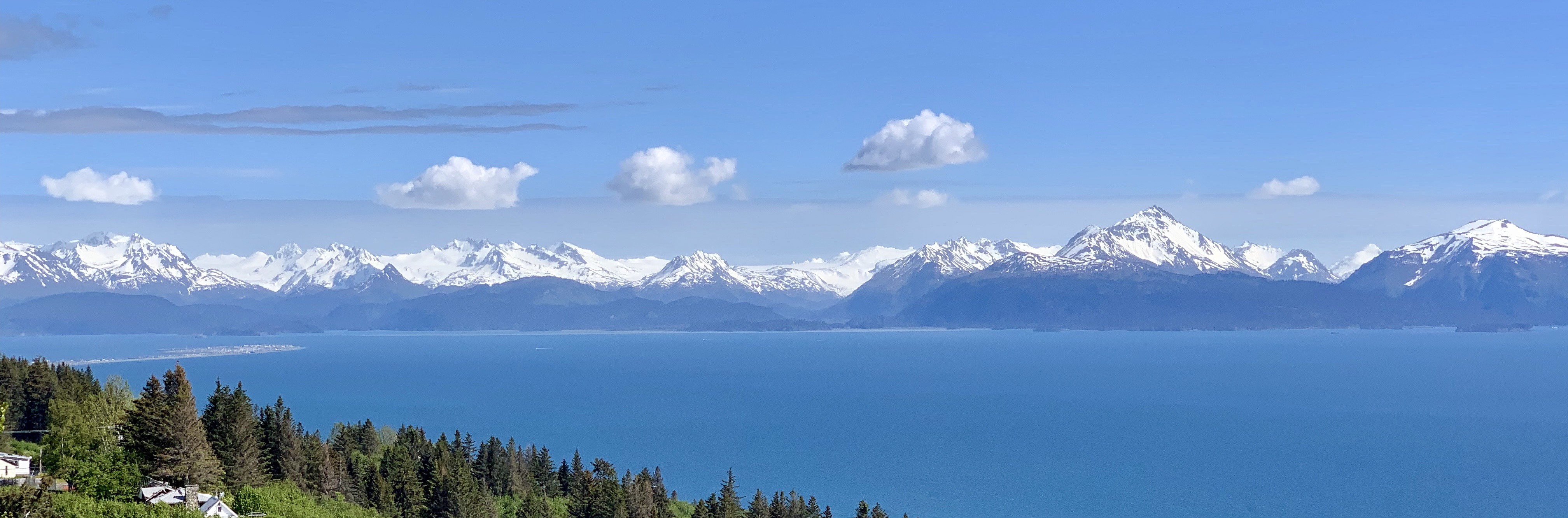
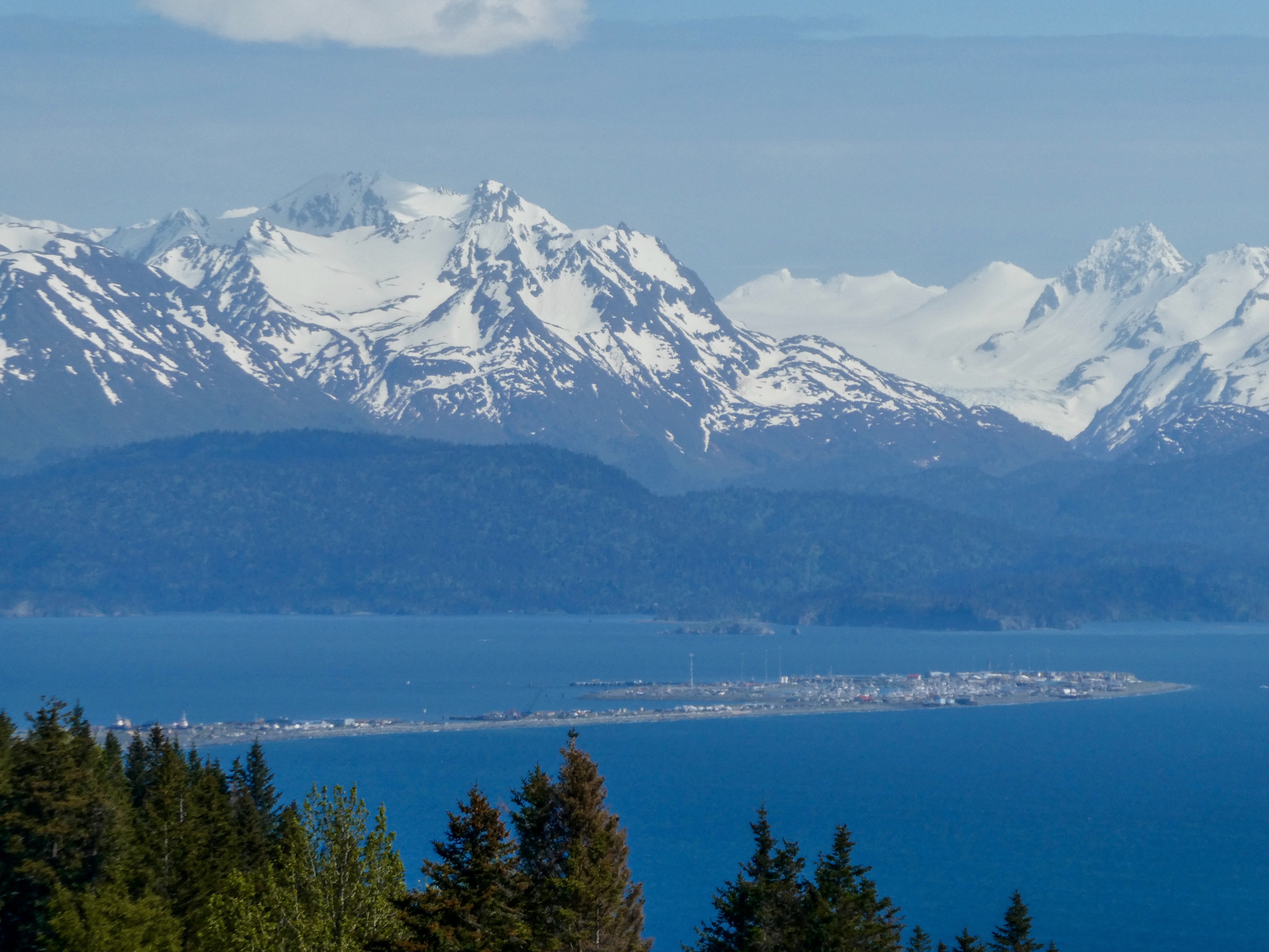
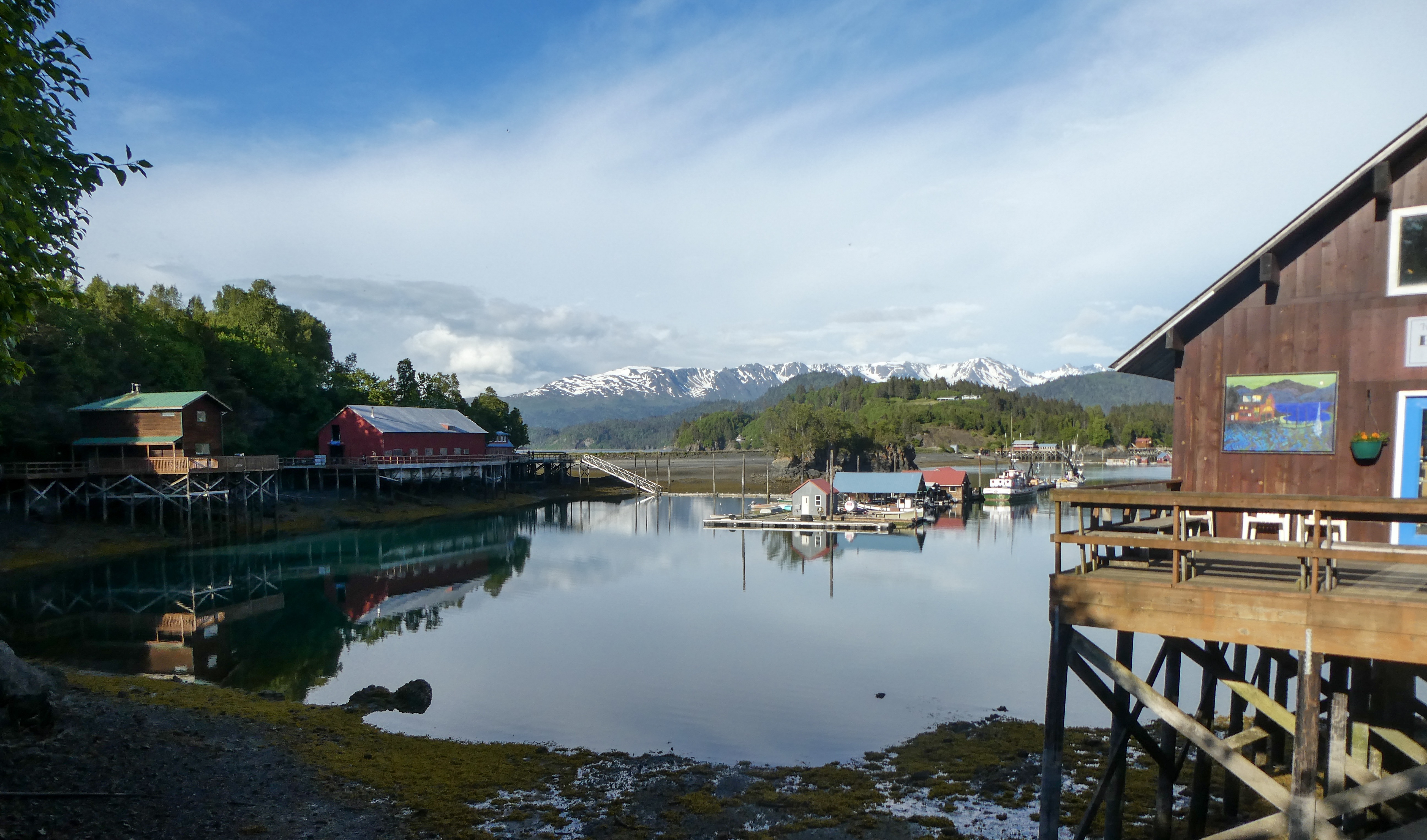
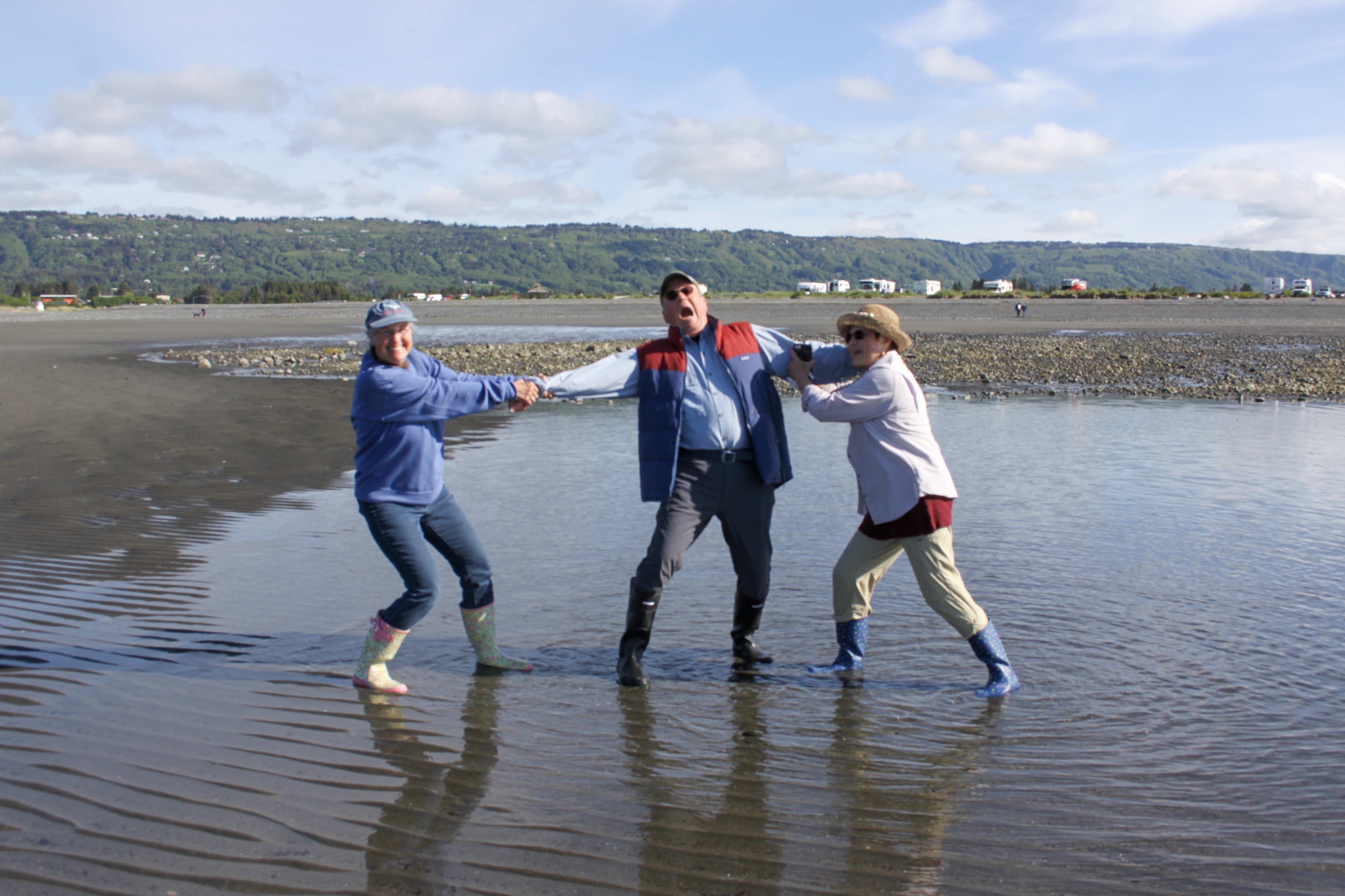
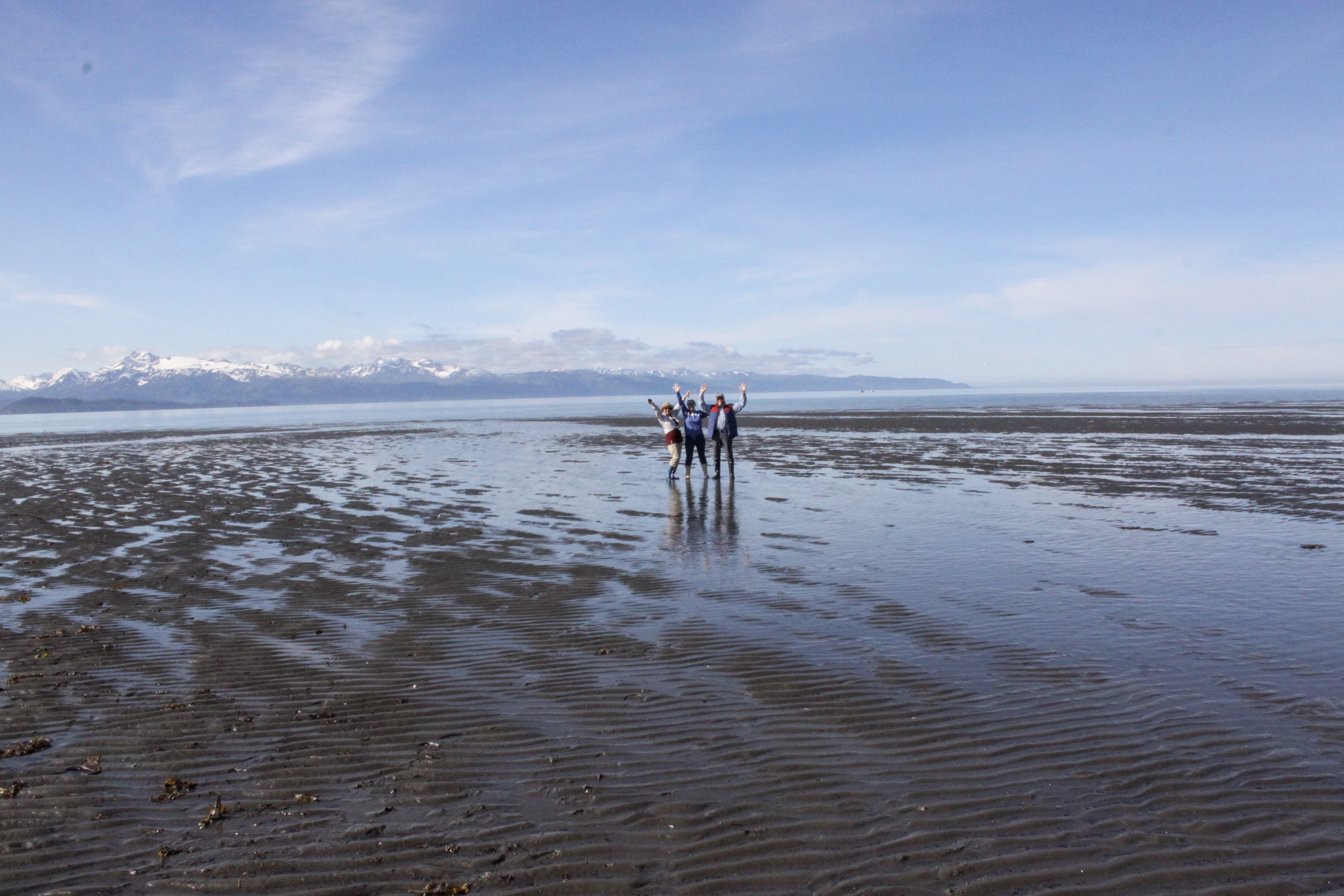
The mountains surrounding Homer, AlaskaThe Homer “Spit”
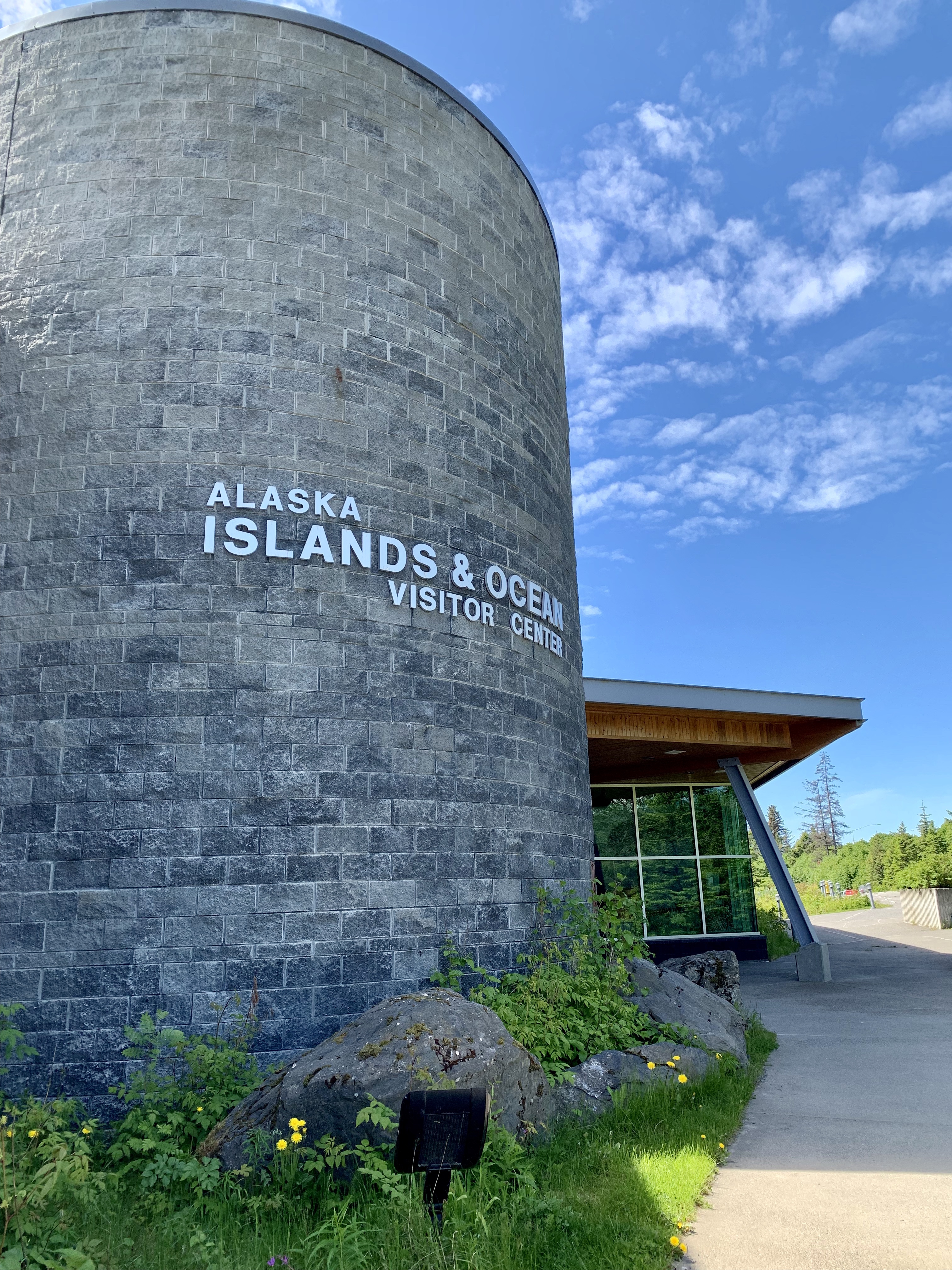
“Homer is a small city on Kachemak Bay, on Alaska’s Kenai Peninsula. A focal point is the Homer Spit, a long strip of land with shops, art galleries, seafood restaurants and beaches (mostly tacky, in my opinion). Fishing boats dock at its harbor. Galleries also cluster on Pioneer Avenue, near the Pratt Museum, which shows local art and artifacts, including a pioneer cabin. The Alaska Islands and Oceans Visitor Center has wildlife exhibits.”
Needing showers, we checked into a B&B, then scoped out campgrounds on the Spit for tomorrow night.
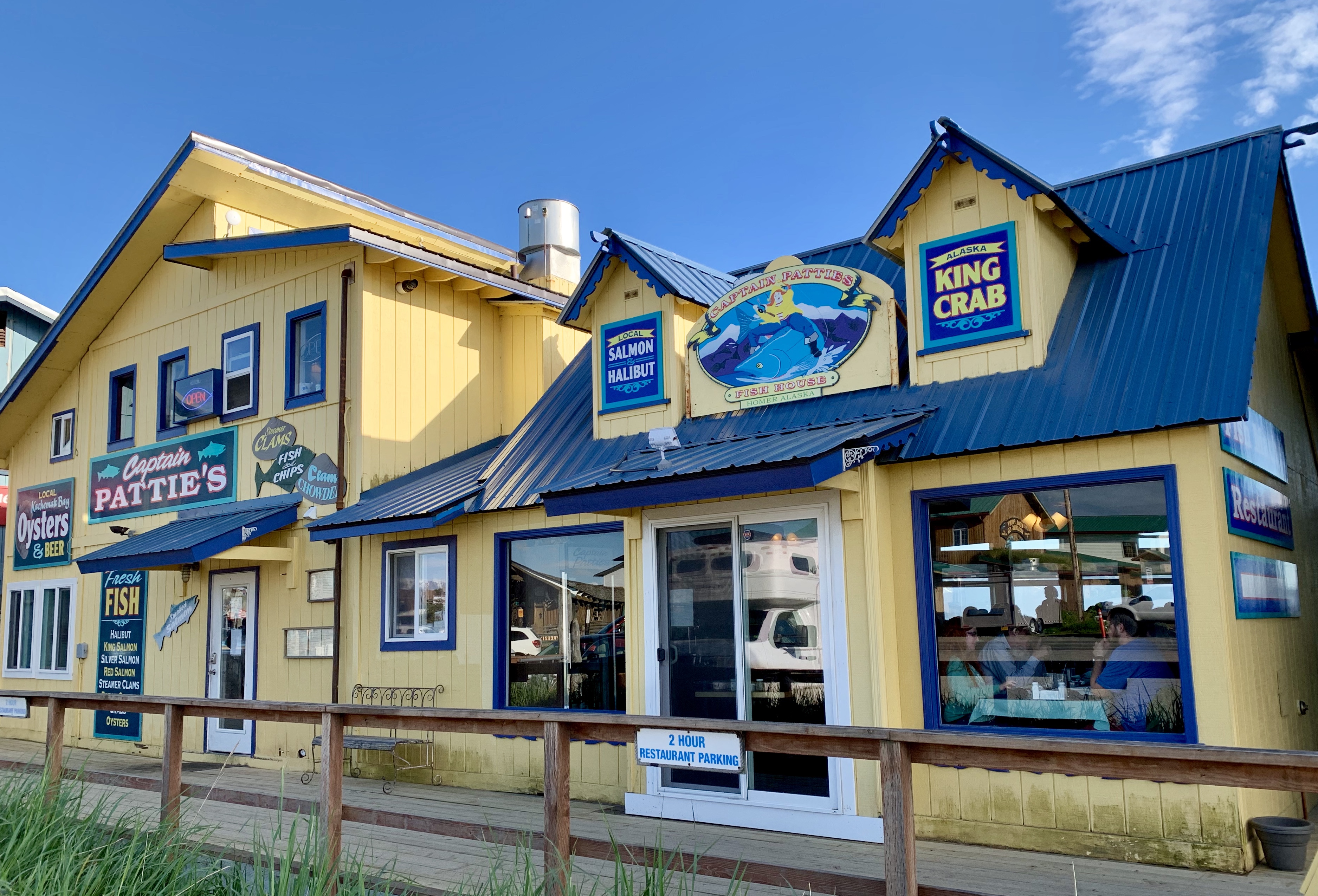
Captain Pattie’s Seafood on the Spit
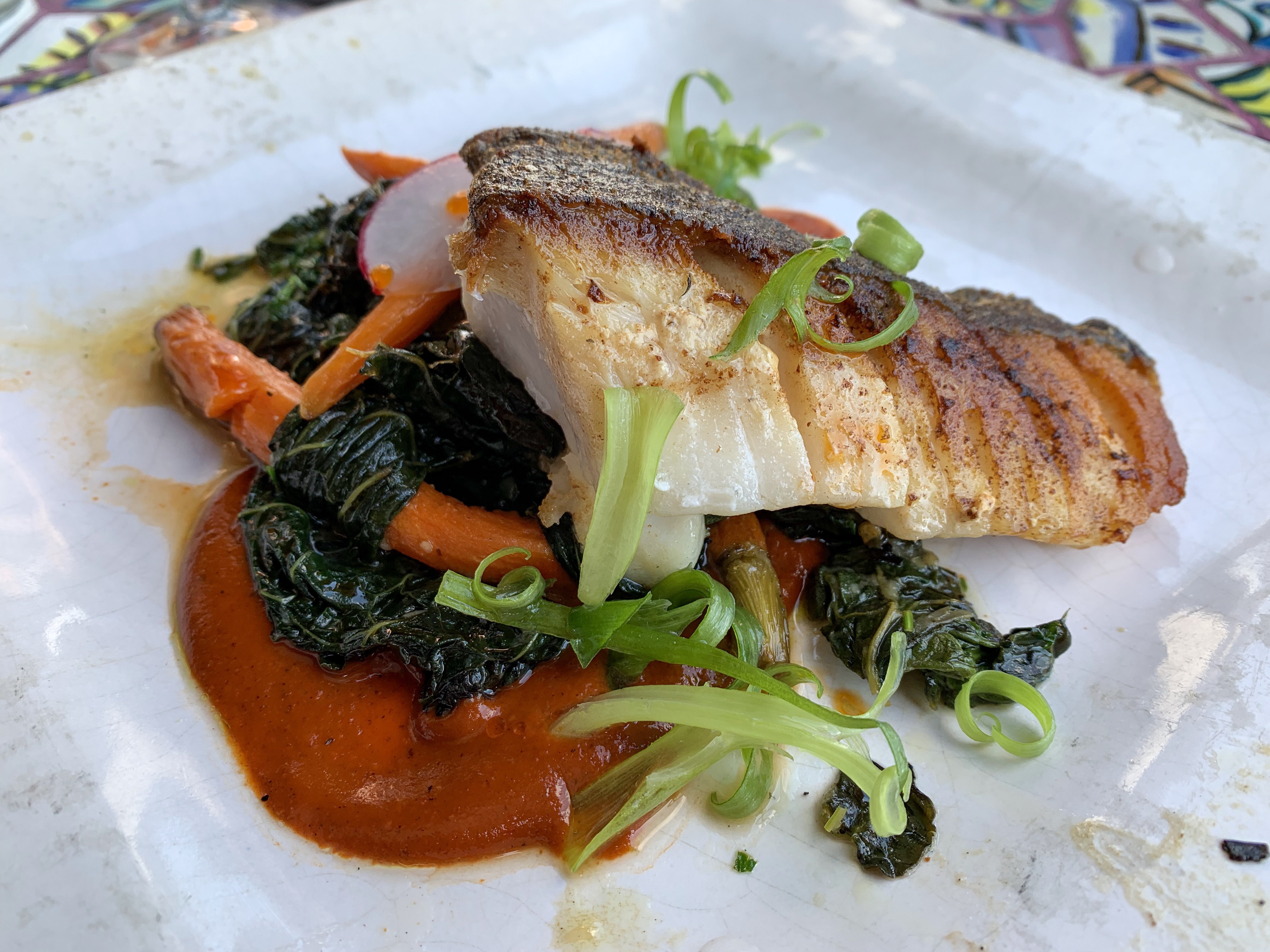
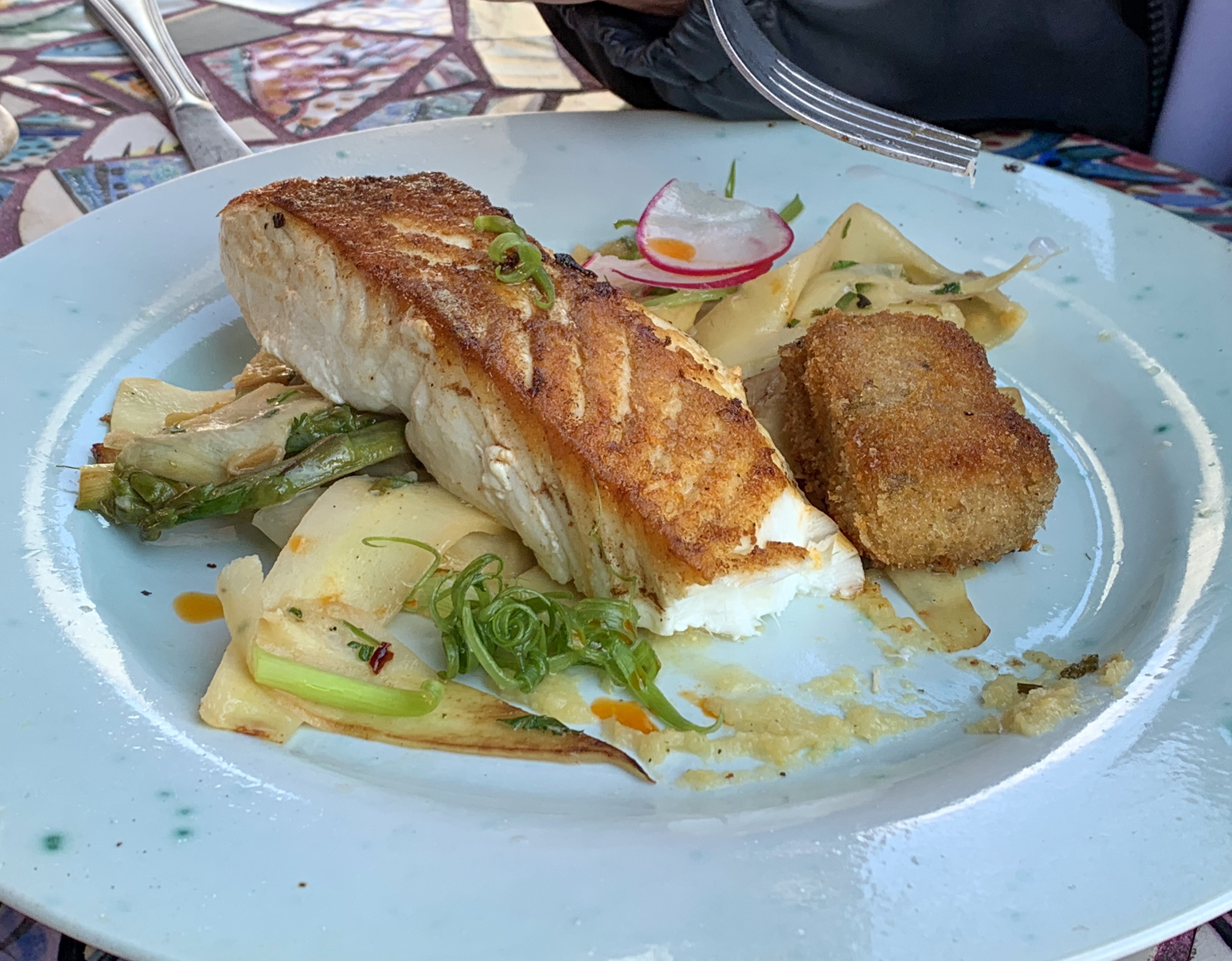
We have been “seafood spoiled” recently. For dinner we ate at Captain Patties Seafood on the spit recommended by a couple local sources as the best seafood in Homer. We had a variety of dishes. Our evaluation- passable, not great.
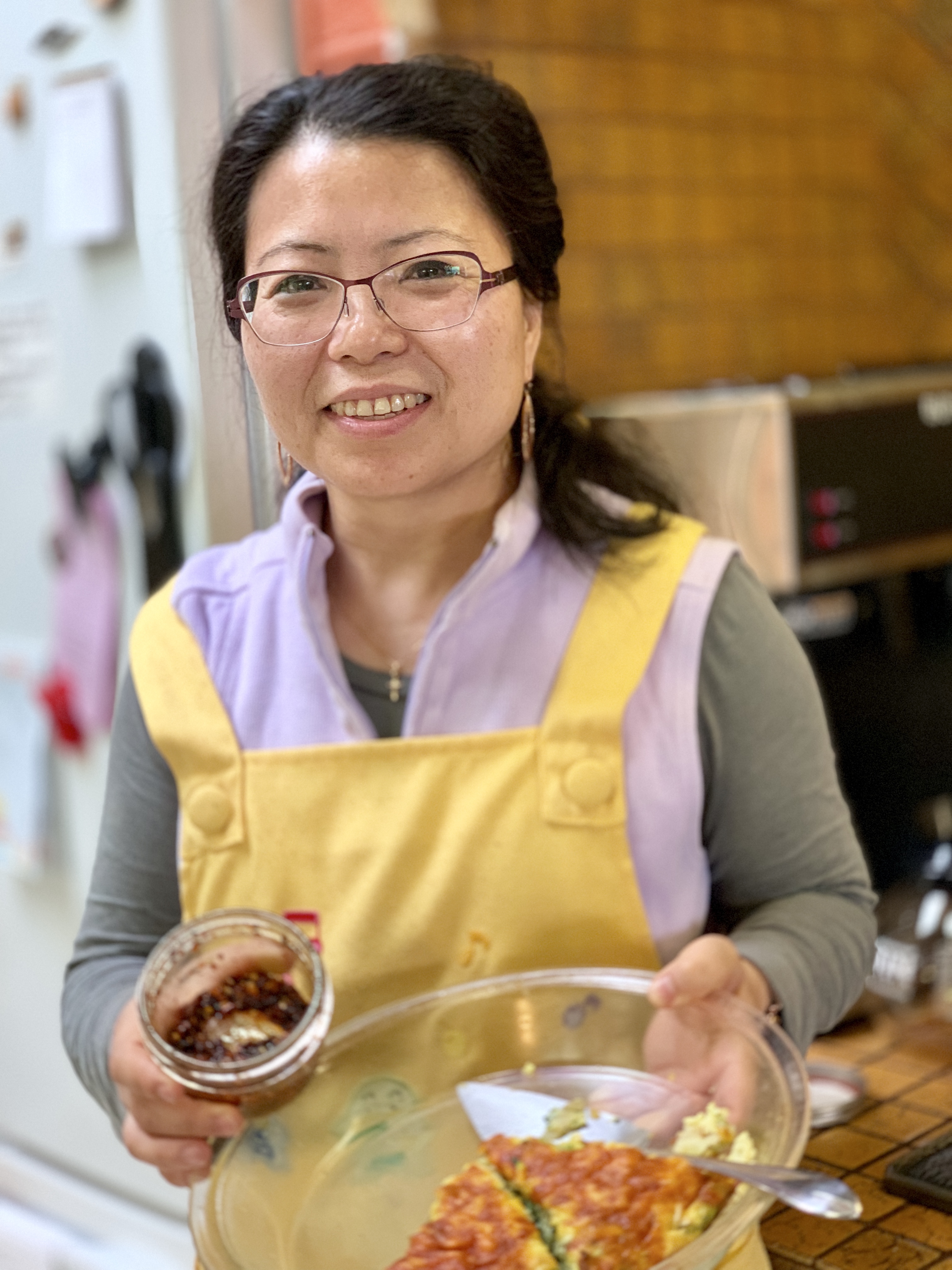
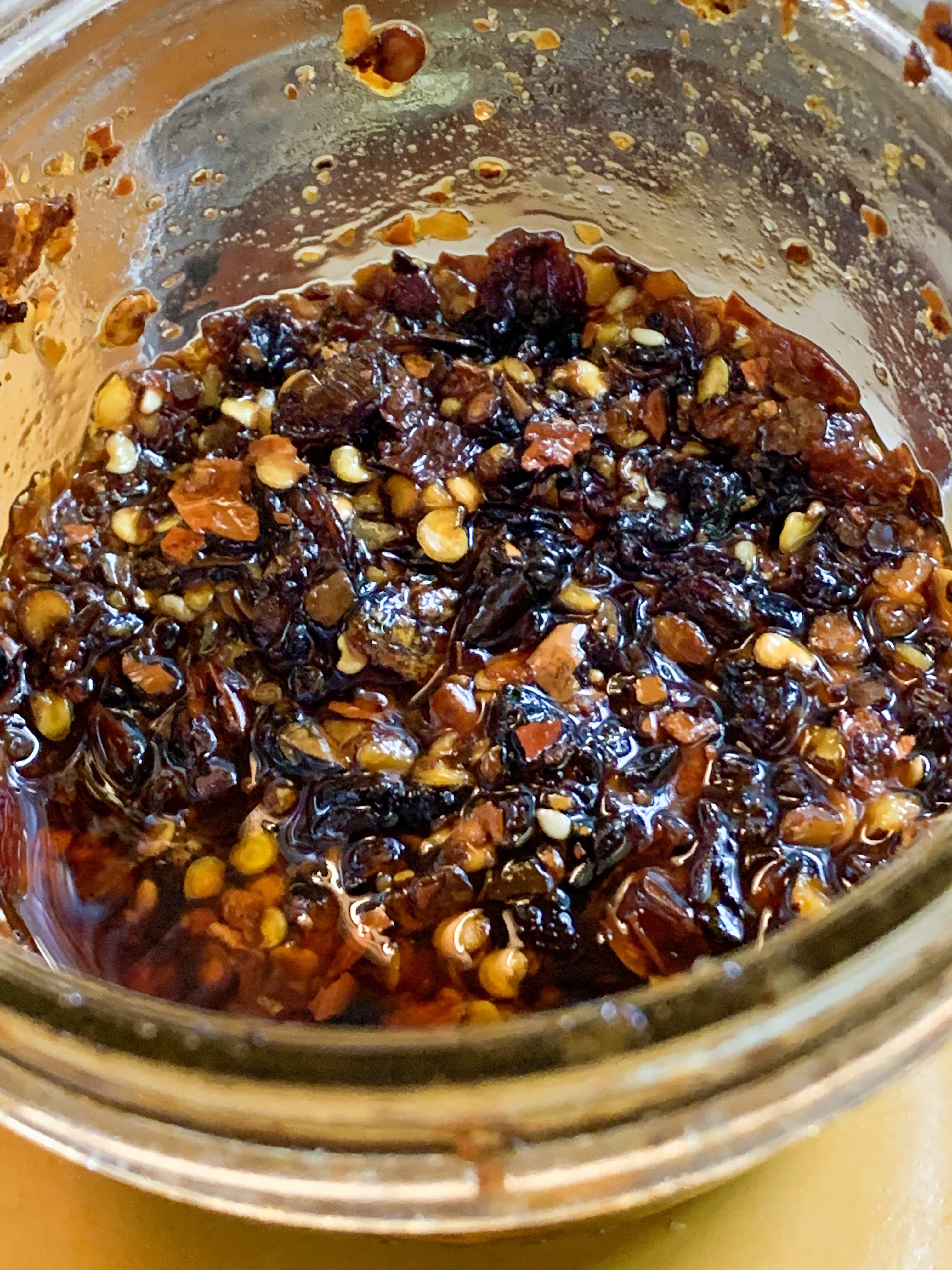
Our Innkeeper, lovely Ju Xia shares Sichuan cooking secrets Jun Xia’s homemade chili sauce. I have the recipe if you would like to make some.
Great Display! “The Alaska Islands & Ocean Visitor Center takes you on a dramatic journey through the refuge’s past and present . . . surrounds you with the sights, sounds – and even the smells of a seabird colony . . . and invites you to follow biologists as their research ship sails to remote islands each year.”
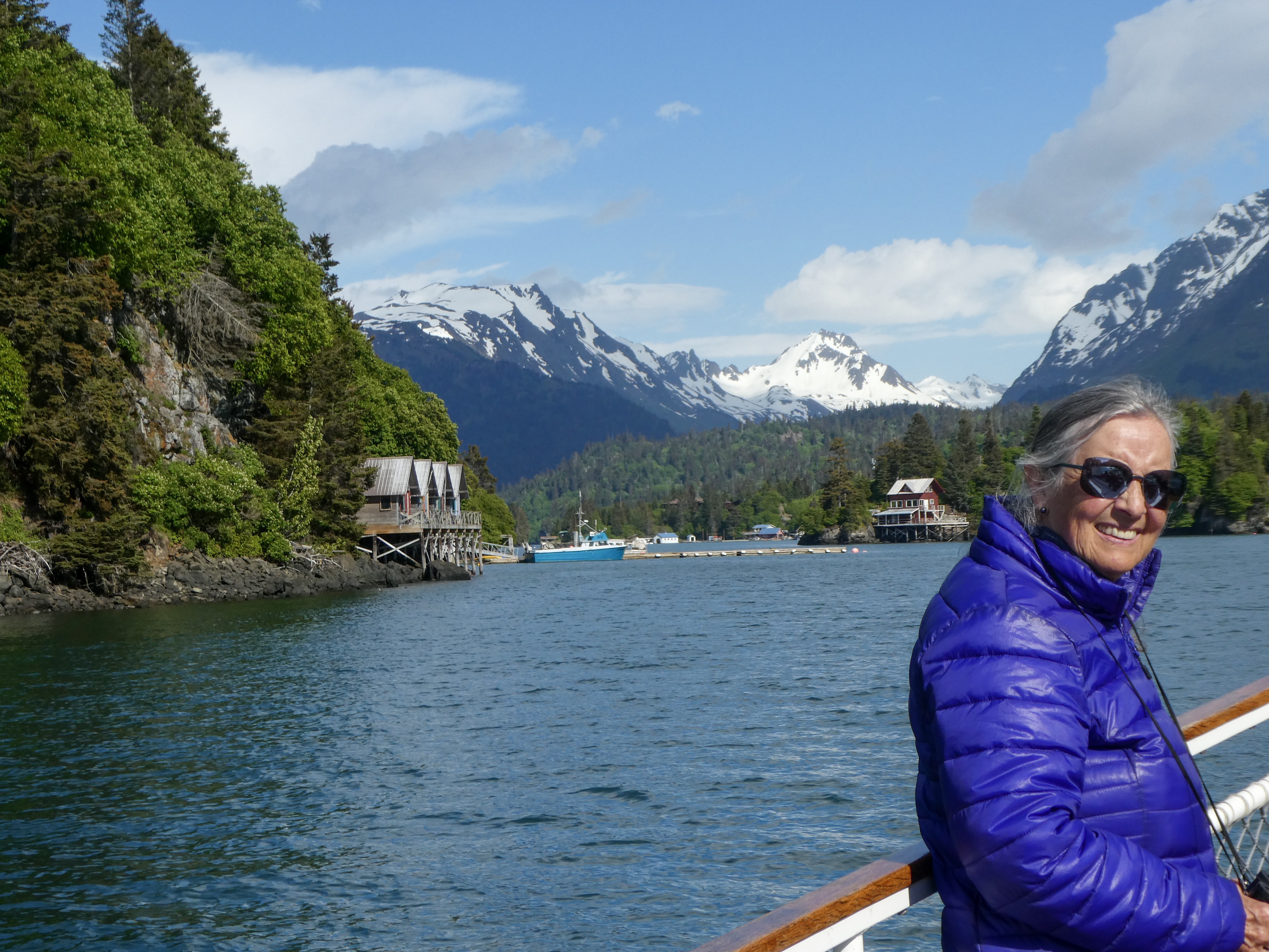
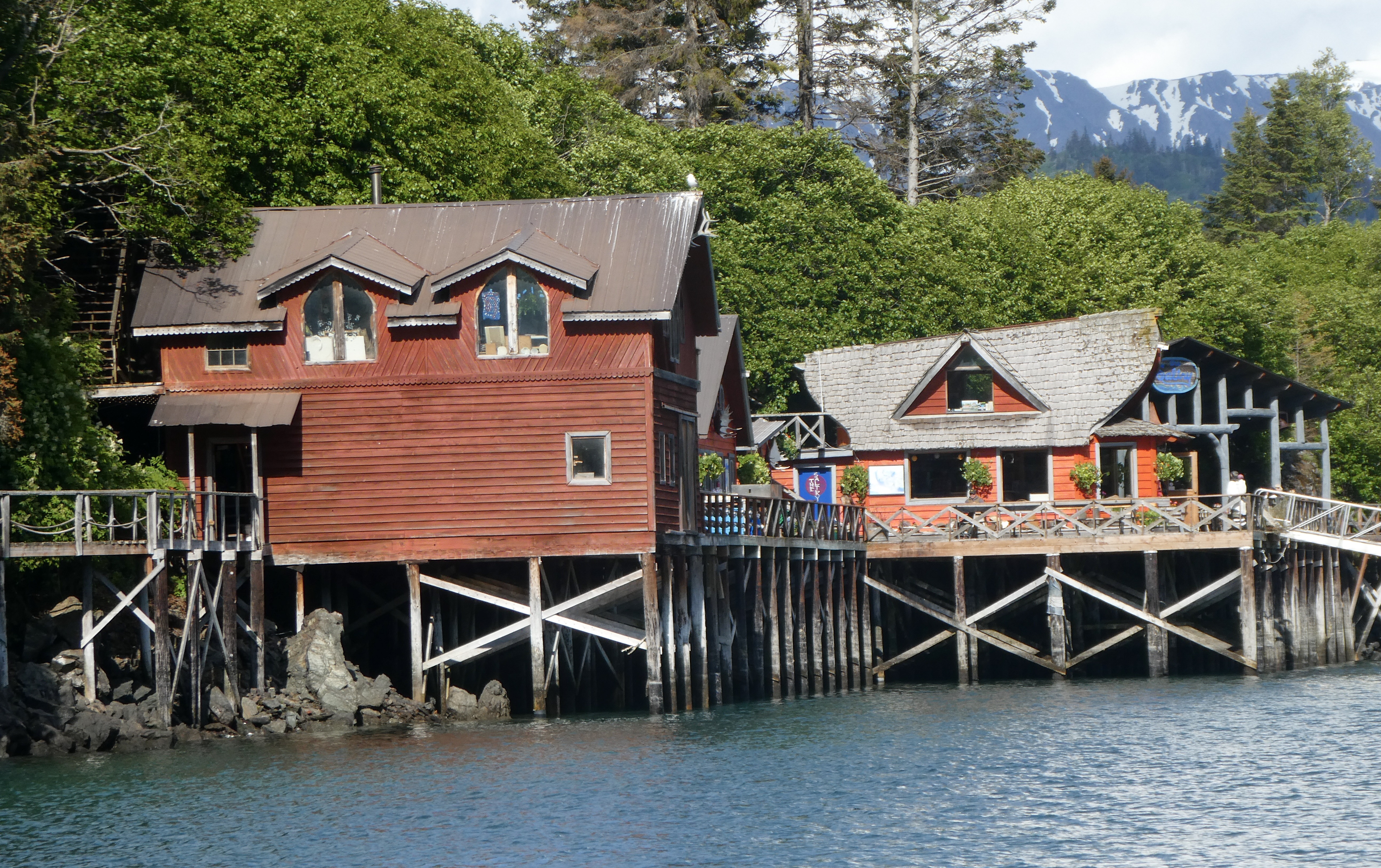
Halibut Cove And The SaltryRestaurant
”Originally a fishing village, Halibut Cove is now home to several artists and businesses. One of the only floating U.S. post offices is there. A popular tourist destination, the cove offers several lodges and cabins and the only way to get around the cove is by boat.”
”Located on Ismailof Island in Halibut Cove, Alaska, The Saltry Restaurant opened in 1984. On an overcast day in the fall of 1983 the Saltry, jacked up and teetering on three foot wooden stilts, floated slowly down the Halibut Cove channel, flanked by skiffs bearing “no wake” signs. Rising over all was the Saltry’s steeply peaked roof line-attributes that had earlier caused the locals to dub it “The Flying Nun.”When the perfect building to house an island eatery presented itself, Marian and Dave Beck acted instantly to acquire the unique structure that became the Saltry Restaurant. A U-shaped dock was constructed in preparation for the Saltry’s arrival. Moving day was chosen for its twenty-three foot tide, the highest of the season. When the tide was at its highest point, the barge was eased into the U-shaped opening. As the tide dropped, the empty barge eased down and away with the tide. Pilings were erected from the beach at low tide to brace the Saltry from underneath. If you look at the dock around the Saltry now, it’s possible to see how it sits not quite square, how its final settling place is slightly caddywhompus.
The Saltry first opened its doors in April 1984. Eighty people arrived for the celebratory potluck, despite the howling blizzard of rain and snow. At its inception, the Saltry provided simple fare: drinks at the bar, hot chowder, fresh bread and cold appetizers-such as pickled fish- that are still on the menu today. Today, the Saltry serves about 100 people everyday during the summer season, dishing out gourmet food from a kitchen decidedly more sophisticated than in 1984. What hasn’t changed is the incredibly beautiful setting of the Saltry, with its view of the mountains and glaciers from its perch above the water, and the desire to bring the freshest fish, mussels and oysters straight from Kachemak Bay to your table.
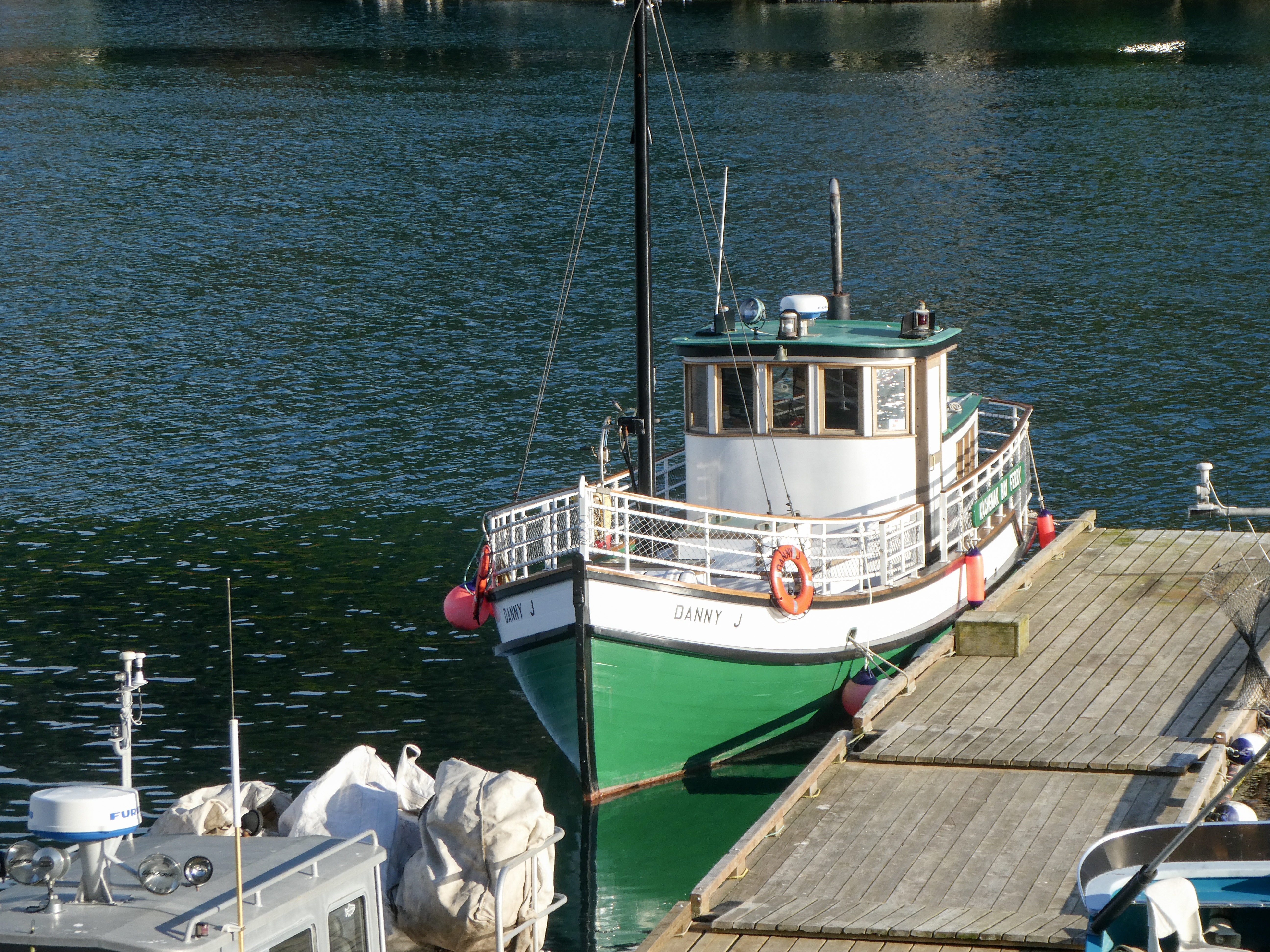
The ”Danny J” – Our ferry to Halibut Cove 45 minutes from Homer. Captain Elsa Of the “Danny J”
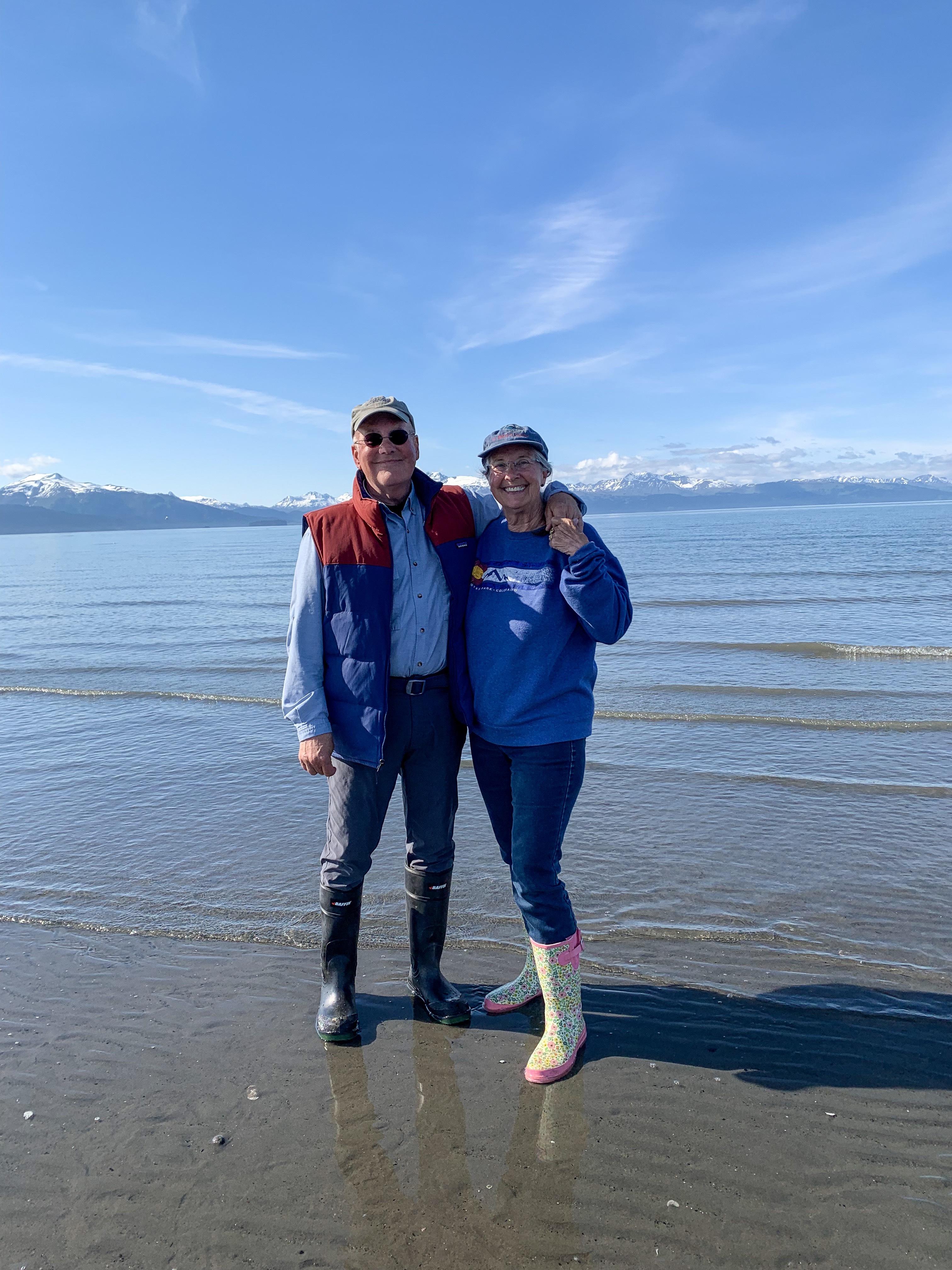
Captain Elsa told Sally “Women come to Alaska and become the men they always wanted to marry”. We saw women doing many physical jobs that men often perform. Needs must!
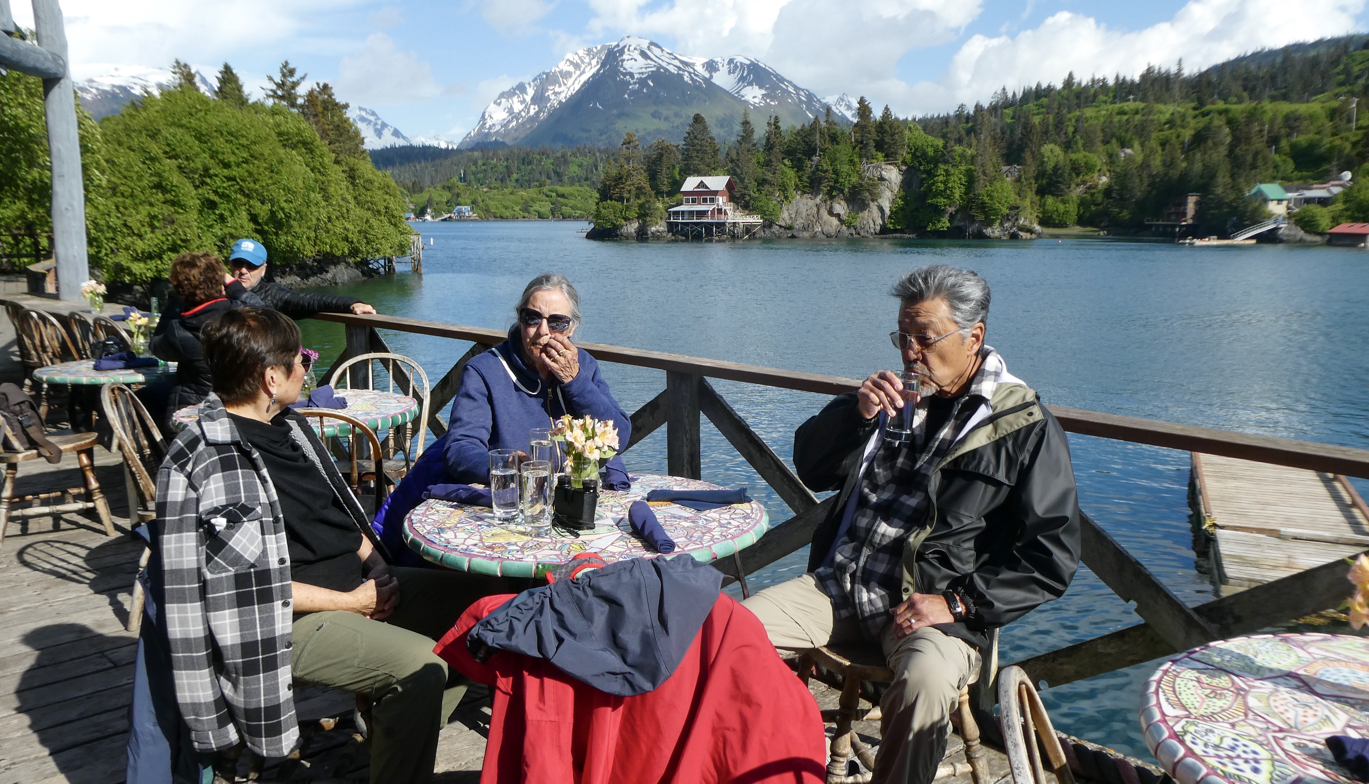
Ready for a nautical adventure The Saltry coming into view Lovely dinner setting Black cod. Incredibly delicious Ray’s Halibut. Excellent!
Appetizers included mussels harvested that morning, 300 yards from the restaurant, shrimp poke, and pickled salmon.
Halibut CoveSally doing her “Titanic” impression. I don’t have enough hair to be Leonardo DiCaprioThe tide is way out, so we walked the beach in our rubber boots!Mermaids, pulling David under!
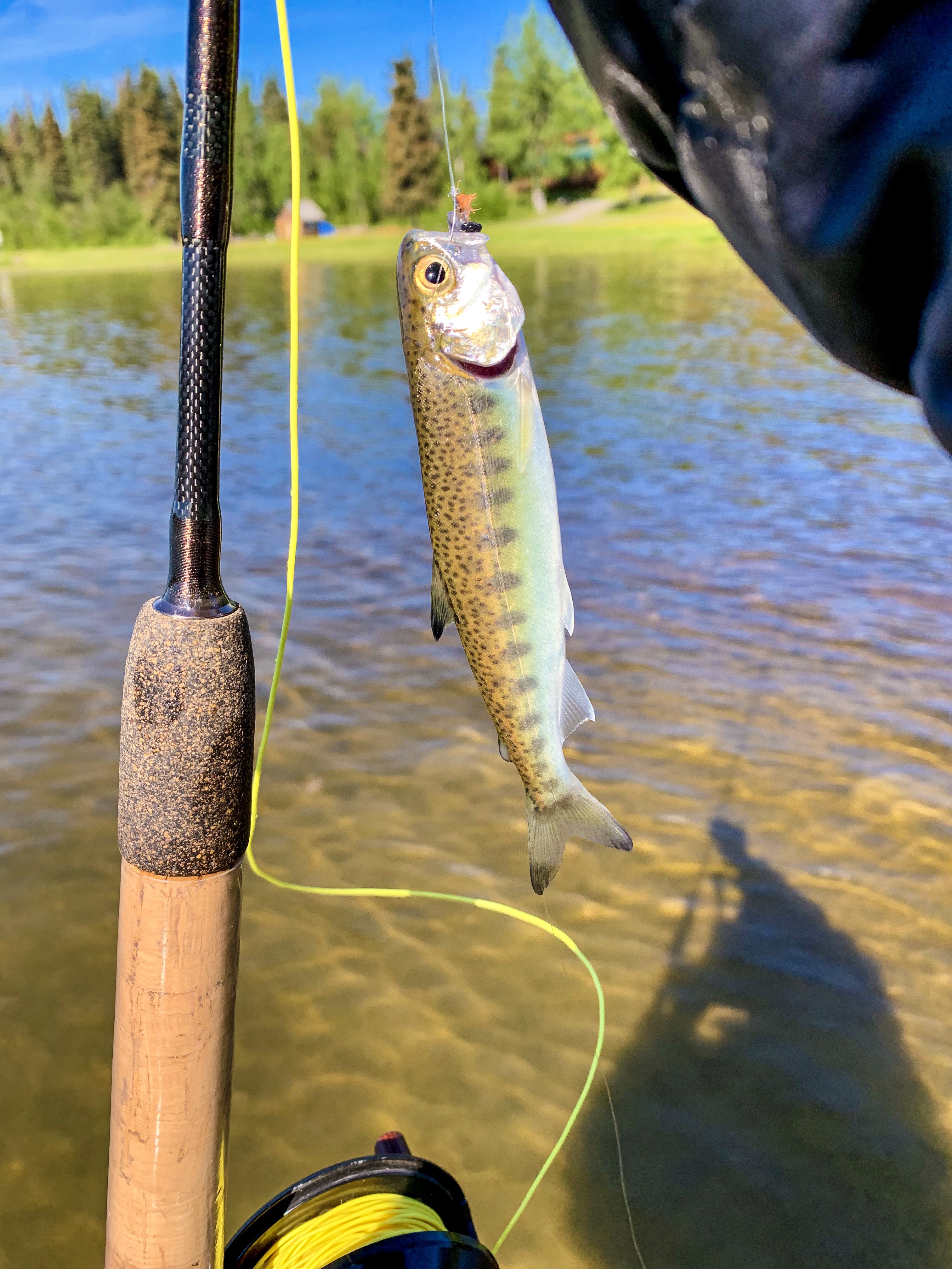
Leaving Homer, we camped for the night on the Kenai River
Campsite on the Kenai RiverHappy fishing dude in AlaskaCutthroat Trout. Not huge, but plenty feisty!
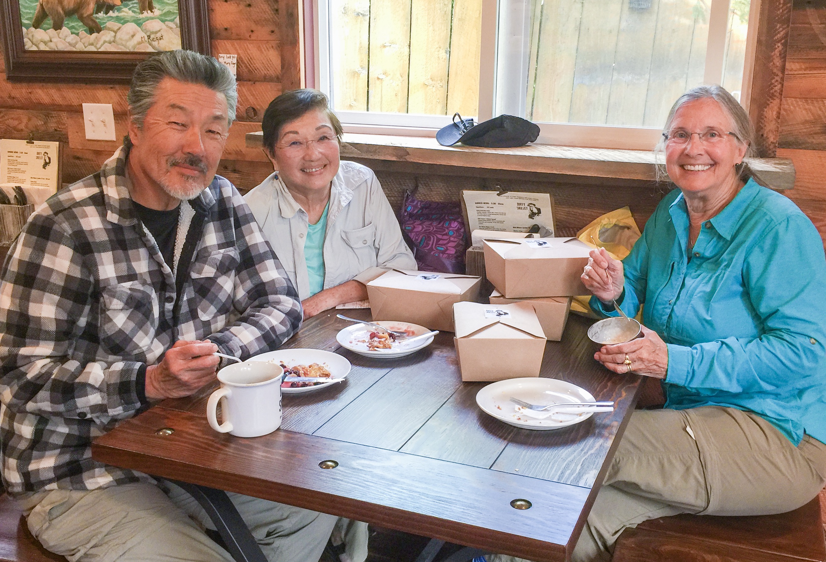
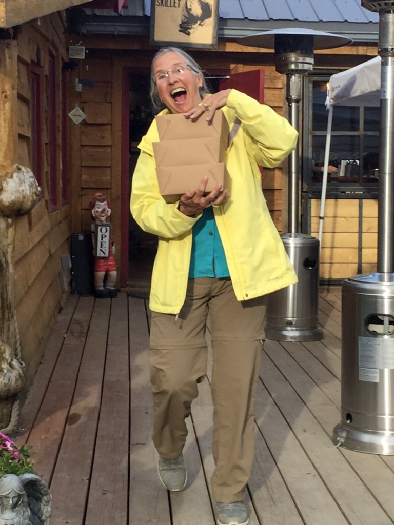
Back to Hope. If asked, we will say we returned to Hope as it was a beautiful, convenient stop on our way to Valdez. In reality, Sally and Ray wanted more pie!
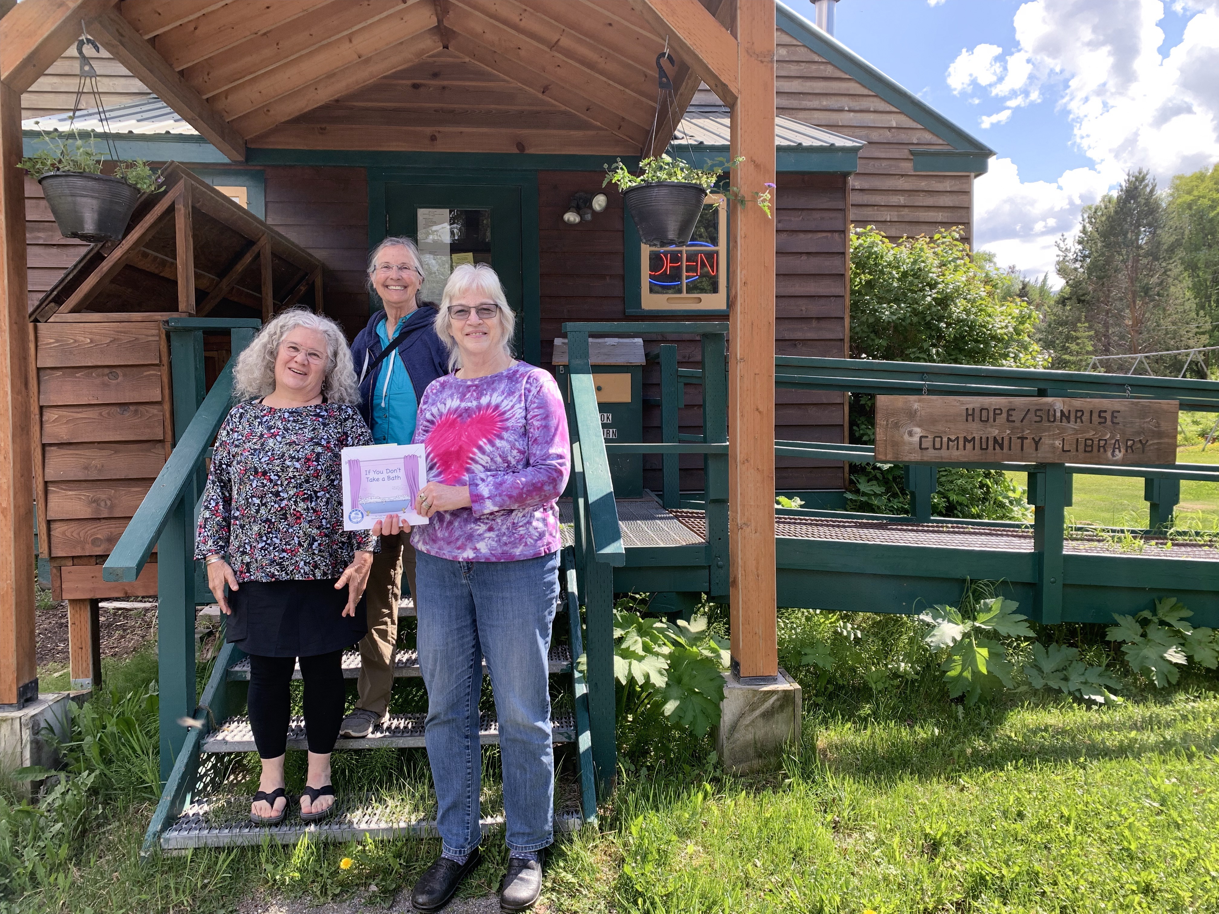
View from our campsite across Turnagain ArmBack in Hope, Ray (“Pie Guy”), Shirley and Sally go for more pie. Pie to Go! Sally dampens her enthusiasm for more pie!Who remembers this? A return to the 1950’sSally donates a copy of her book “If You Don’t Take a Bath” to the Hope library.
Next Post: the city of McCarthy in the Wrangell-St. Elias National Park
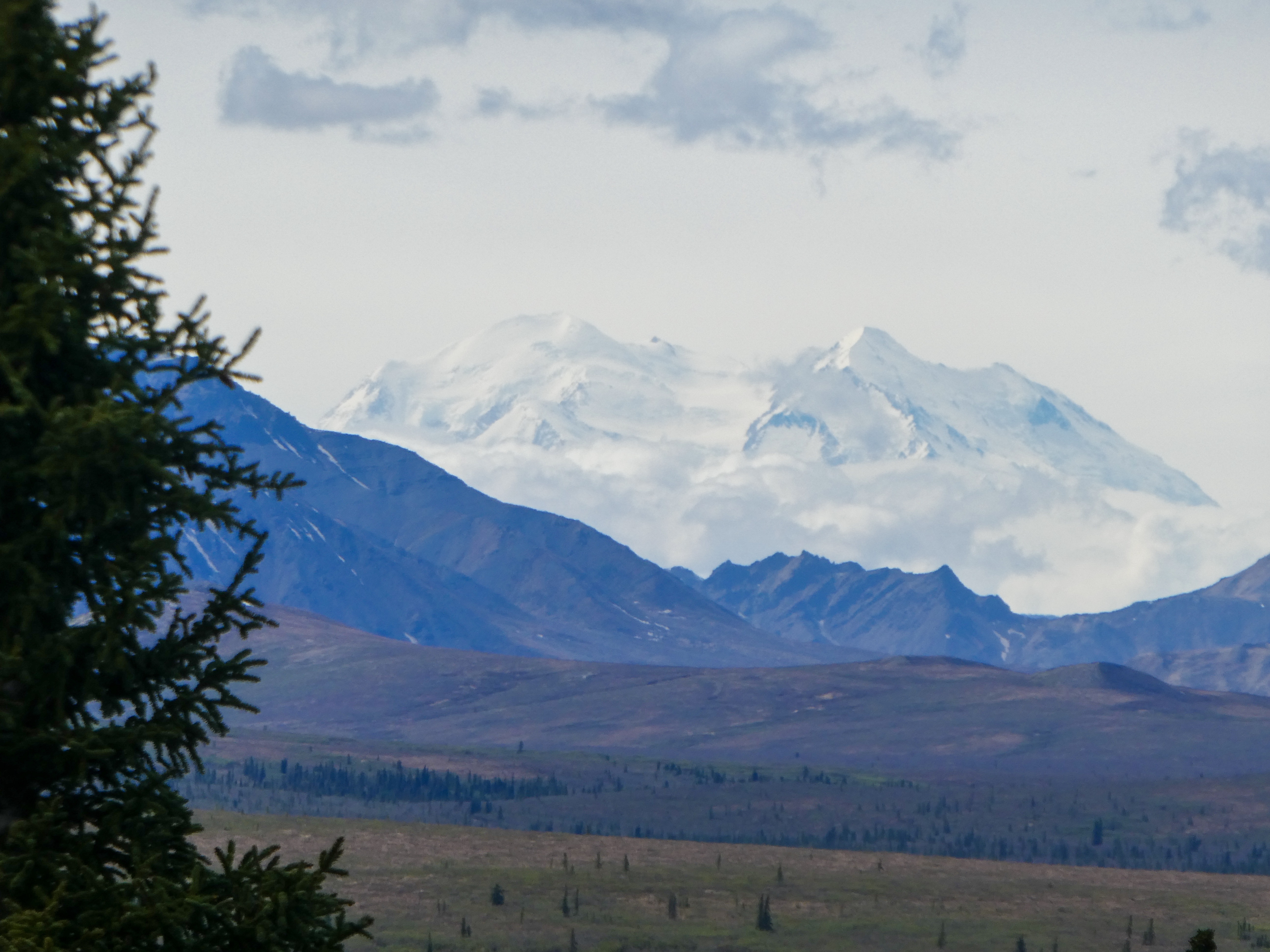
Today: 64 degrees, sunny and Denali is clearly visible. Alaska heaven!
“Denali is six million acres of wild land, bisected by one ribbon of road. Travelers along it see the relatively low-elevation taiga forest give way to high alpine tundra and snowy mountains, culminating in North America’s tallest peak, 20,310′ Denali. Wild animals large and small roam unfenced lands, living as they have for ages. Solitude, tranquility and wilderness await”
View of Denali
Creation of Denali National Park and Preserve
“Charles Sheldon was a hunter and naturalist attracted to Denali specifically by Dall sheep. He had traveled the world hunting sheep and was drawn here by the world’s only wild, white mountain sheep.In the winter of 1907-8, Sheldon observed over 2000 Dall sheep taken from the Denali area by commercial meat hunters who sold the carcasses to Alaska railroad workers and gold miners in Kantishna.
These two occurrences brought the first significant numbers of white men to Interior Alaska. Sheldon was astute enough to realize the hunting of wildlife and the fragile ecosystem would vanish under these kinds of pressures.Sheldon returned to Washington, D. C. and with the help of the Boone and Crockett Club, lobbied Congress to establish Mount McKinley National Park to protect the wildlife within. On February 26, 1917, President Wilson signed into law the bill establishing Mount McKinley National Park as a 2 million acre wildlife preserve.
Considering that at the time most people’s impression of Alaska was “Seward’s Folly, and the fact we did not reach statehood until 1959, it was a courageous act to protect such vast lands in what was then considered by many to be a remote and frozen wasteland.“
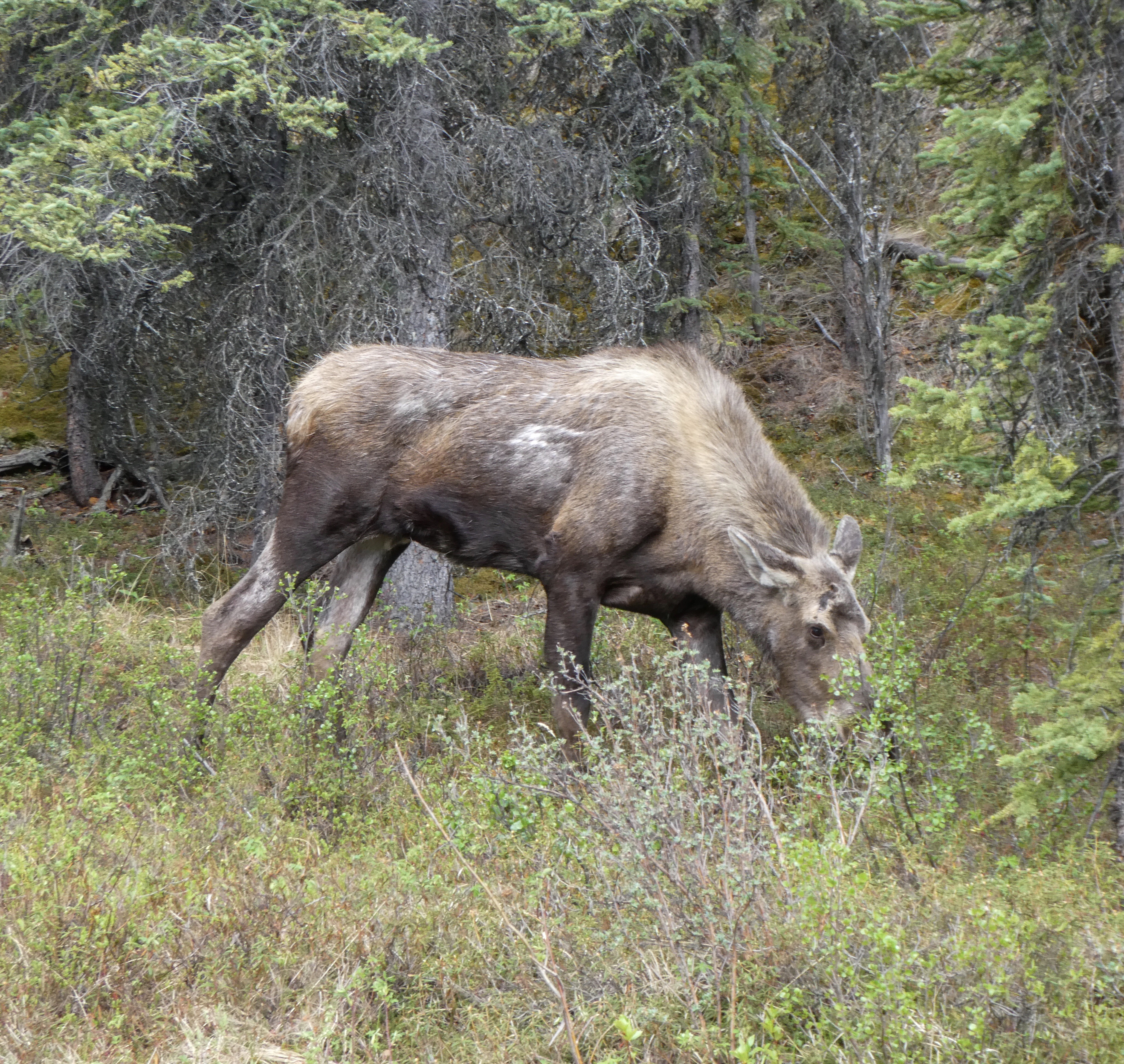
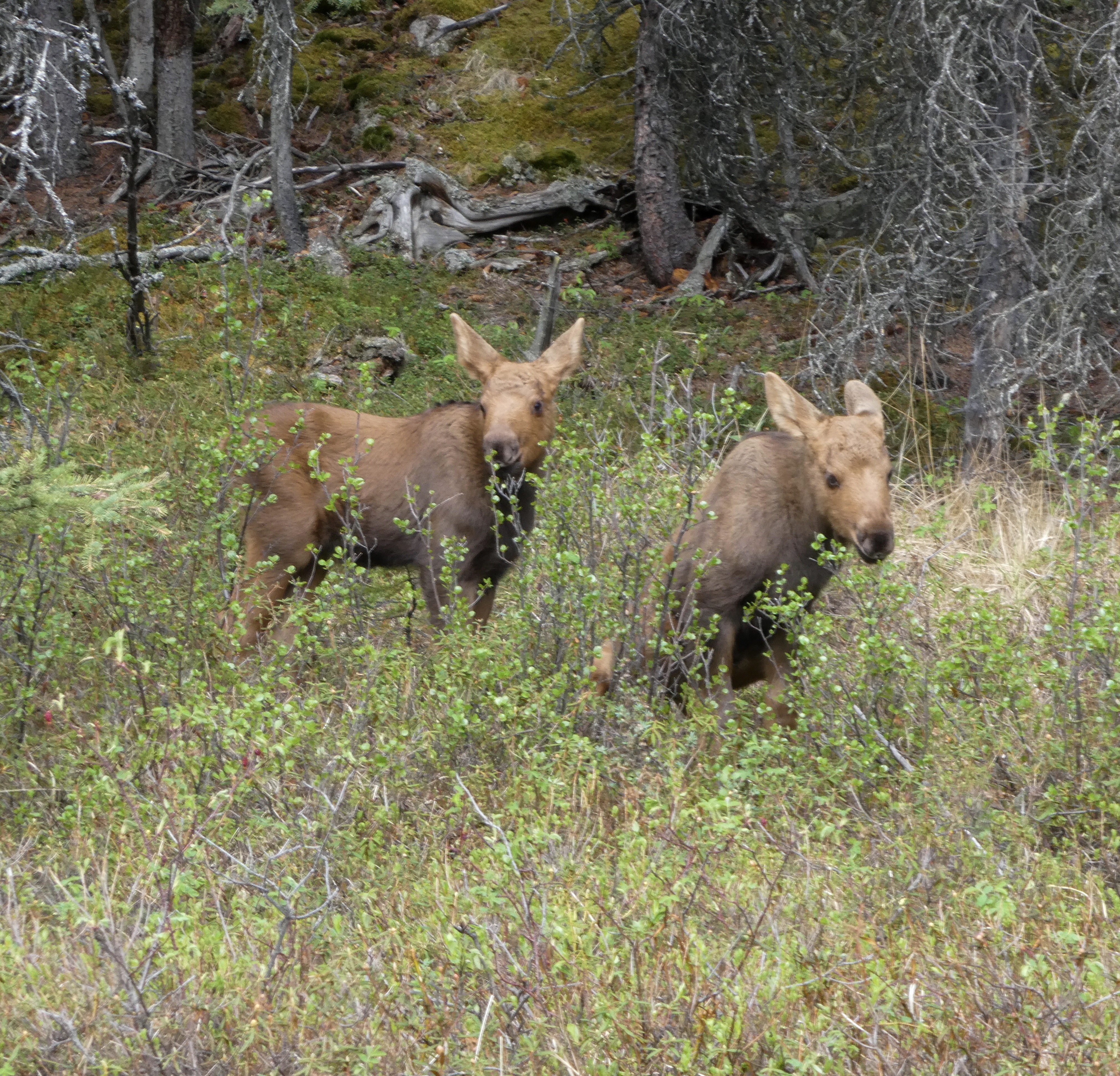
We entered Denali National Park after a long, beautiful trek on the unnpaved Denali Highway. Immediately, we saw a mom moose and her two twin calves next to the road.
Mom Moose, the most dangerous animal in Alaska (or Colorado )Cute moose calves two weeks old, like stuffed toys until mom saw us .
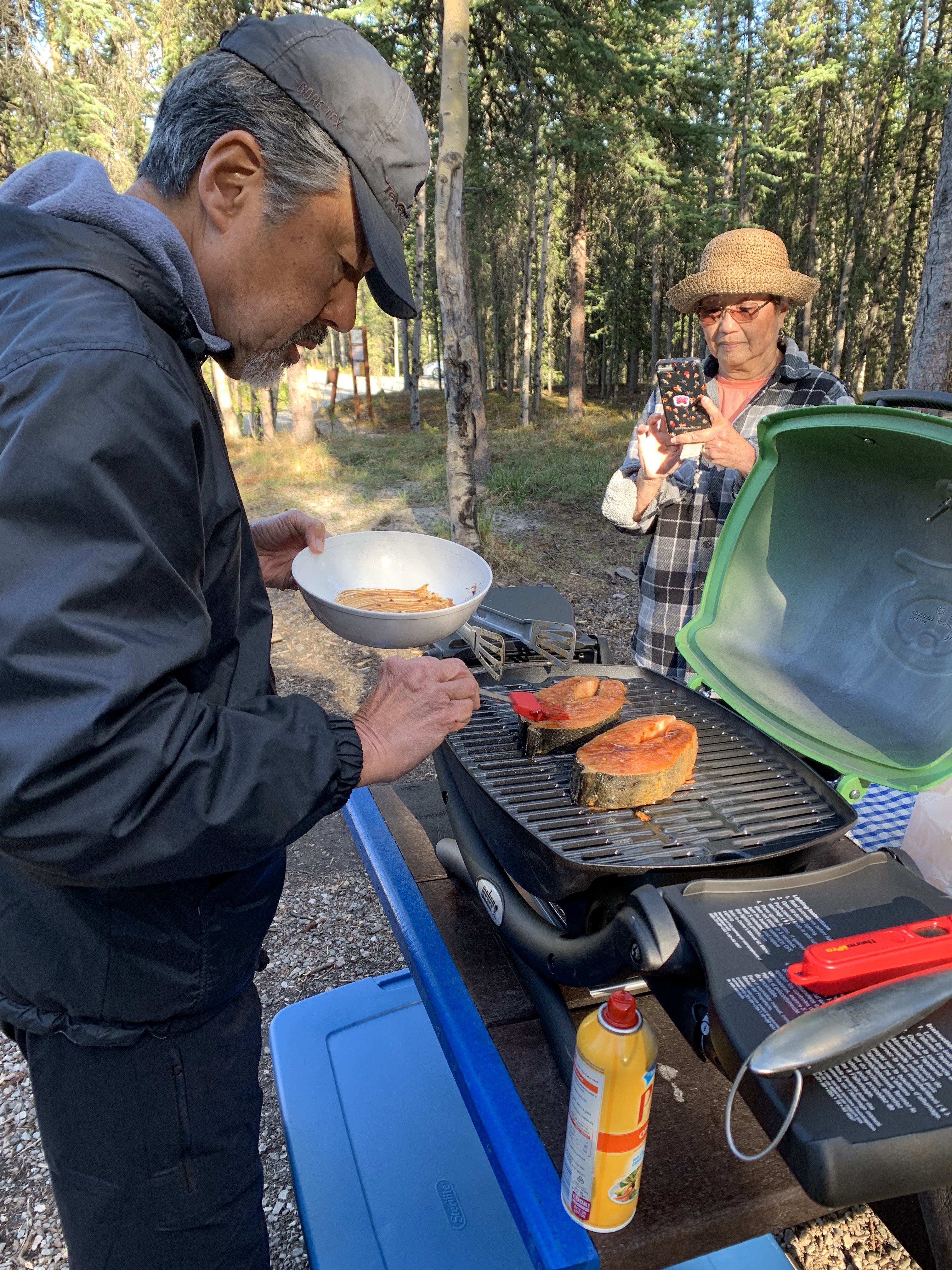
Grilling our King Salmon steaks from the Haines Canning Company. Best Salmon we have ever had.
Raymond Grillmaster prepares King Salmon steaks
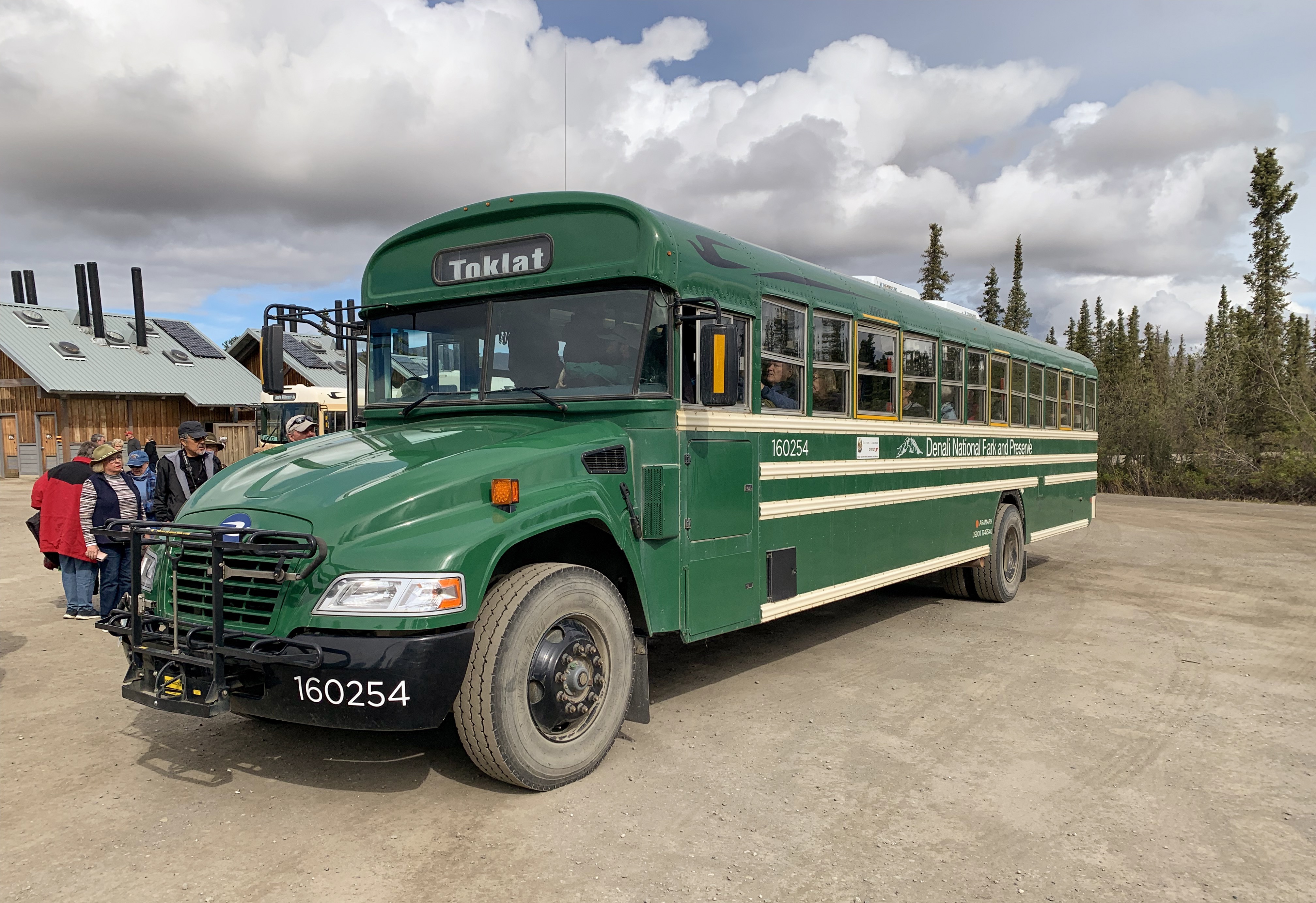
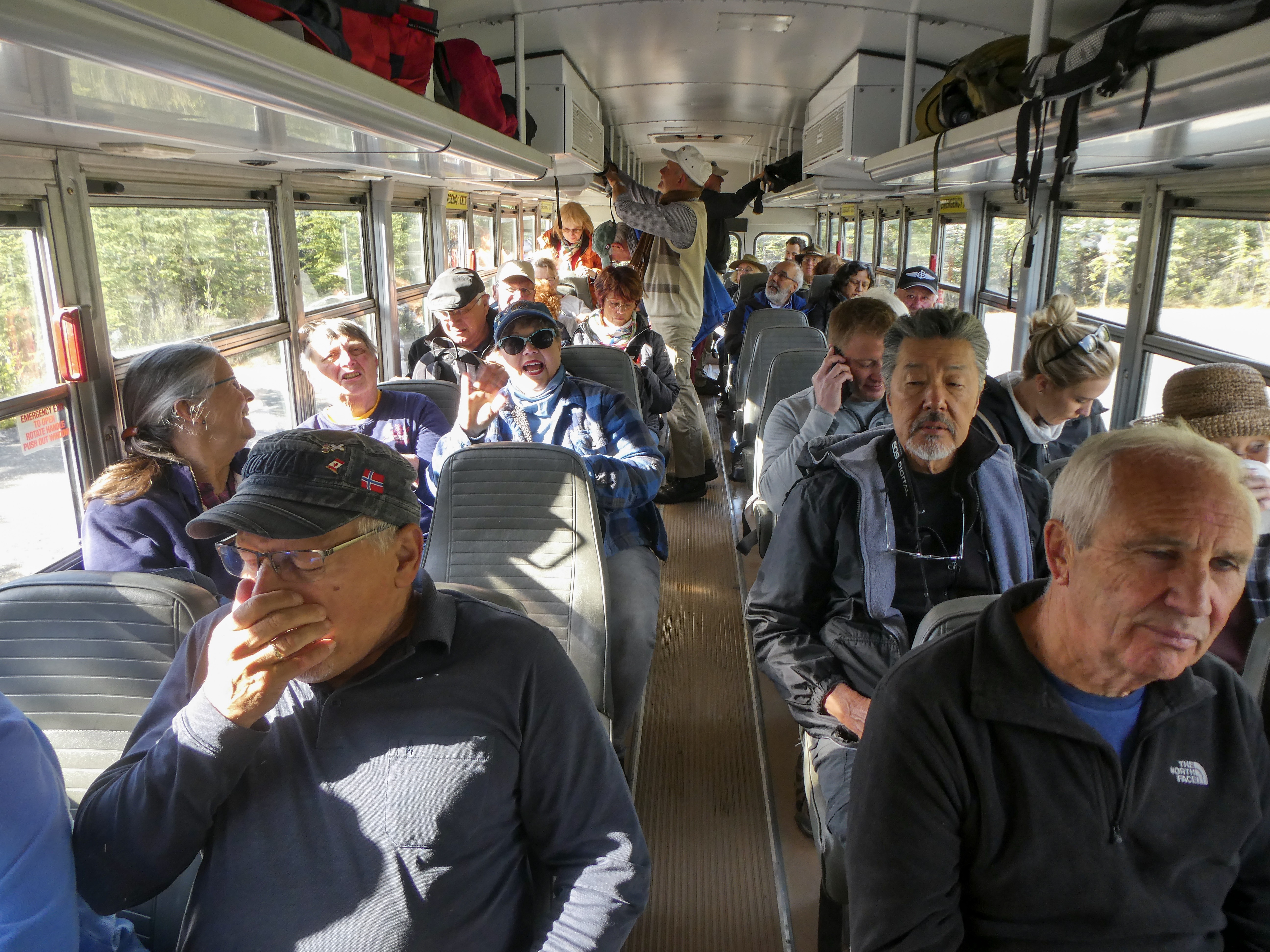
Despite my aversion to tourist busses filled with white (or no hair) retirees, we booked a tour, which is the only way to see the inner areas of the park as personal vehicles are prohibited for much of the park road. It turned out well.
Shuttle bus Lots of stops, On/off where you like and way cheaper than the tan guided busses
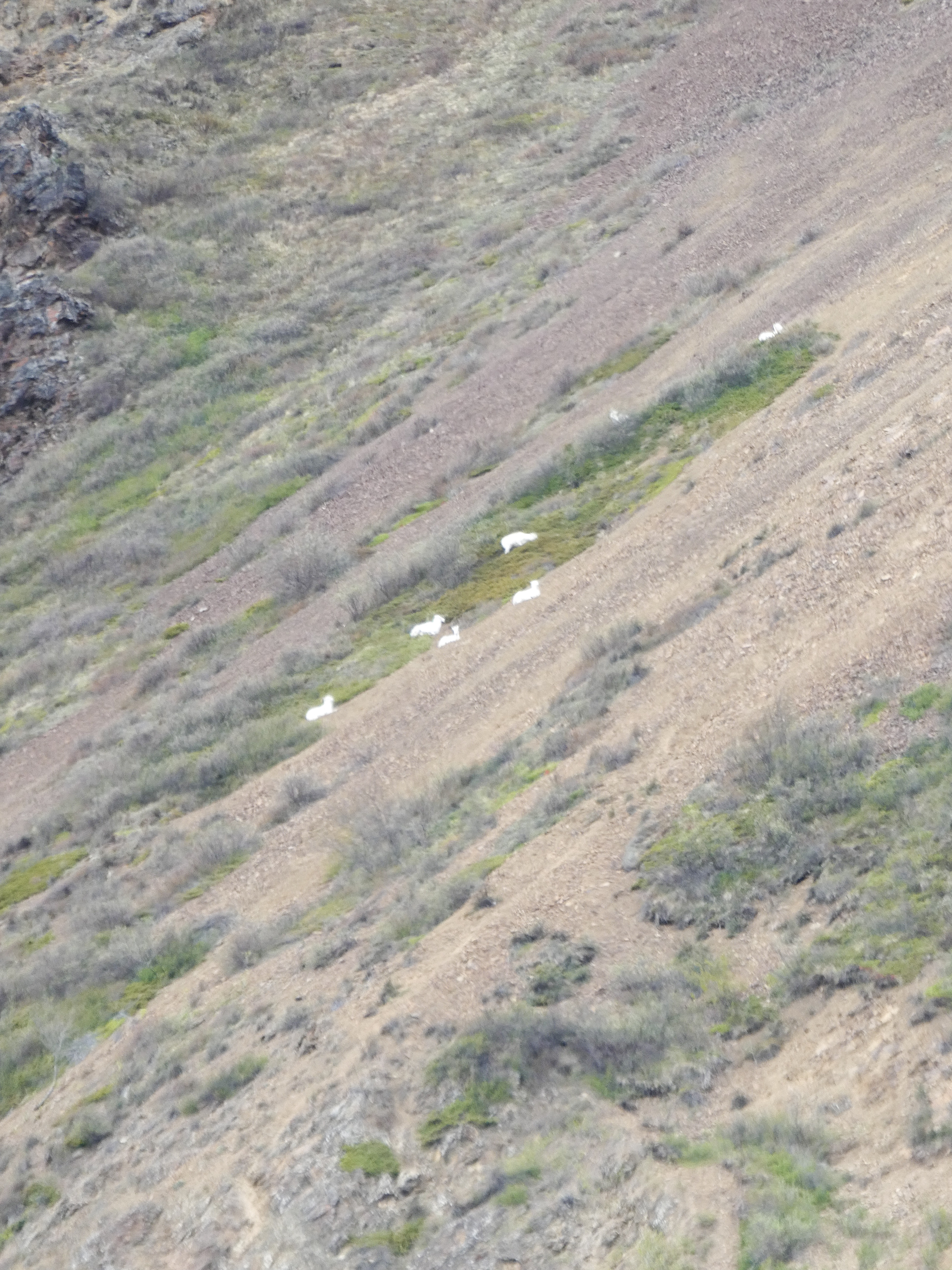
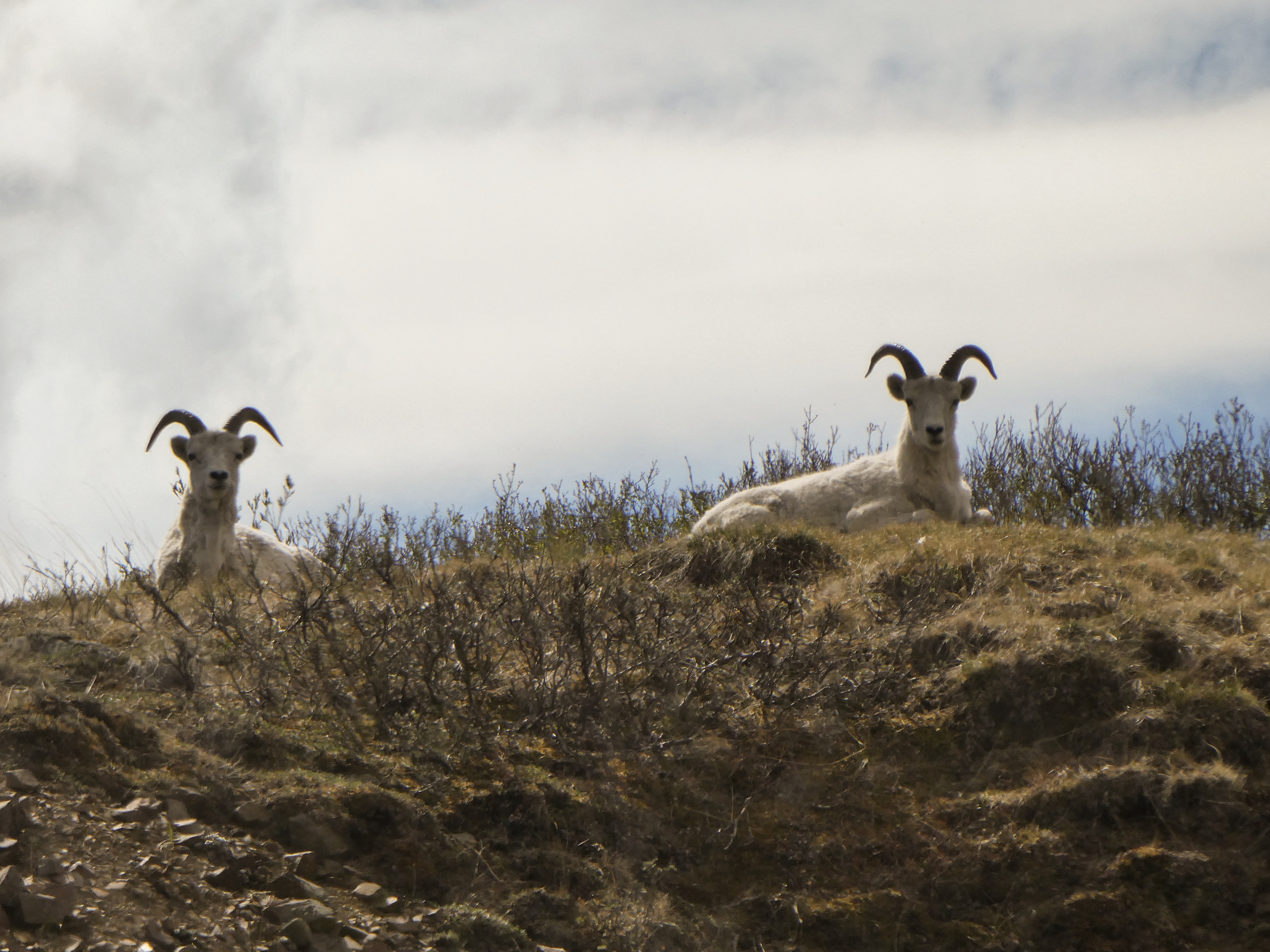
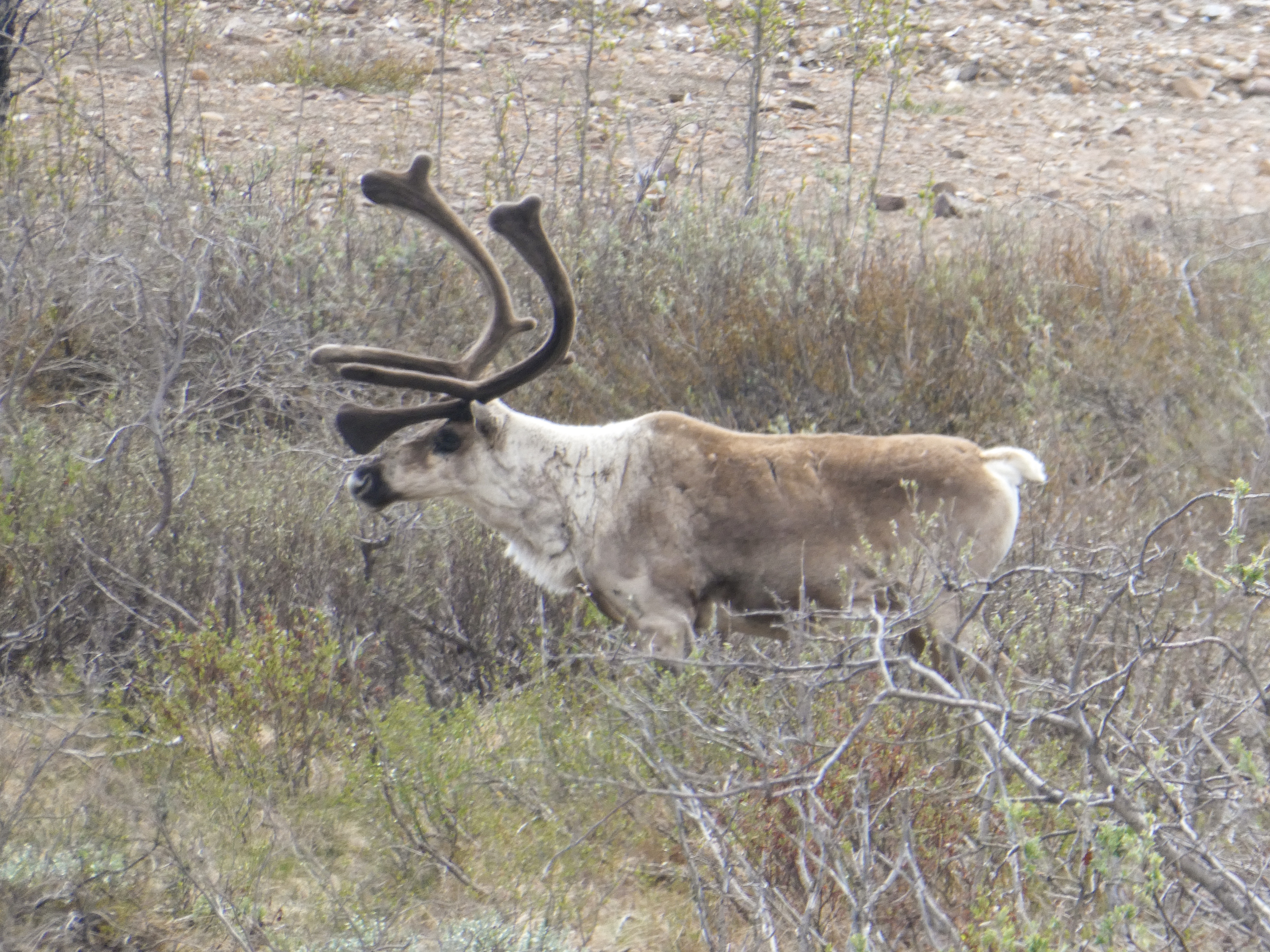
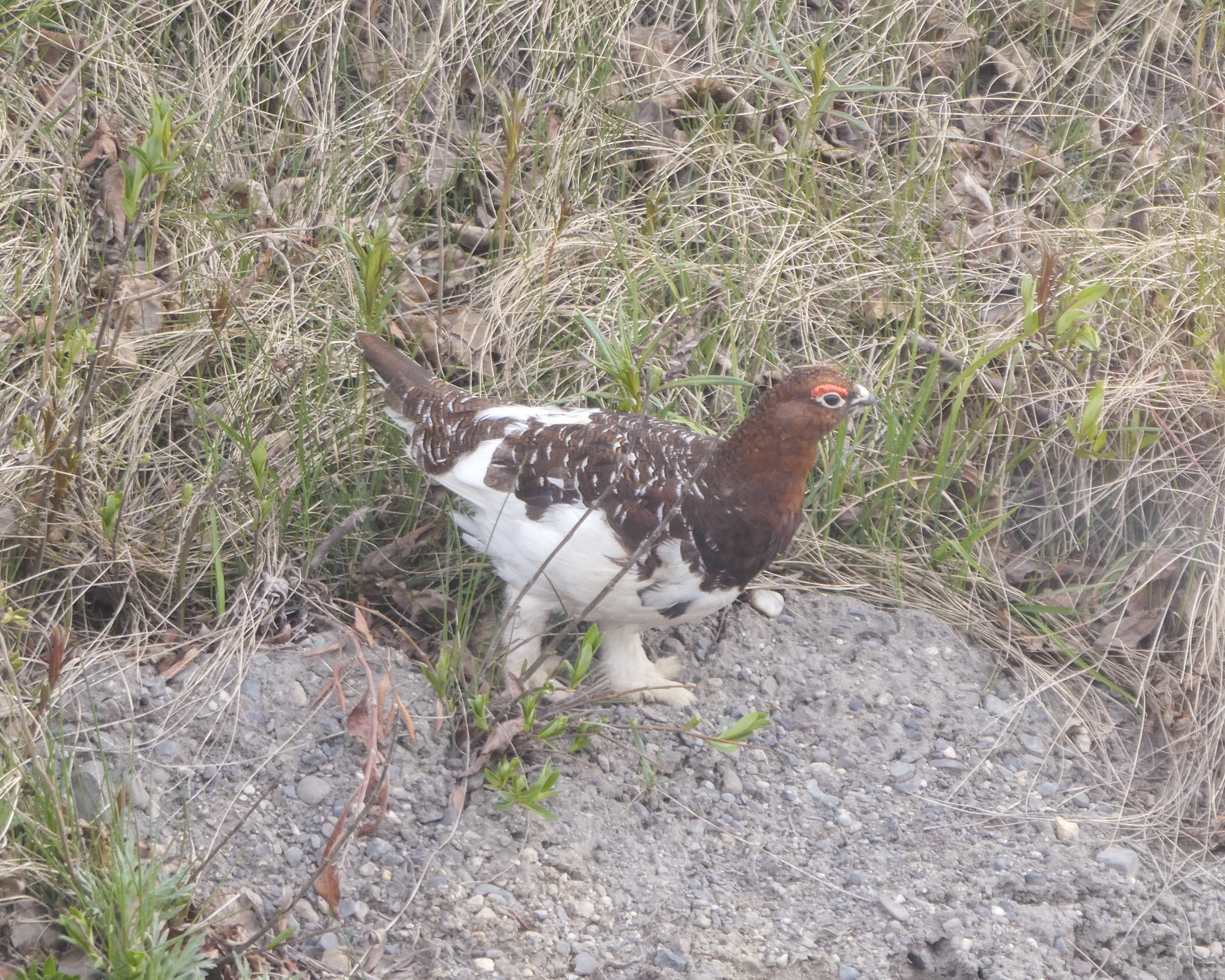
We saw 80 or so Dall Sheep , Ptarmigans, snowshoe hares, a coyote, Arctic Ground Squirrels, many caribou, golden eagles, ravens, and black billed magpies, but regrettably for Shirley, no Grizzly Bears 🐻
A bit crowded and noisy, but ultimately fun!Ready for adventure Steep drop offs. Sally and Shirley’s favorite! Especially when two busses pass…,The white spots are Dall Sheep, nearly wiped out in the early days of the park.Dall Sheep ewes. We saw 80 or so, Dall Sheep One of many caribou.Male Ptarmigan changing from winter to summer attire.
For dinner, we grilled my Wyoming Elk steaks (New York strip cut). Yummy!
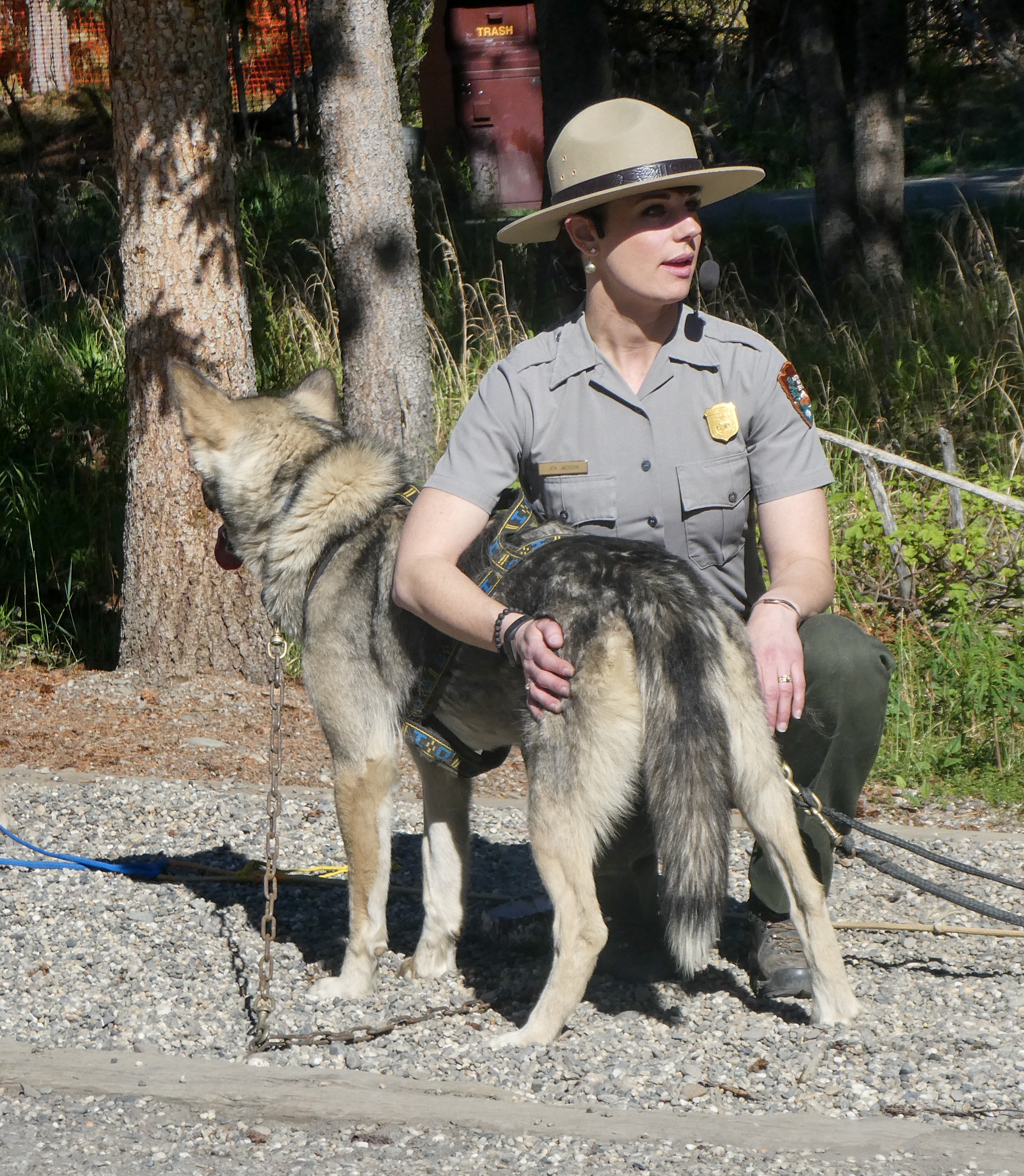
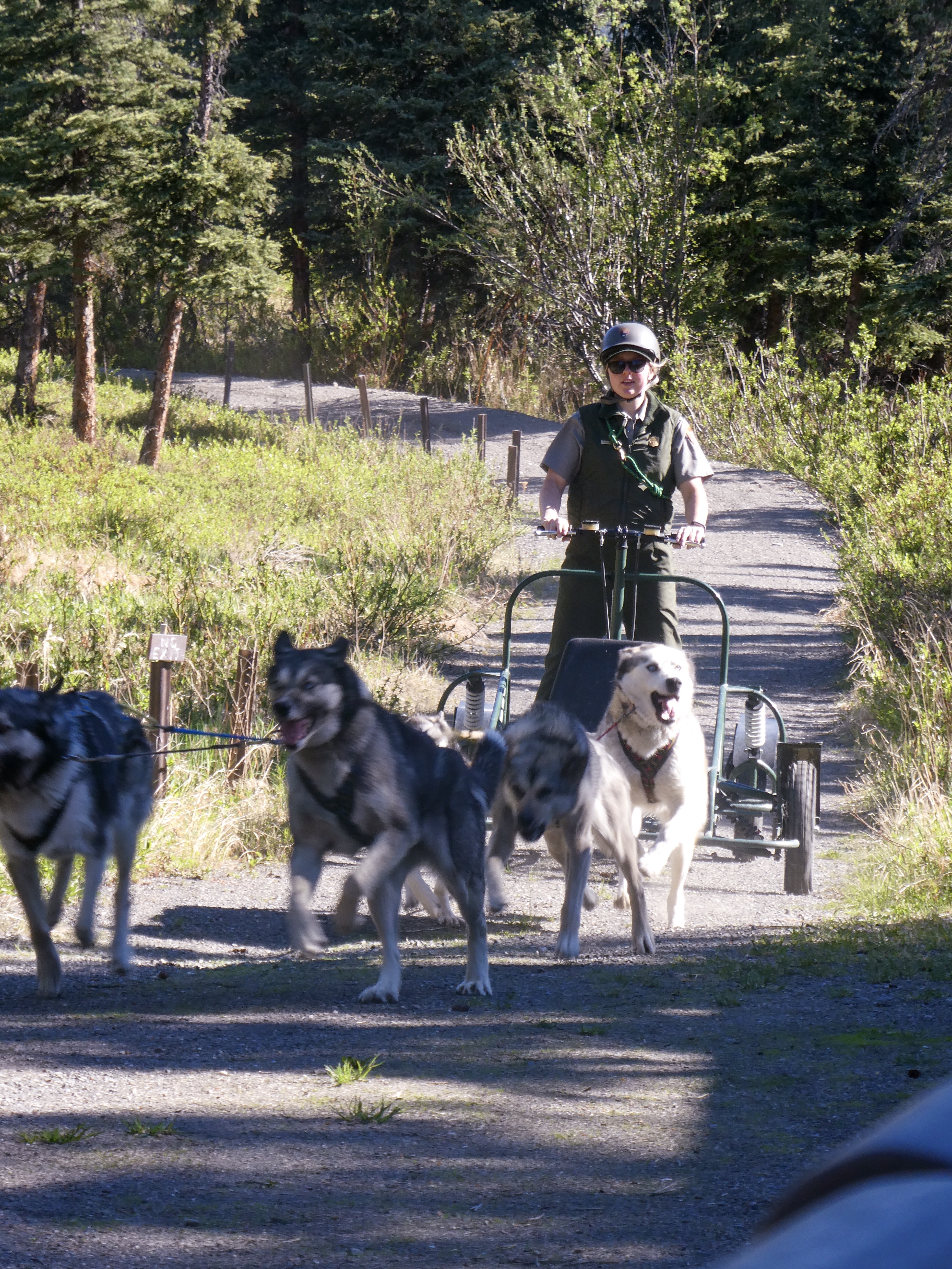
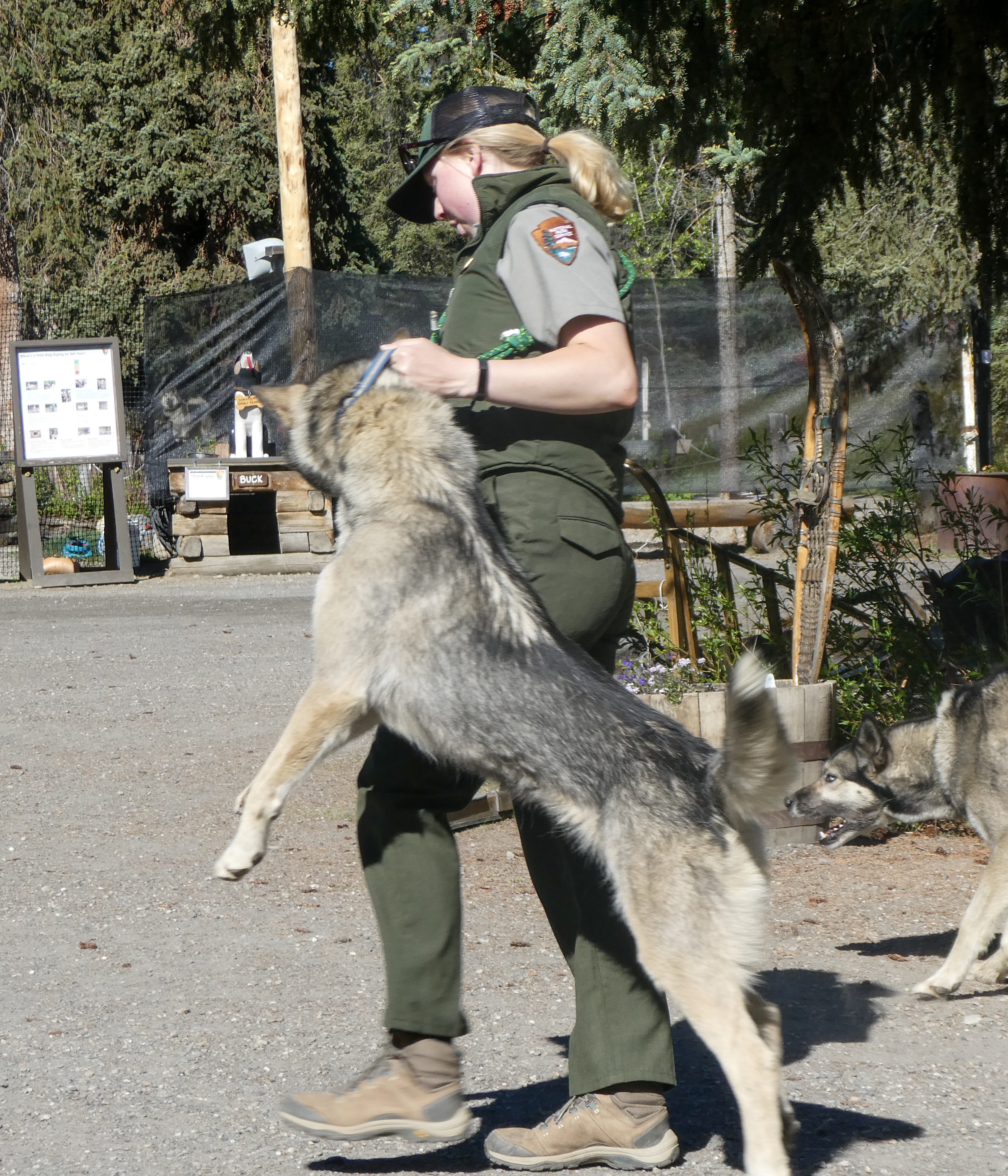
Dogsledding or “Mushing”
A Kennel Ranger “Mushing”
“Why Mush?
In a modern world filled with high tech solutions for everything it can be hard to comprehend why we would still actively choose to use traditional dog team travel rather than any of the modern alternatives. In fact, there are many reasons to choose sled dogs. TraditionDenali has had sled dogs since 1922. Our first Superintendent, Harry Karstens purchased the first seven sled dogs for use patrolling the newly established park boundaries. The park has maintained working dog teams ever since. Their job has evolved over time and they are no longer patrolling for poachers, they are still performing essential and inspiring work in protecting and preserving the unique character of Denali.
Reliability
Sled dogs have hearts and brains that machines like snowmobiles and airplanes do not. Every kennels ranger has a story of wise lead dogs helping them navigate to a patrol cabin in a white out or to avoid dangerous ice obscured under snow. The dogs know this landscape so well they can provide invaluable wisdom that machines cannot. While a team of sled dogs is obviously far slower than an airplane or a snowmobile, they are arguably more reliable to operate in the extreme conditions of a sub-arctic winter.When it is 40 below zero it can be near impossible to try to start a motor, whereas a dog team simply needs a good breakfast and they are ready and willing to run.
Overflow is a common challenge on rivers and trails in Denali. Snowmobiles can get bogged down and sink in this slushy mess whereas a dog team can run right through it and roll in the snow to dry off on the other side. If a machine breaks down in the middle of remote wilderness like Denali you had better hope you are carrying the right spare parts and tools to fix it. However, if a sled dog gets sick or injured you still have the rest of the team to pull the sled while the injured one can run loose or ride in the sled until they are recovered.
Access
Similar to summer’s back-country rangers, kennels rangers on dogsleds contact winter recreationists and provide information on trail conditions, offer assistance, and monitor use in a low-impact style that preserves the wilderness spirit essential to Denali. The sled-dog trails made during winter field operations are used by winter recreationists who want to explore Denali on skis, snowshoes, or with their own dog team. In winter (November-April) you can use a map to track the travels of the NPS sled dogs and get updates on current conditions throughout the park.
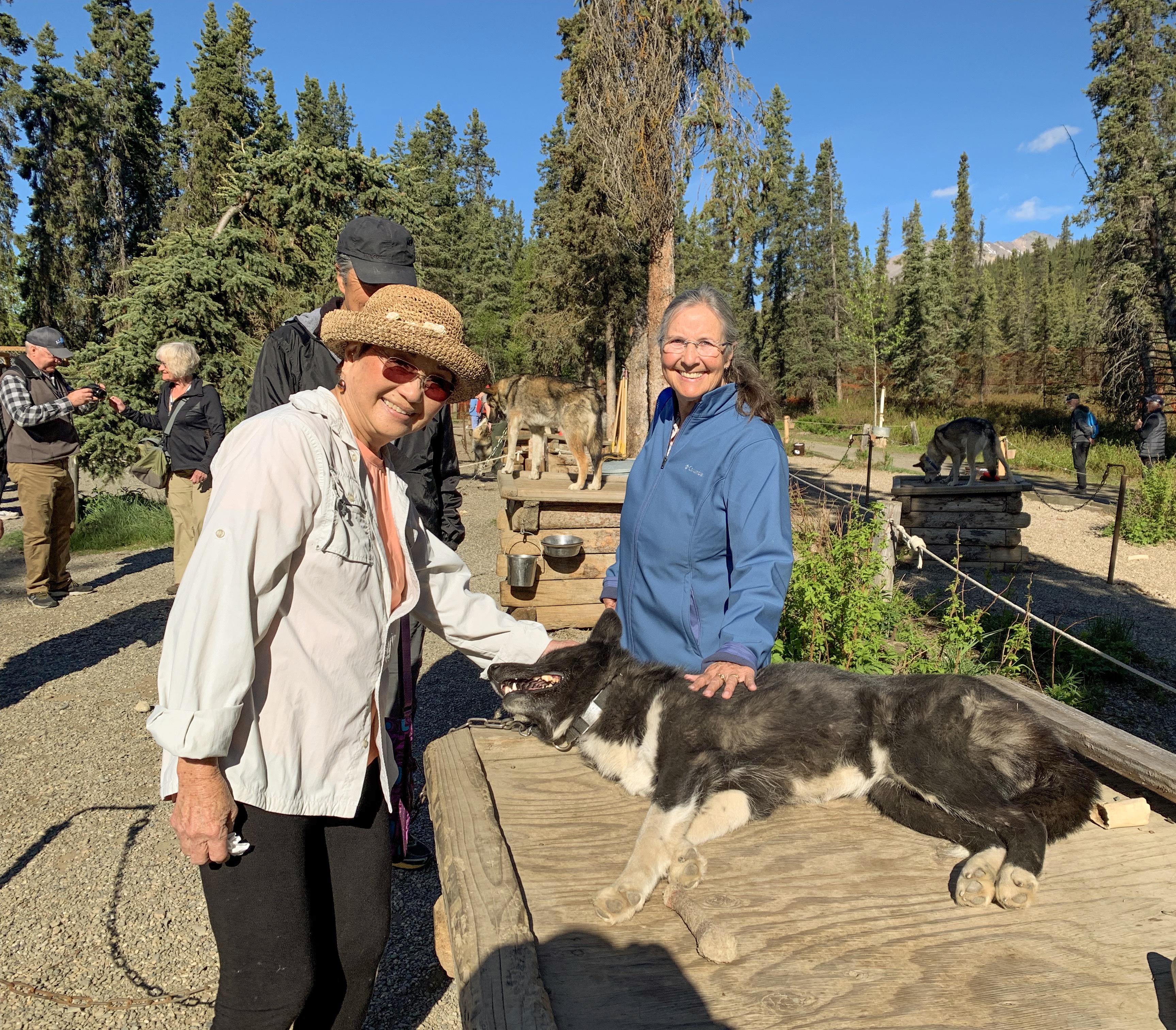
Wonderful presentation by Ranger Jen describing the physical traits of a great sled dog.Eager Alaskan Huskies pulling the training sledDogs going home in “two paw drive”Shirley and Sally petting a ferociously dangerous sled dog.Nice views of Denali – fairly rare.
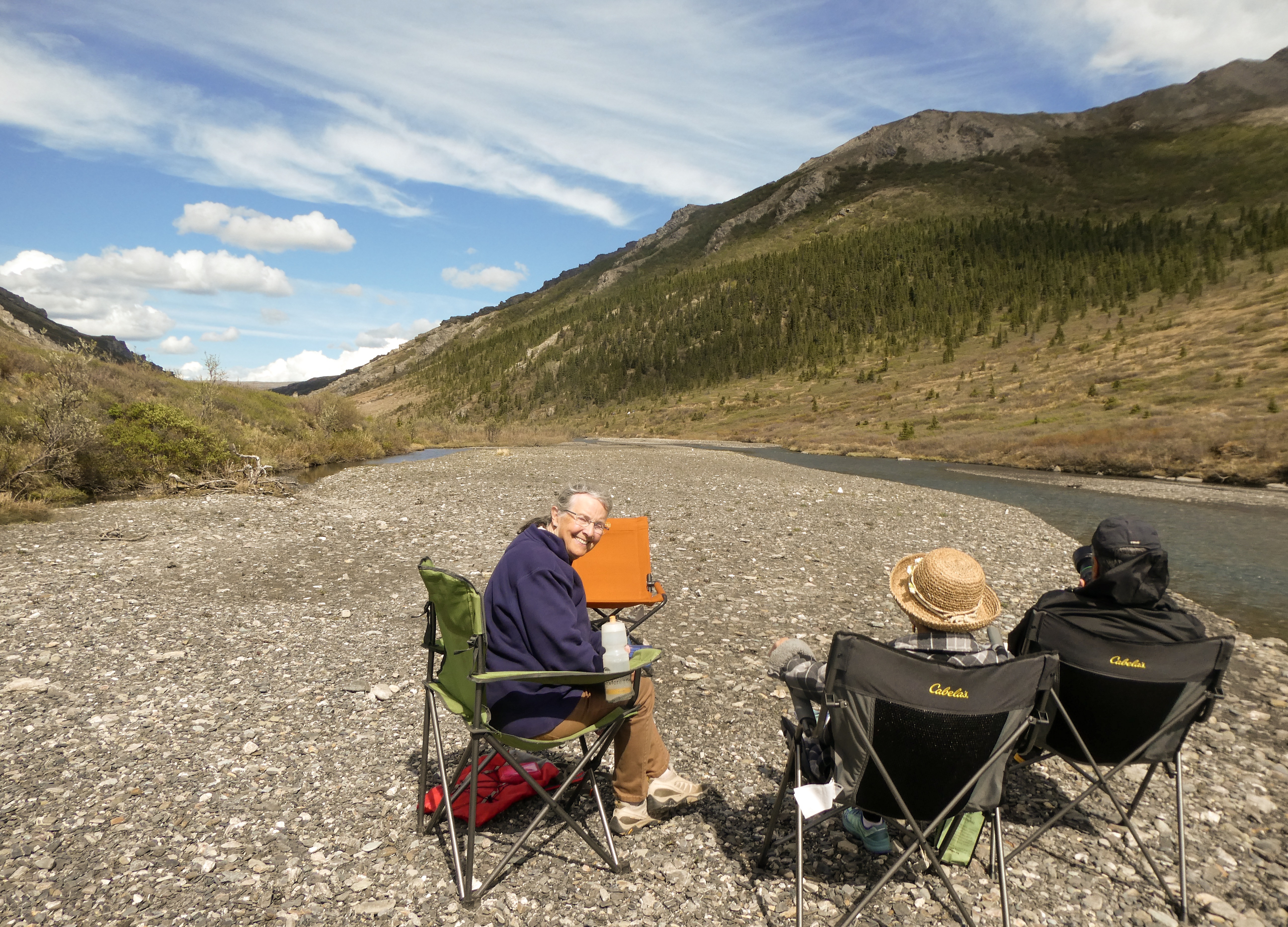
Picnic Lunch at Savage Creek
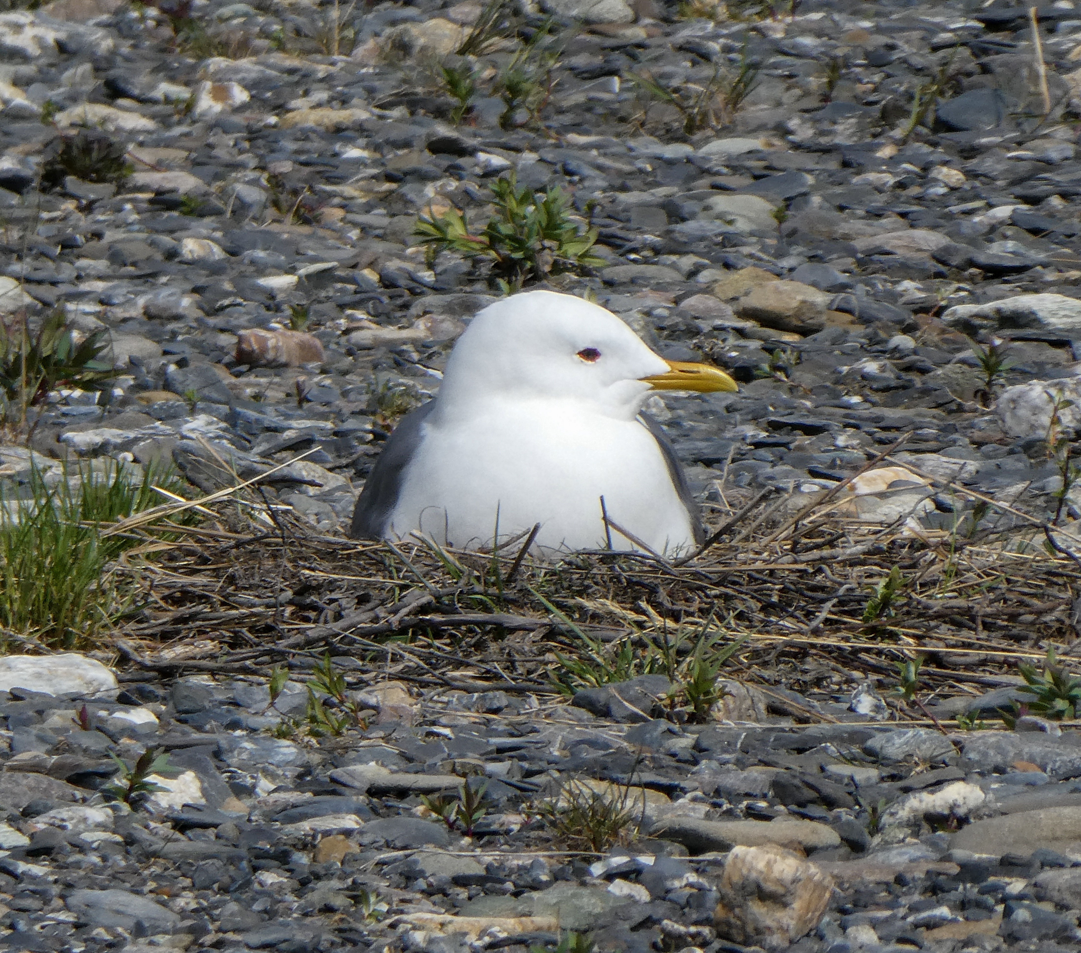
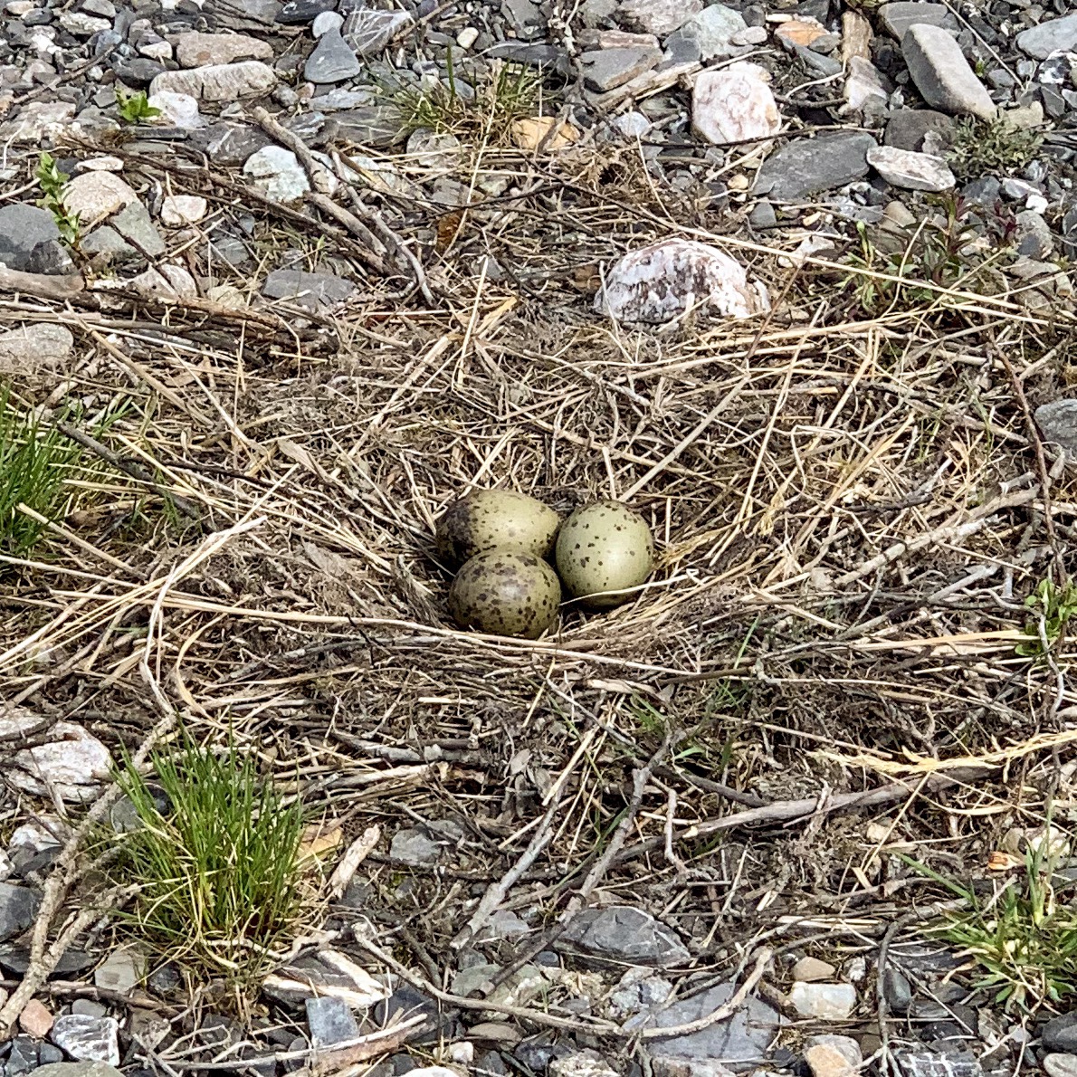
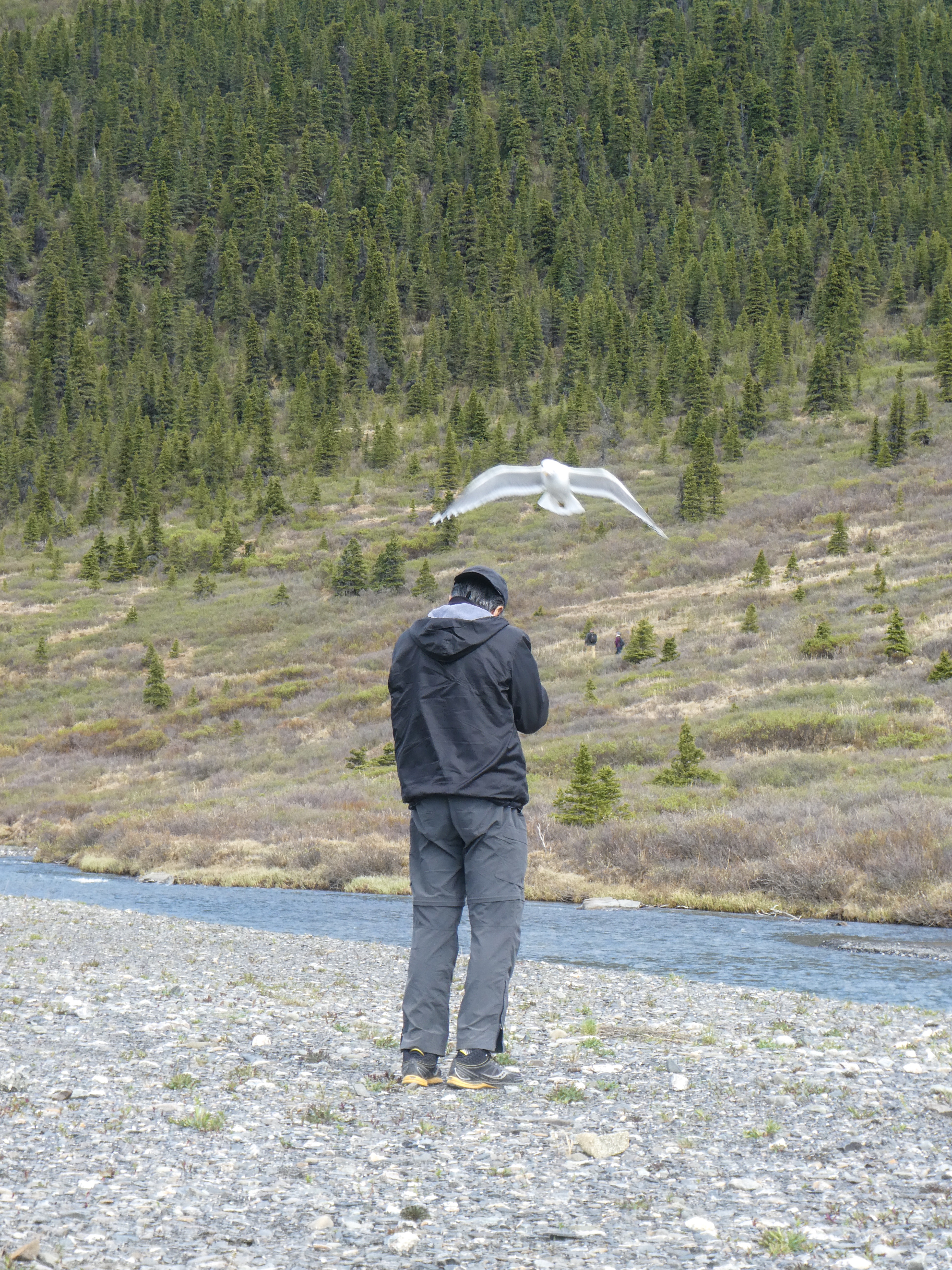
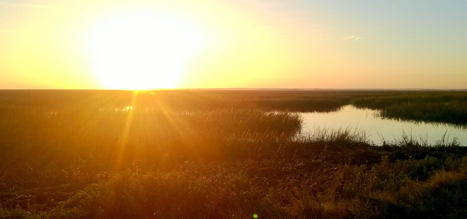
Mother Seagull on her nest by the creek.Mom left her nest for a few minutes and we could see her eggs . Who knew seagull eggs were green?Female seagull dive-bombing Ray as he photographed her nest .Green eggs and Spam? Seagull omelette for dinner ….? No Way!!
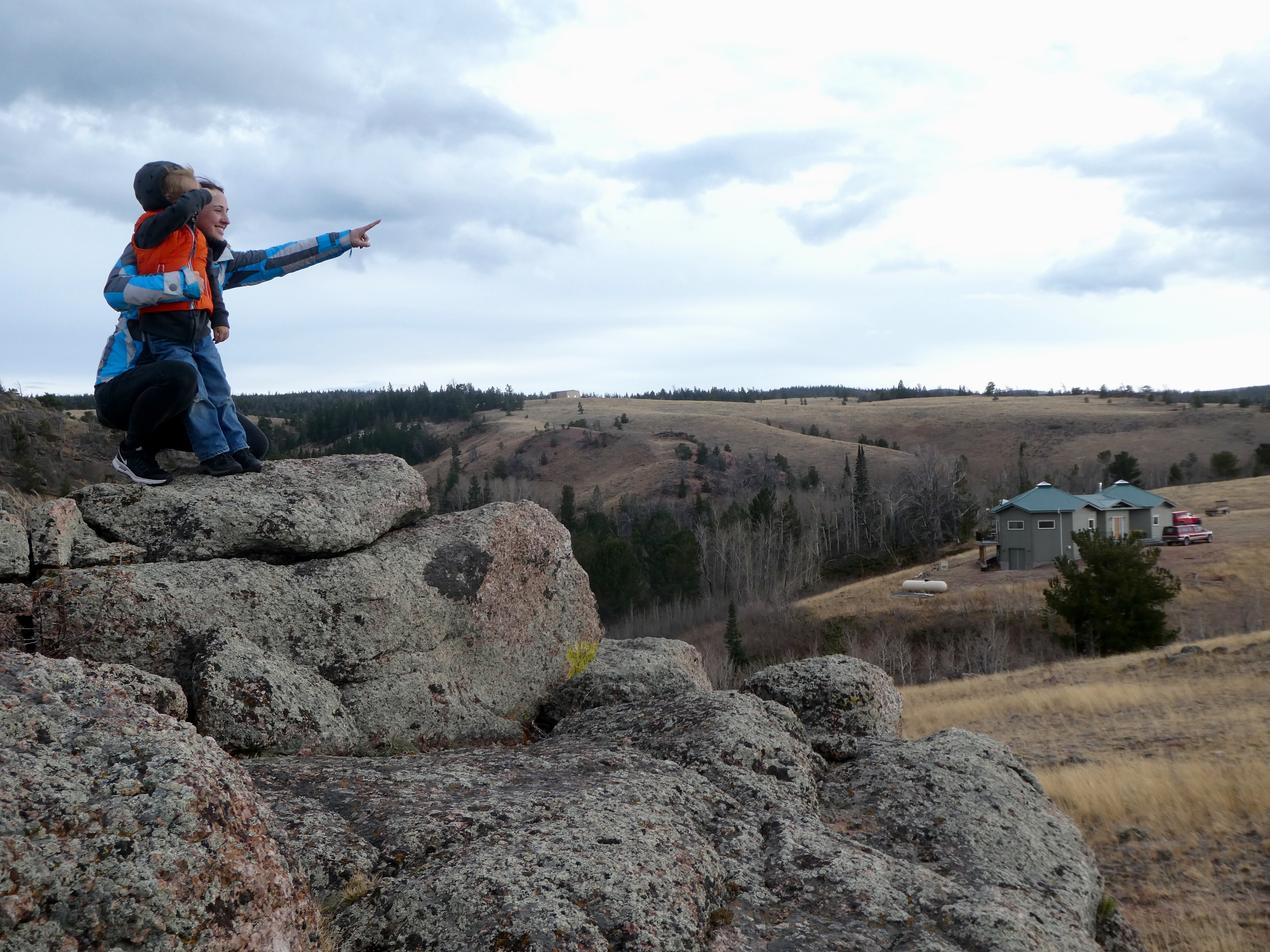
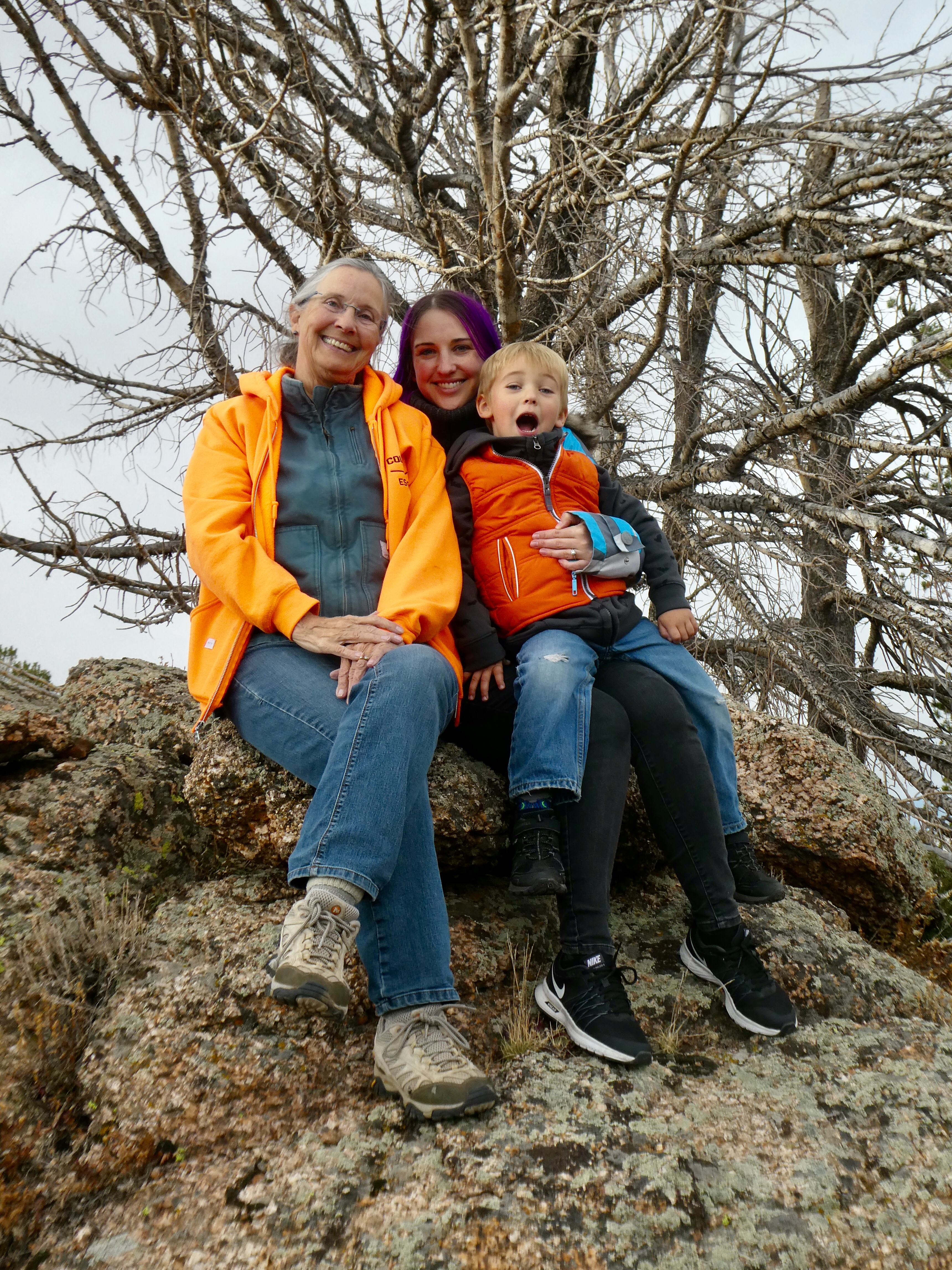
Since our grandson’s family would not be with us during this Christmas holiday, Sally proposed a road trip to celebrate her birthday and Christmas with her twin sister Julie in Savannah, Georgia. When older sister Jo disclosed her intention to also join us in Savannah, the trip plan was locked in.
Deciding to take our camper to make a grand sight-seeing / camping tour, we determined to stop in St Louis to visit friend Doris, re-explore the Great Smoky Mountains National Park, the Blue Ridge Parkway and visit cousin Jackie in Tennessee. On the return from Savannah, we planned to bask in the sunshine throughout the warm sunny south, touring the Natchez Trace, antebellum mansions in Natchez itself and finally do some camping and hiking on the Ozark Mountains of Missouri and Arkansas.
Most of our plans came to fruition however, due to unseasonable cold weather bringing snow and ice to portions of our intended route, we had to make some changes and regrettably our shorts and sandals never were unpacked.
Driving across Kansas and stopping in Saint louis, we spent a couple of nights with our friend Doris who lived across the hall from us in Shanghai, China.
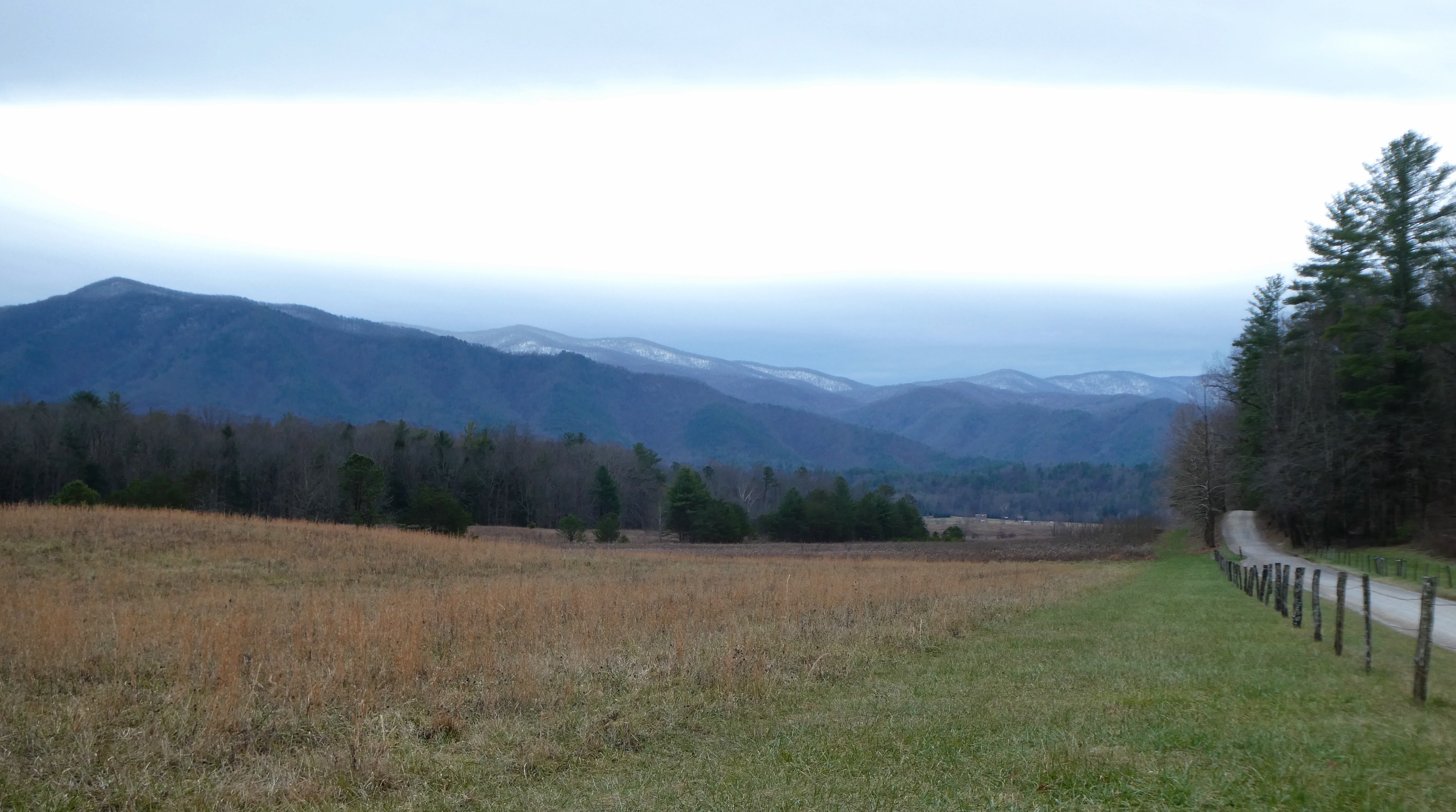
Continuing on, we arrived in the Great Smoky Mountains National Park as the temperatures began to drop and the clouds rolled in.
Cade’s Cove Road, Great Smoky Mountains National Park
My son-in-law, Ben, and I recently returned from a guided horseback elk hunt with Lynn Madsen, at Yellowstone Outfitters, Afton, Wyoming. It was incredible!
Here’s what Lynn has to say about his outfit:
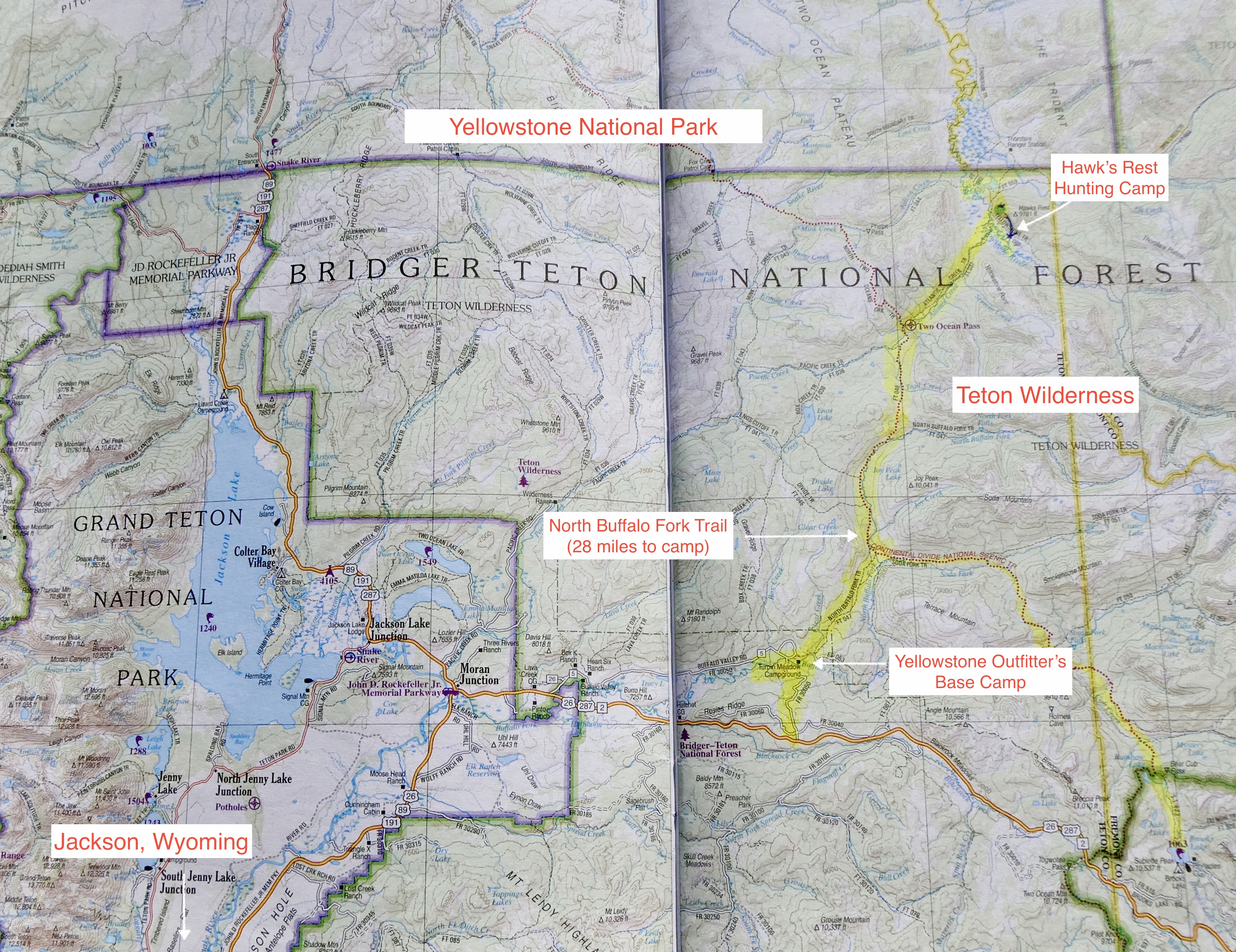
“Our Hawks Rest Camp is located in the Teton Wilderness northeast of Jackson…It sets off the southeast corner of Yellowstone Park between the Yellowstone and Thorofare Rivers (Area 60 on a Game & Fish map). It is one day-pack 28 miles, from our base camp at Turpin Meadows…The Hawks Rest camp holds the reputation of being the furthest spot in the continental United States from a road in any direction. Not only will you be hunting in one of the best trophy elk camps in the United States but you will also be hunting in country that looks the same as it did 100 years ago.
Our fully equipped camp consists of a large cook tent, shower tent, sleeping tents with cots, foam mattresses, and wood burning stoves along with plenty of fire wood. We are proud to say that our camps hold an excellent reputation earned by hiring reputable licensed guides, maintaining a clean comfortable camp, serving good food and supplying both good horses and mules and equipment.”
Well, our experience lived up to Lynn’s promotional material and then some. We had a “once in a lifetime” experience. Read on, if you are interested in the details.
Ben flew in from California and the following day we made the 8 hour drive from Fort Collins, Colorado to Jackson, Wyoming, where we spent the night. You can fly into Jackson’s small airport, but it’s kinda expensive and you have to pay hundreds of dollars to ship your elk meat back home, so driving seemed like the frugal option. Besides we were able to enjoy each other’s company and the lovely Wyoming scenery as we motored along.
On Monday morning October 9th we rose early, ate breakfast and made the 1 hour drive north and East to Turpin Meadows where we met Lynn, our guide, four other hunters and were introduced to our horses who would become our new and closest friends for almost 10 hours today.
Lynn provided quality, well cared for horses that are a cross between big, strong draught horses (for strength and stamina) and quarter horses (to reduce the size). They are still really big, tall horses and getting a leg up into the stirrup was my yoga/stretching challenge each time we mounted. Getting off was no issue, but is was a long way down.
The yellow marker highlights the beautiful pack trail into camp. We cross the Continental Divide at Two Ocean Pass and gain over 1,300 feet in elevation over the 28 mile trek.
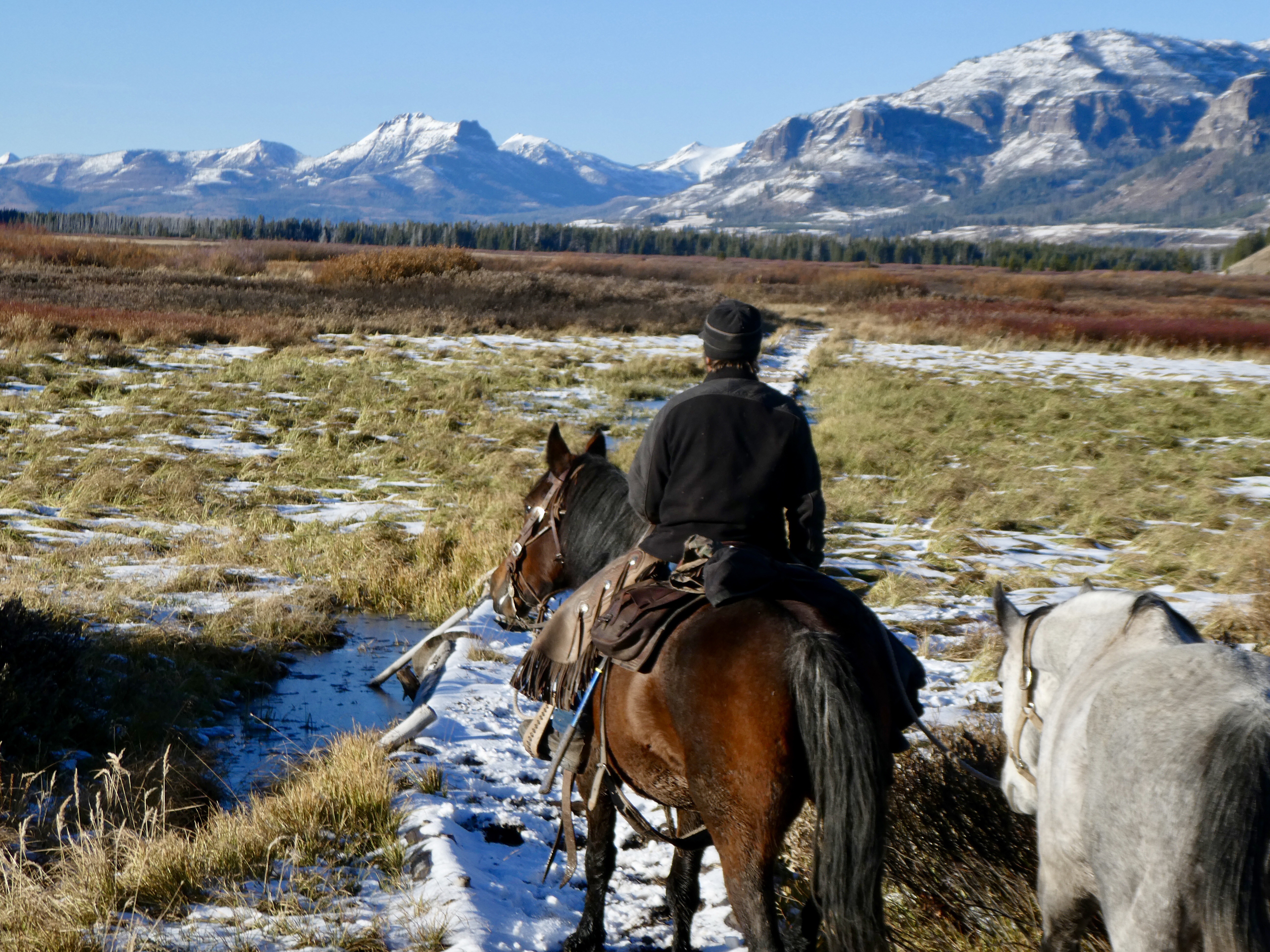
Hunters “chew the fat” while pack mules wait patiently
Heading up the mountain, we were passed by Lynn’s string of mules bringing our gear and replenishing needed supplies. On the way in we passed several sets of grizzly and wolf tracks.
Buffalo Fork Valley
Crossing Atlantic Creek
Heading up the mountain
Nearly there! Riding through the Yellowstone Valley, soon to cross the Yellowstone River, Hawk’s Rest Mountain in the distance.
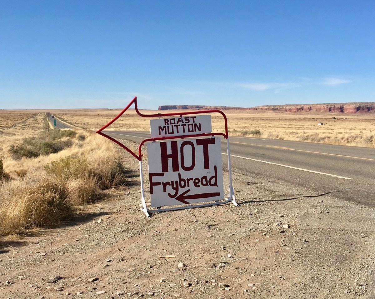
Navajo Fry Bread, Mutton Stew and Camping on the Jicarilla Apache Reservation
Stopping at Teec Nos Pos, for traditional Navajo food. The food truck was heavily patronized by native people (signifying, I hope, authenticity). It was totally yummy and satisfying !
Fry bread is a flat dough bread, fried or deep-fried in oil, shortening, or lard. Made with simple ingredients, frybread can be eaten alone or with various toppings such as honey, jam, powdered sugar, or hot beef. Frybread can also be made into tacos, like Indian tacos. It is a simple complement to meals.
According to Navajo tradition, frybread was created in 1864 using the flour, sugar, salt and lard that was given to them by the United States government when the Navajo, who were living in Arizona, were forced to make the 300-mile journey known as the “Long Walk” and relocate to Bosque Redondo, New Mexico onto land that could not easily support their traditional staples of vegetables and beans.
For many Native Americans, “frybread links generation with generation and also connects the present to the painful narrative of Native American history”. It is often served both at home and at gatherings. The way it is served varies from region to region and different tribes have different recipes. It can be found in its many ways at state fairs and pow-wows, but what is served to the paying public may be different from what is served in private homes and in the context of tribal family relations.
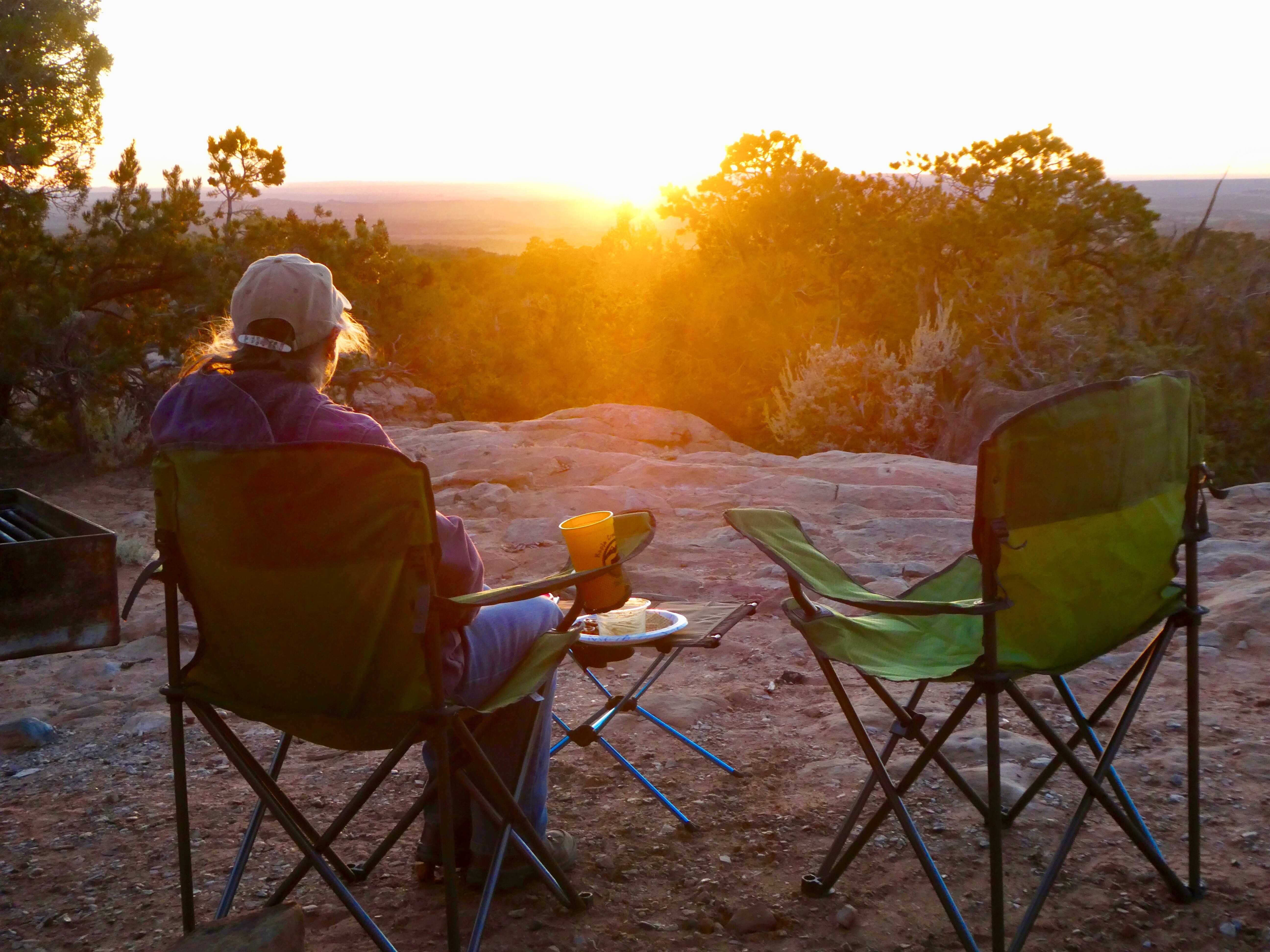
Our cold (12 degrees Farenheit last night) but lovely campsite on the Jicarilla Apache Nation, next to Stone Lake was scenic and inexpensive (free)!
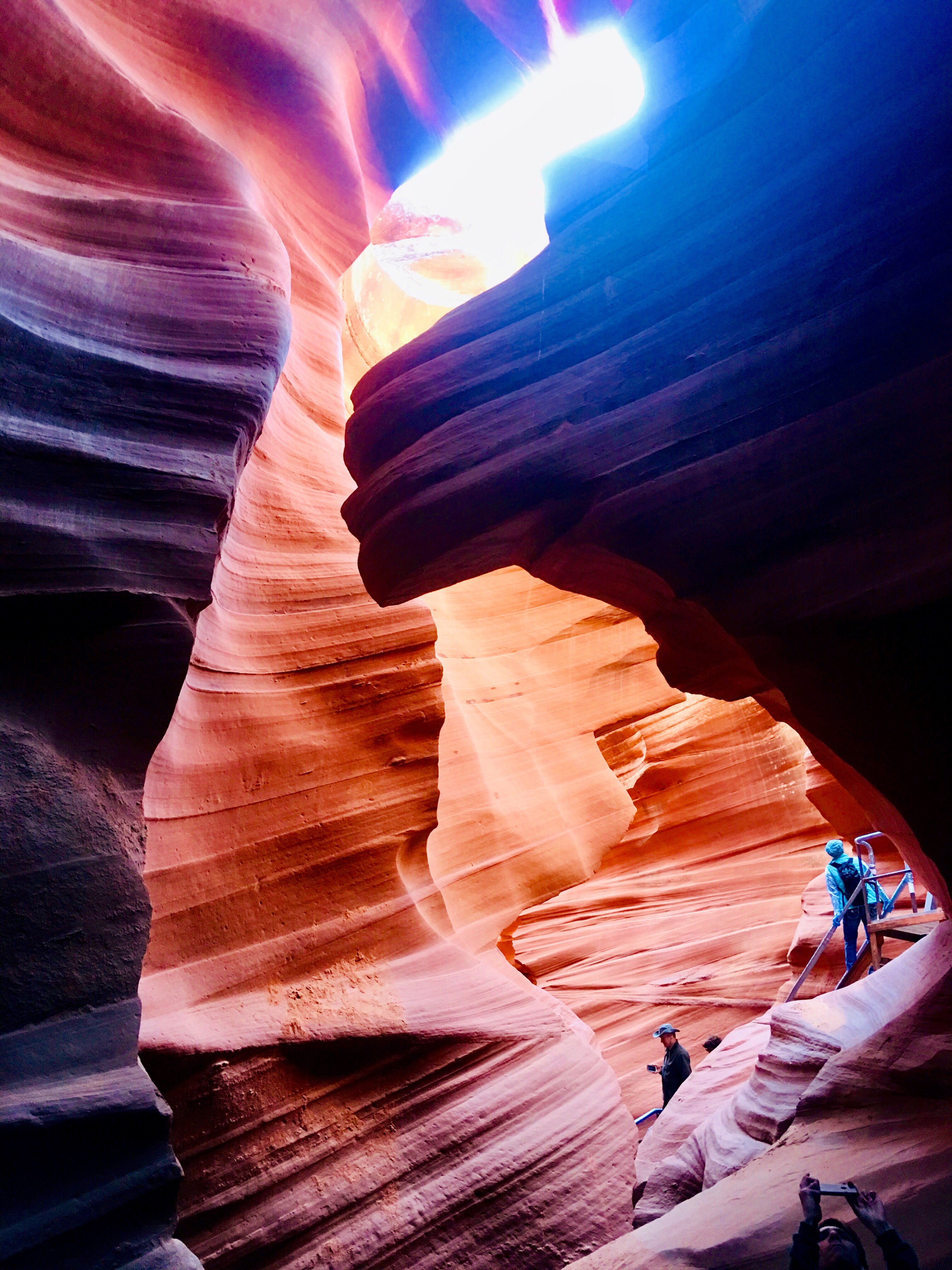
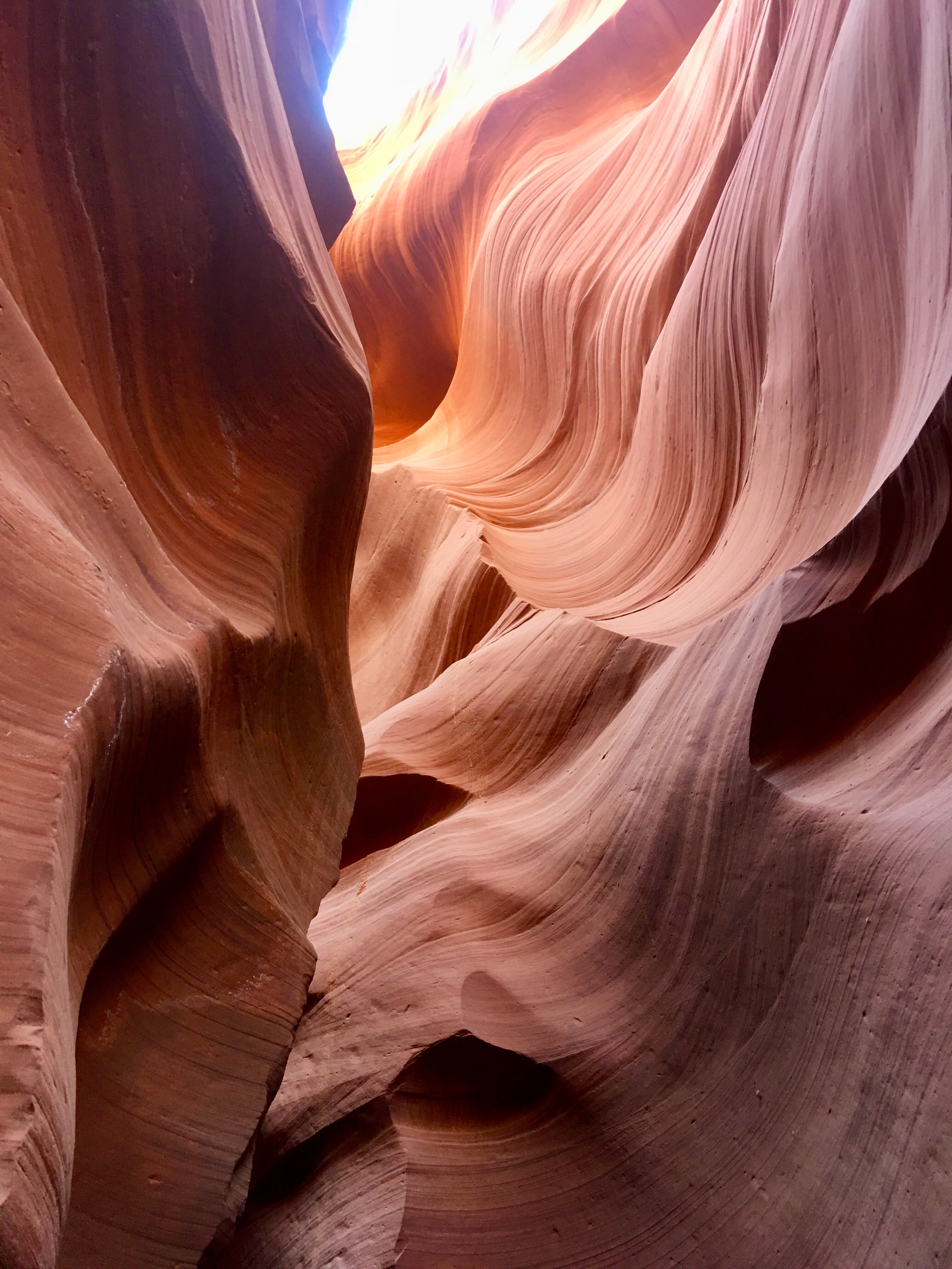
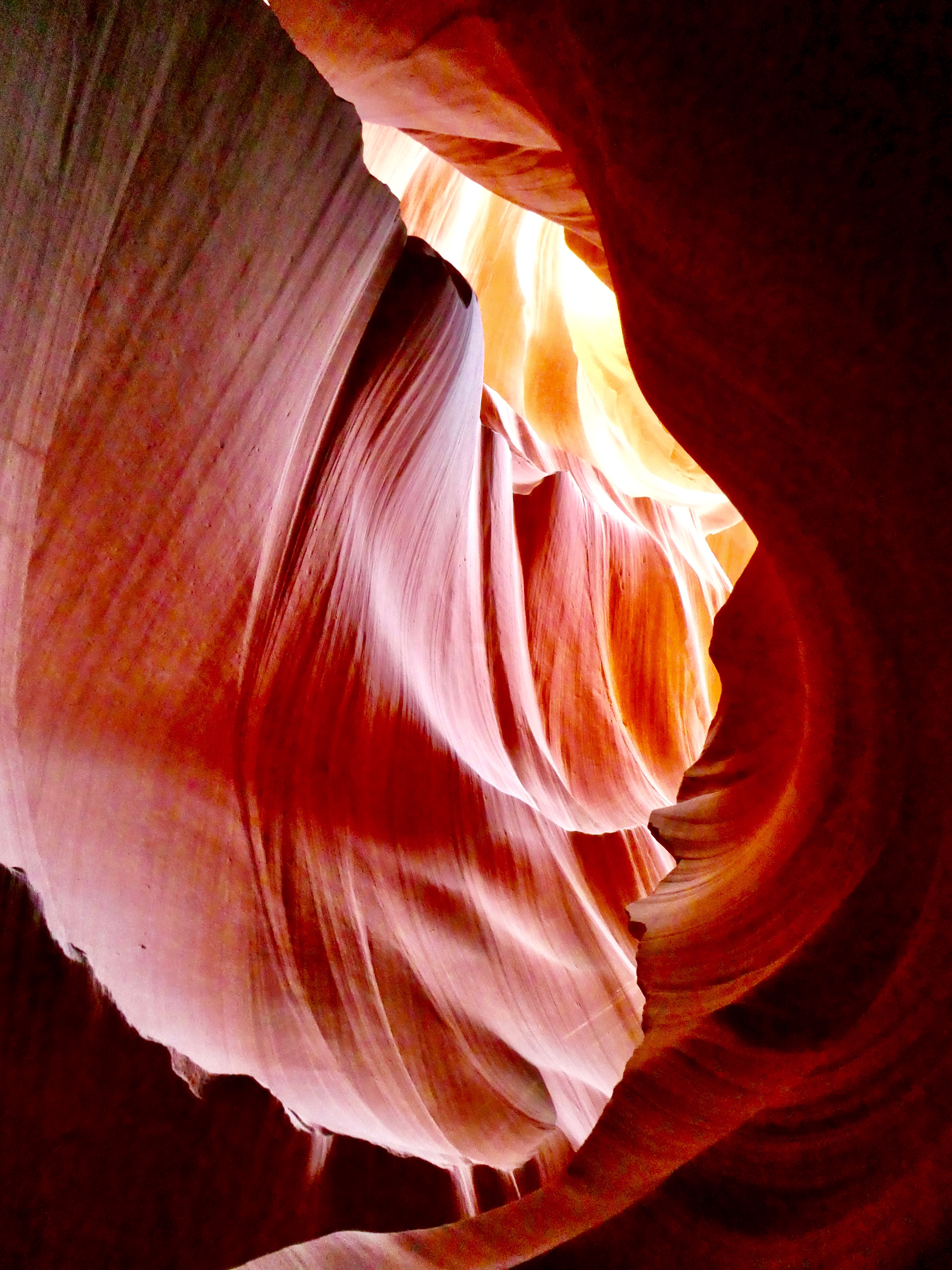
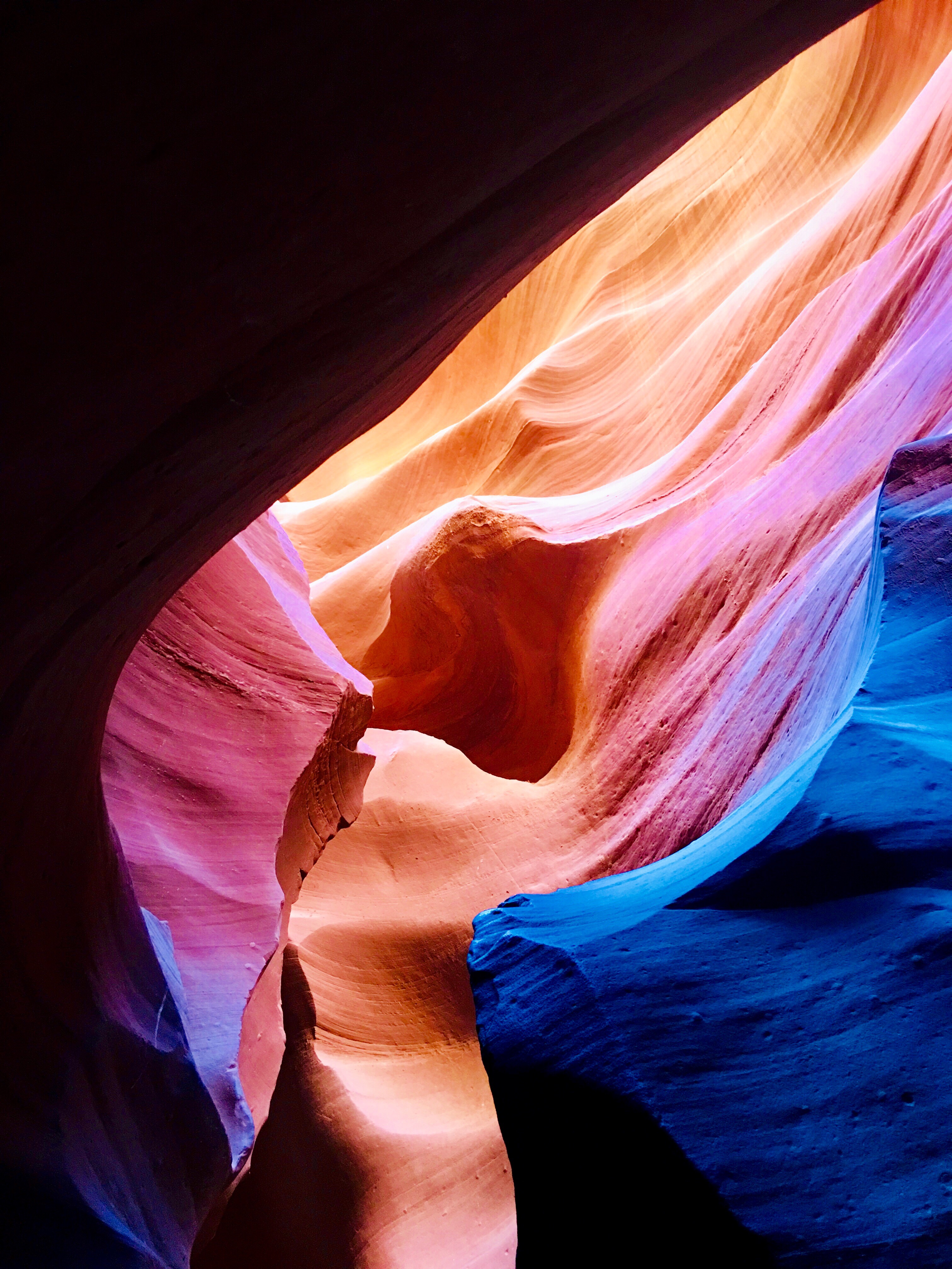
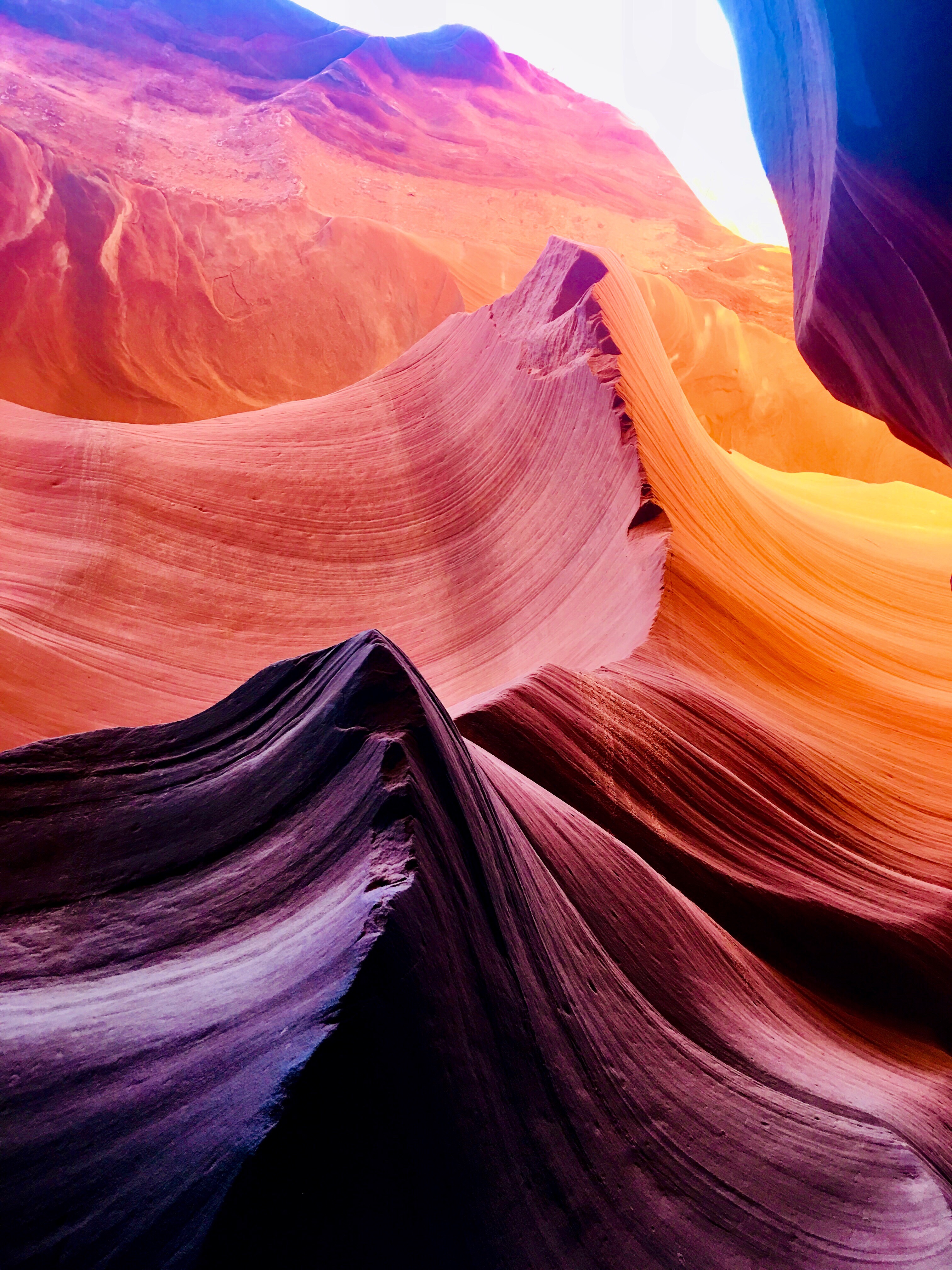
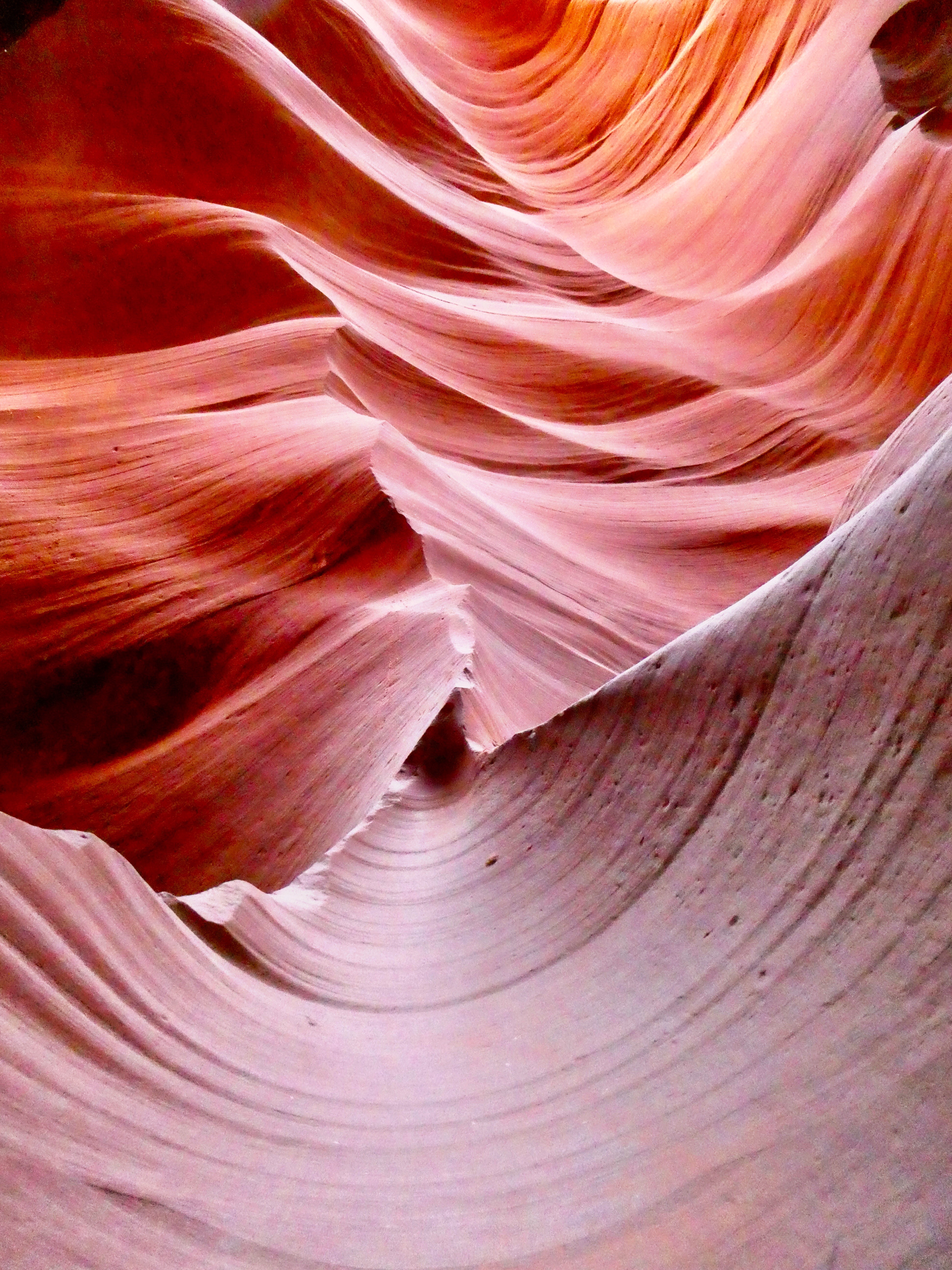
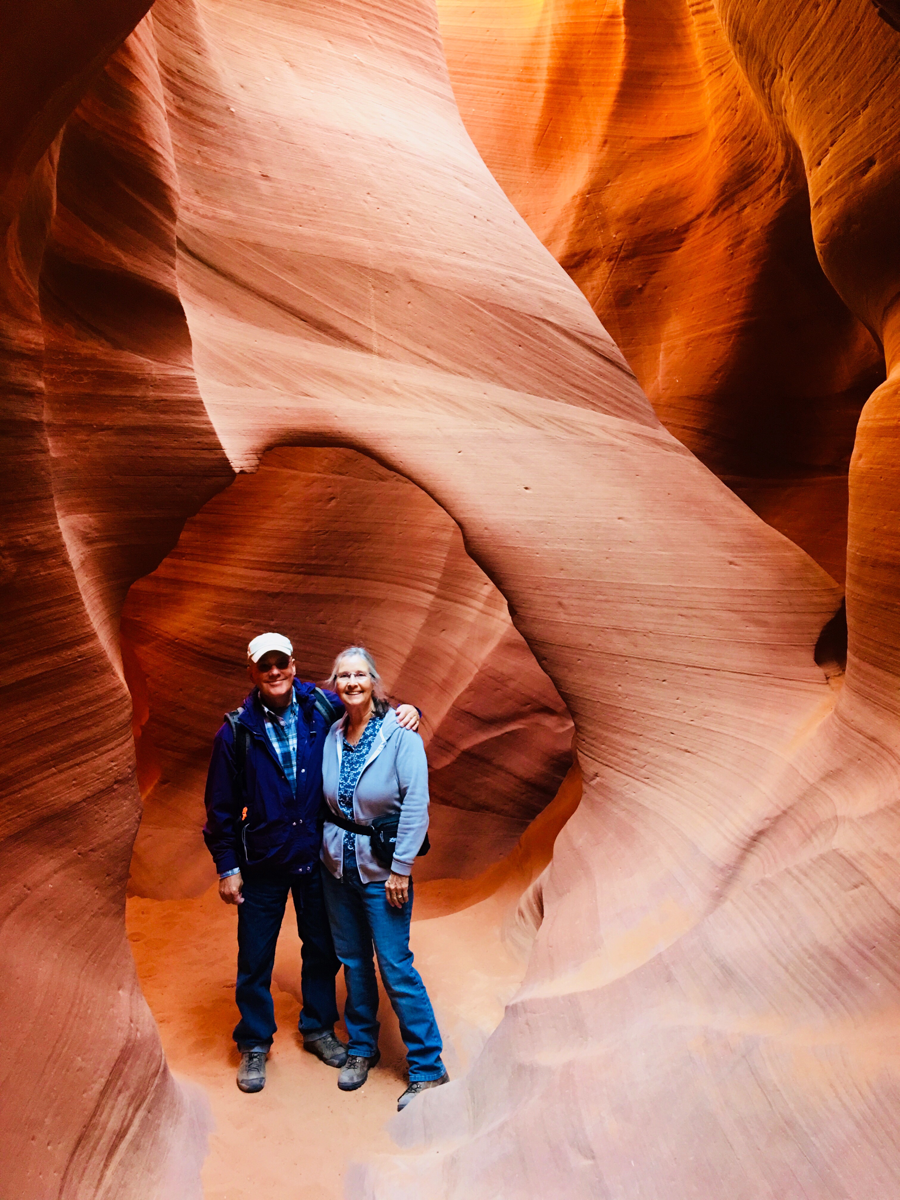
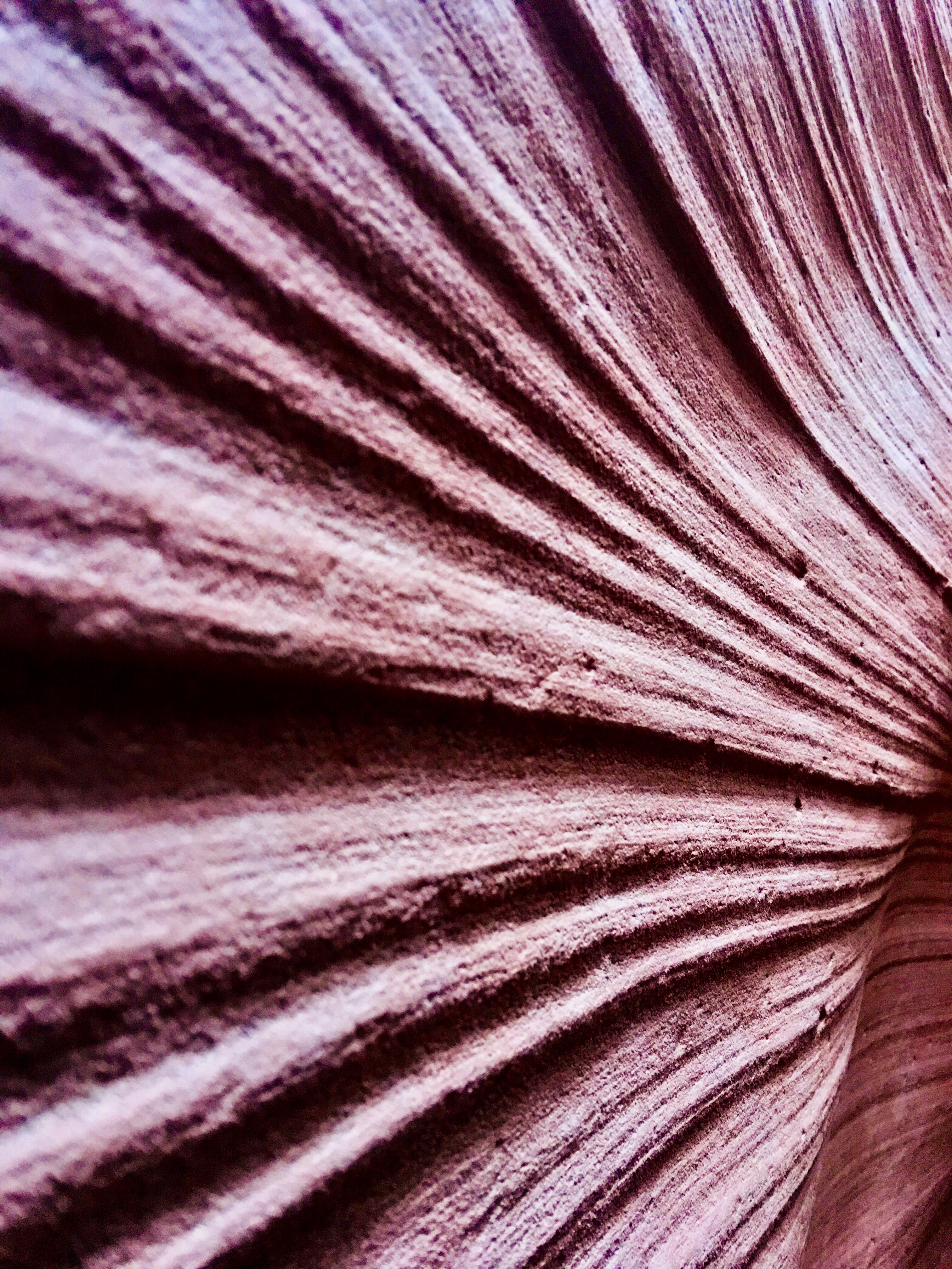
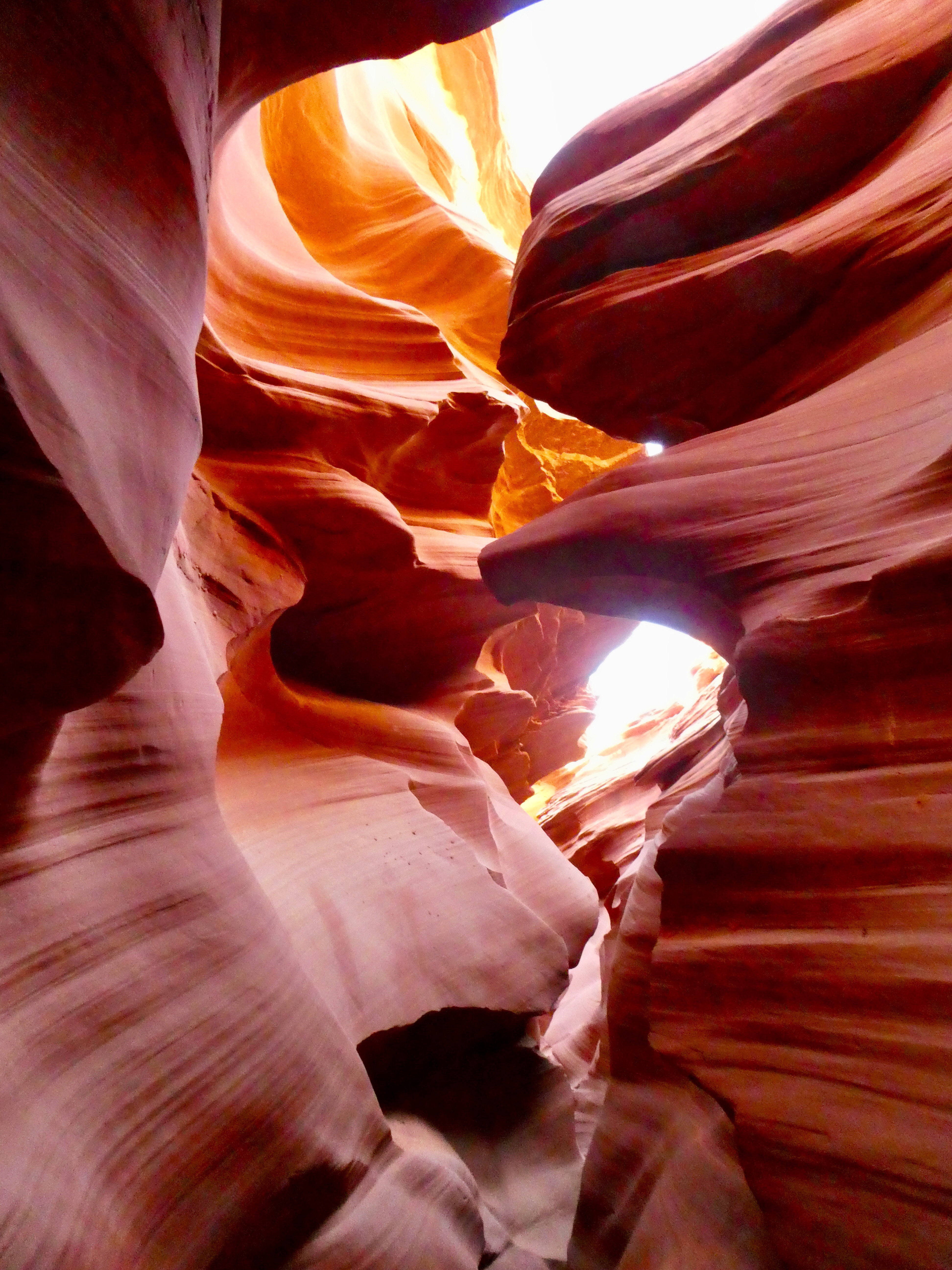
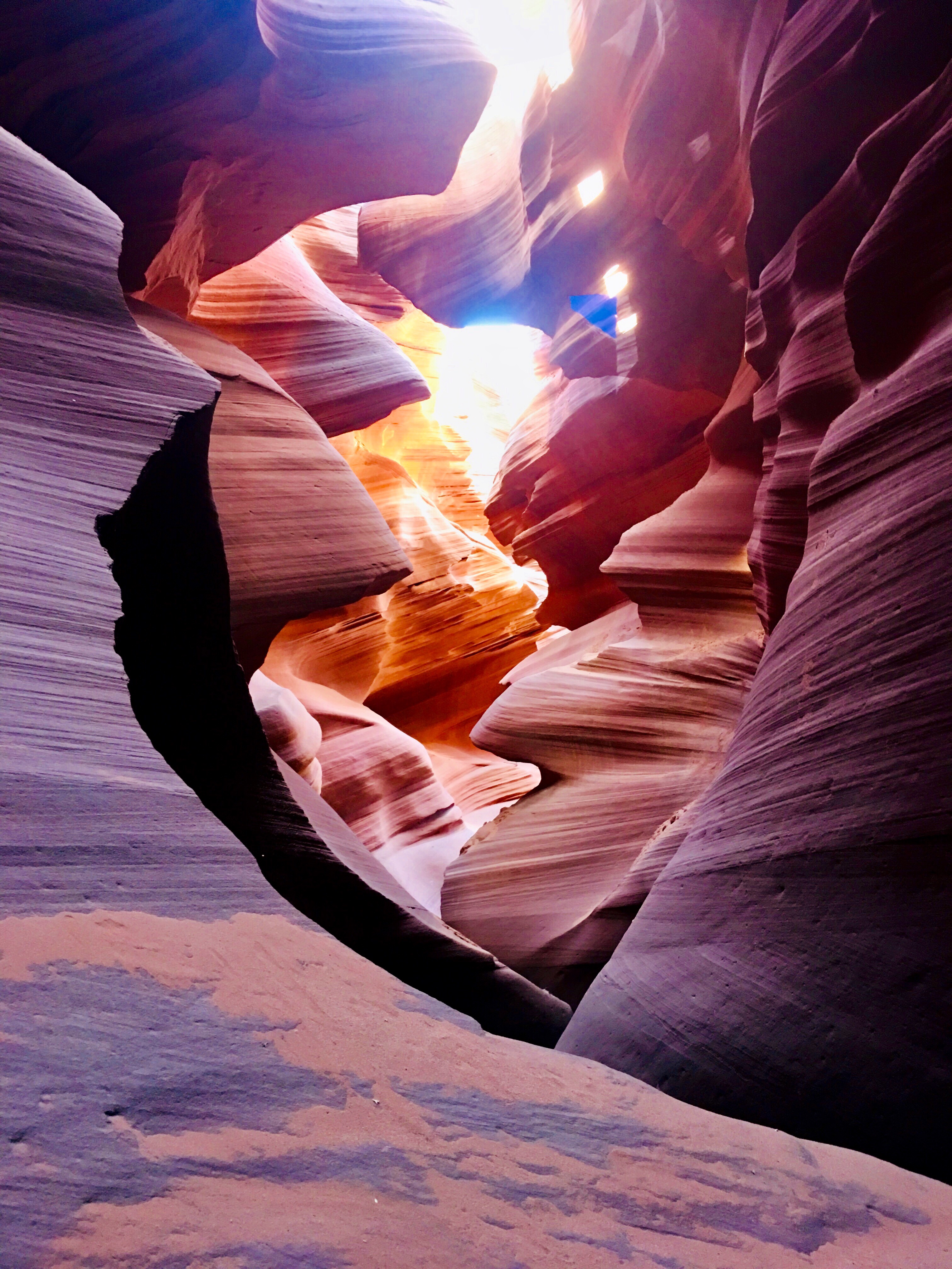
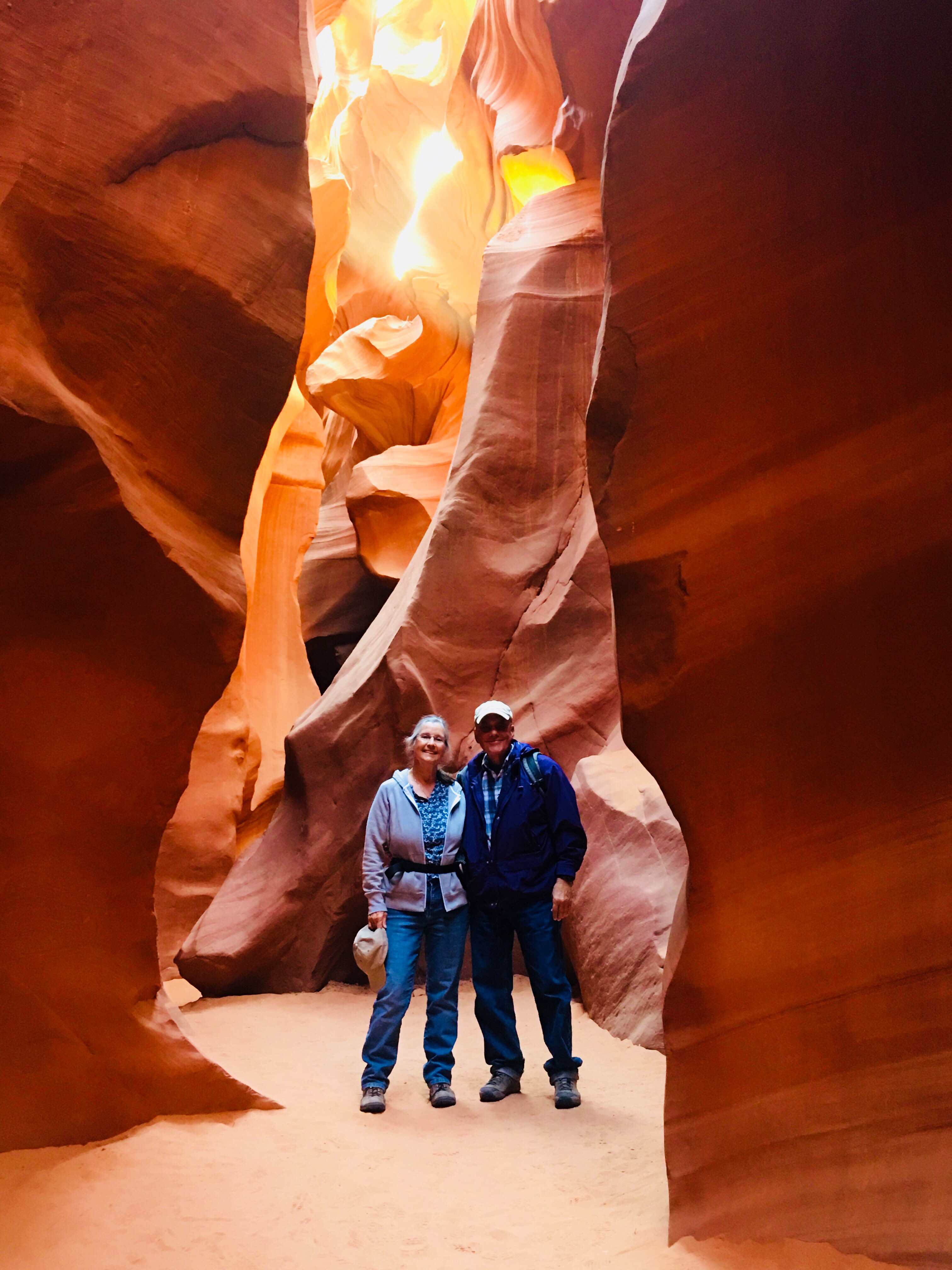
Antelope Canyon is located near Page on Navajo Nation land, just outside Glen Canyon National Recreation Area. Antelope is the most visited slot canyon in the Southwest, partly because it is easily accessible and by far the most publicized, and also since it is extremely beautiful, with just the right combination of depth, width, length, rock color and ambient light; many other slot canyons are deeper, narrower or longer, and some have rock that is even more colorful and sculptured, but here conditions are ideal.”
Our Hopi guide Mathew takes us down into the canyon
“Antelope Canyon was formed by erosion of Navajo Sandstone, primarily due to flash flooding and secondarily due to other sub-aerial processes. Rainwater, especially during monsoon season, runs into the extensive basin above the slot canyon sections, picking up speed and sand as it rushes into the narrow passageways. Over time the passageways eroded away, making the corridors deeper and smoothing hard edges in such a way as to form characteristic “flowing” shapes in the rock.”
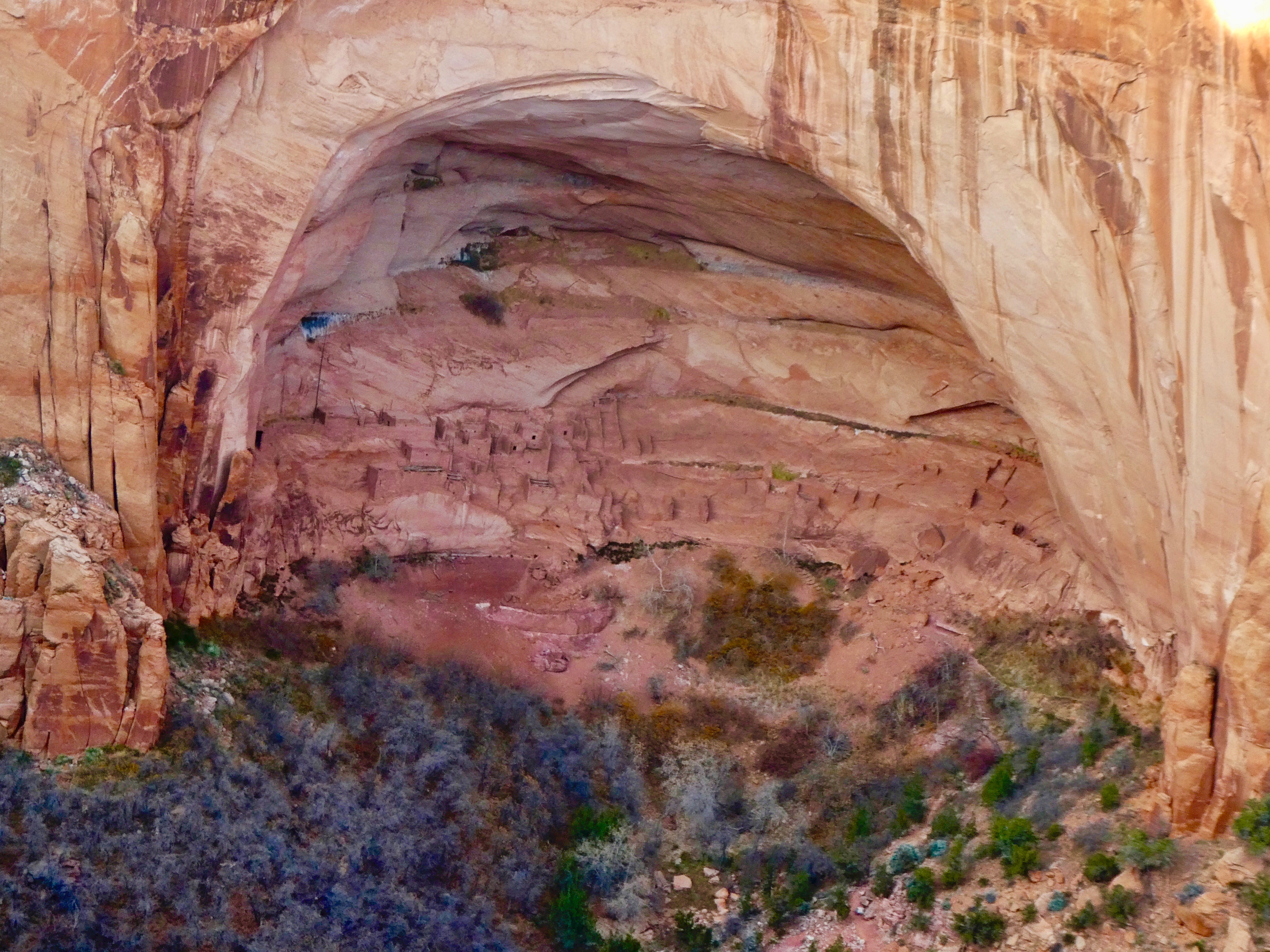
Navajo National Monument
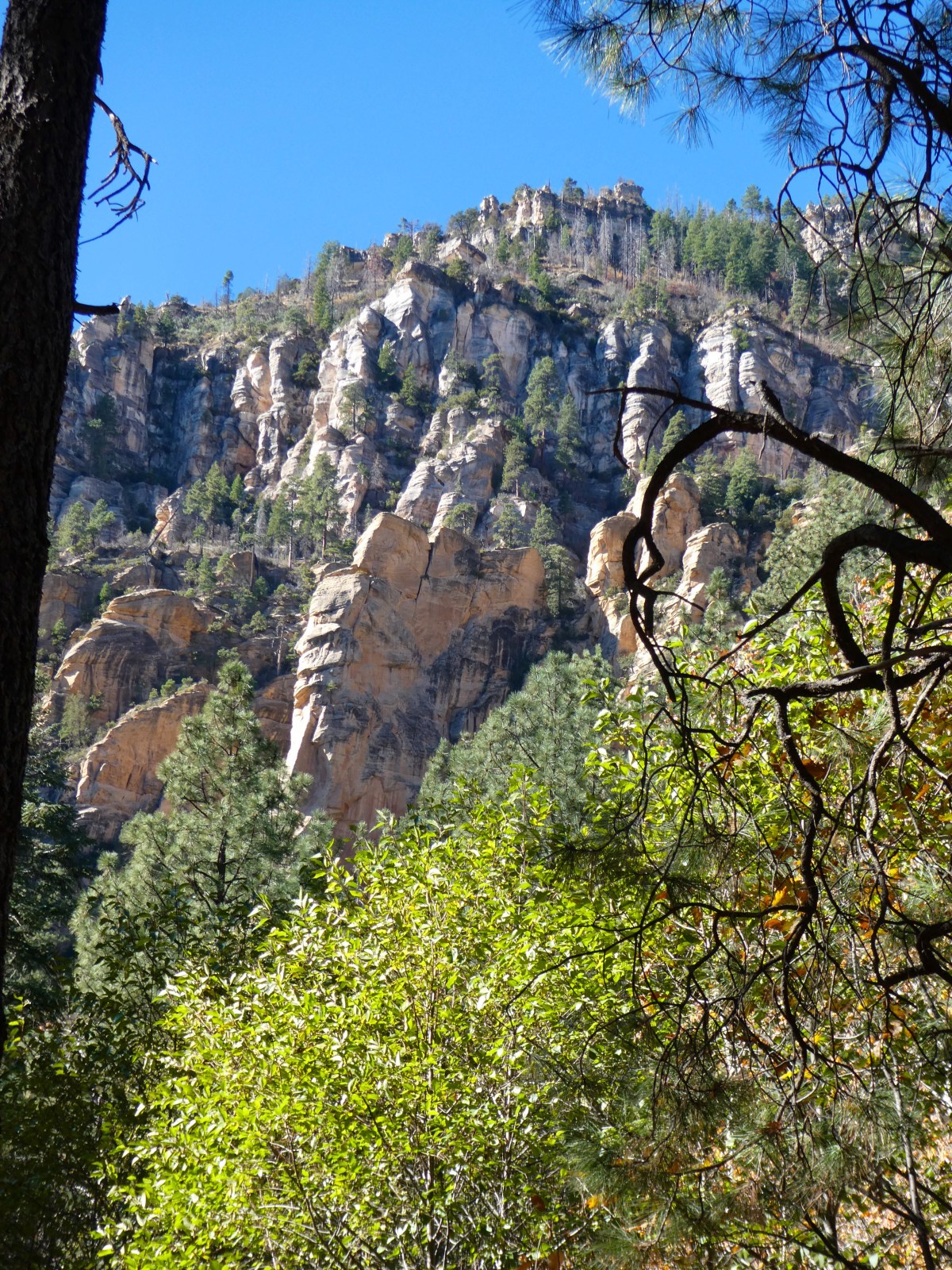
Navajo National Monument is a National Monumentlocated within the northwest portion of the Navajo Nation territory in northern Arizona, which was established to preserve three well-preserved cliff dwellings of the Ancestral Puebloan People: Broken Pottery (Kitsʼiil), Ledge House (Bitátʼahkin), and Inscription House (Tsʼah Biiʼ Kin). The monument is high on the Shonto plateau, overlooking the Tsegi Canyon system, west of Kayenta, Arizona. It features a visitor center with a museum, two short self-guided mesa top trails, two small campgrounds, and a picnic area. Rangers guide visitors on free tours of the Keet Seel and Betatakin cliff dwellings.“
After a short hike to view the Betatakin cliff dwelling, we settled into our lovely campsite for the evening. This time of year, the campground was nearly empty and is always free of charge!
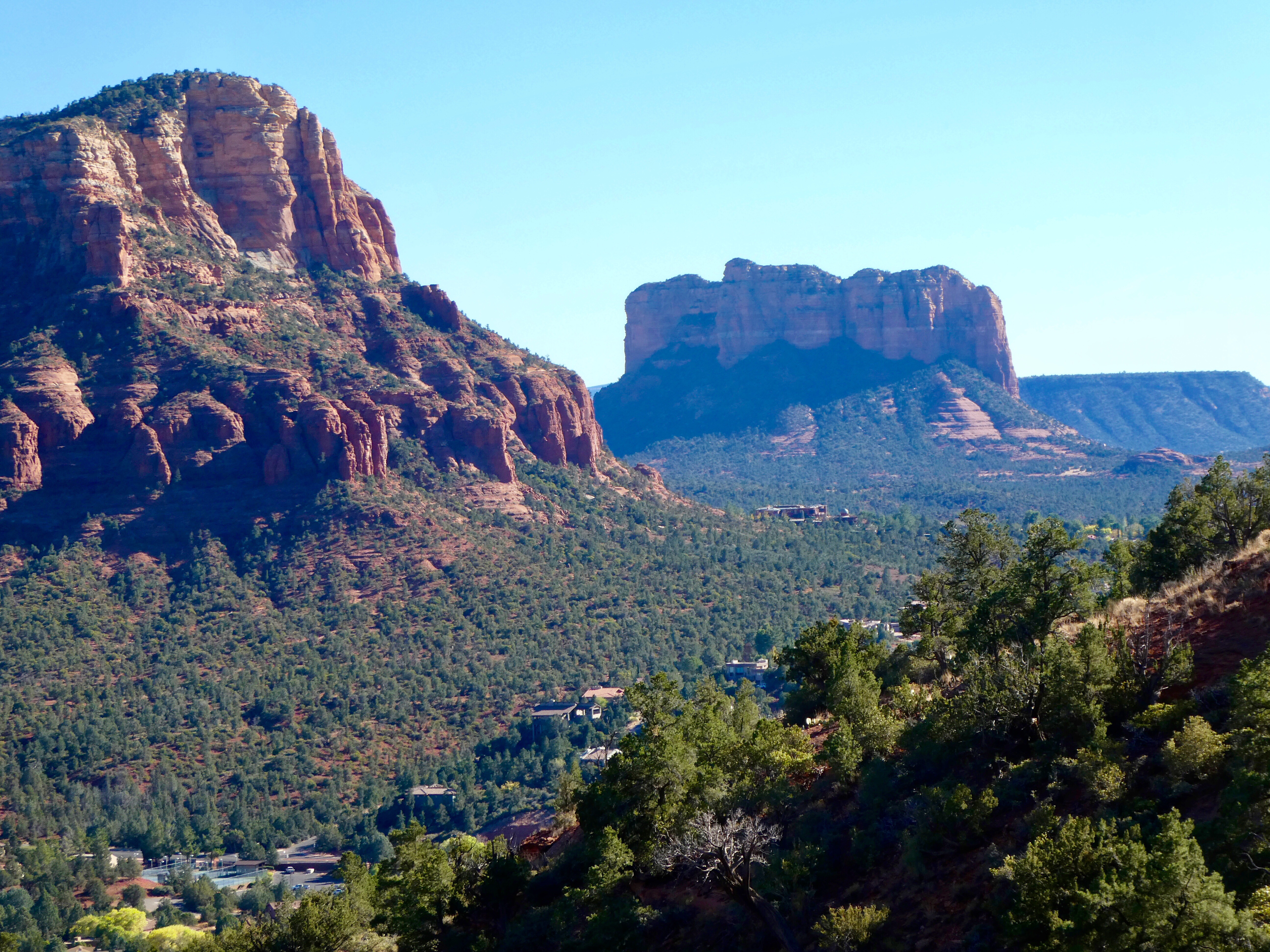
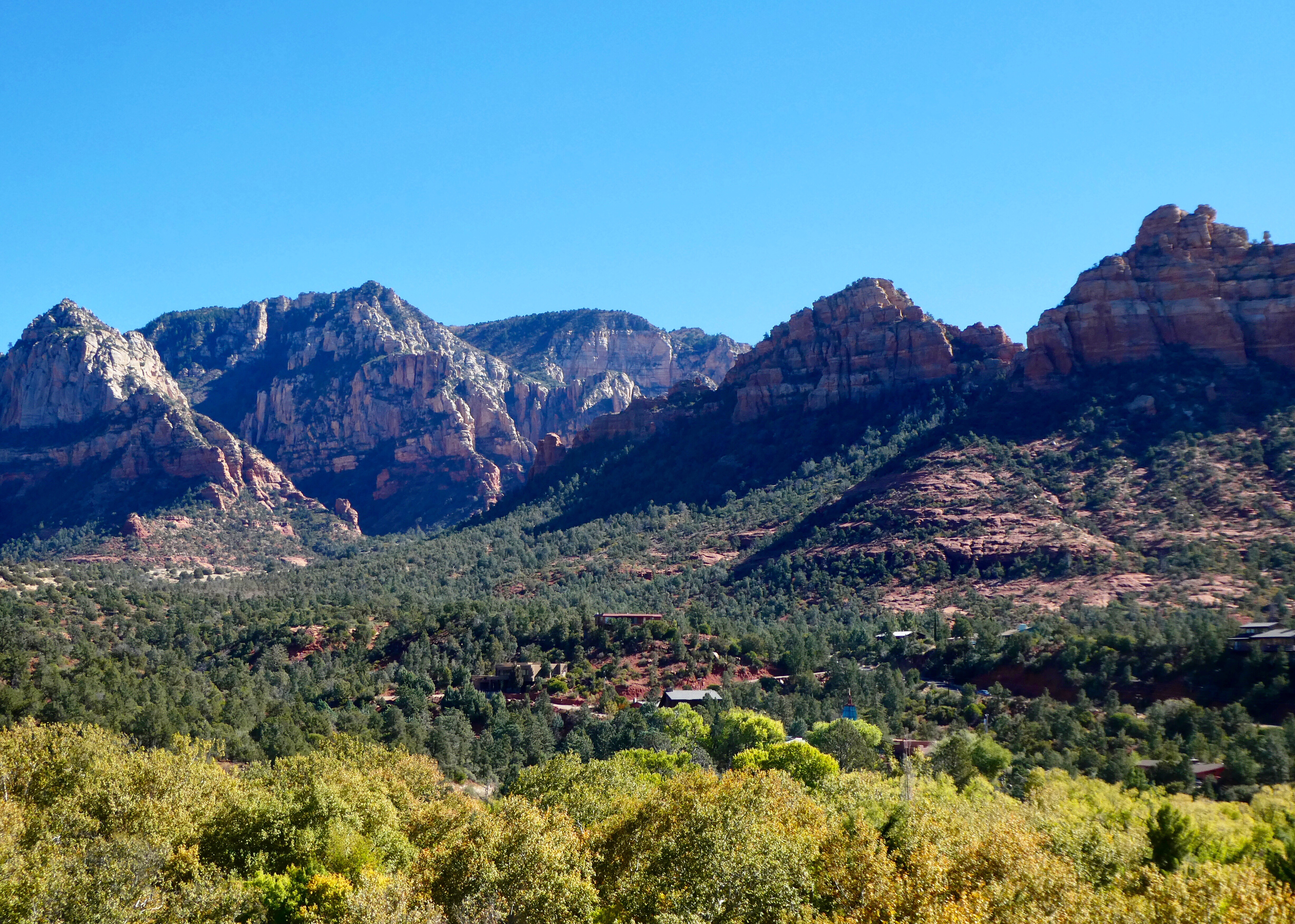
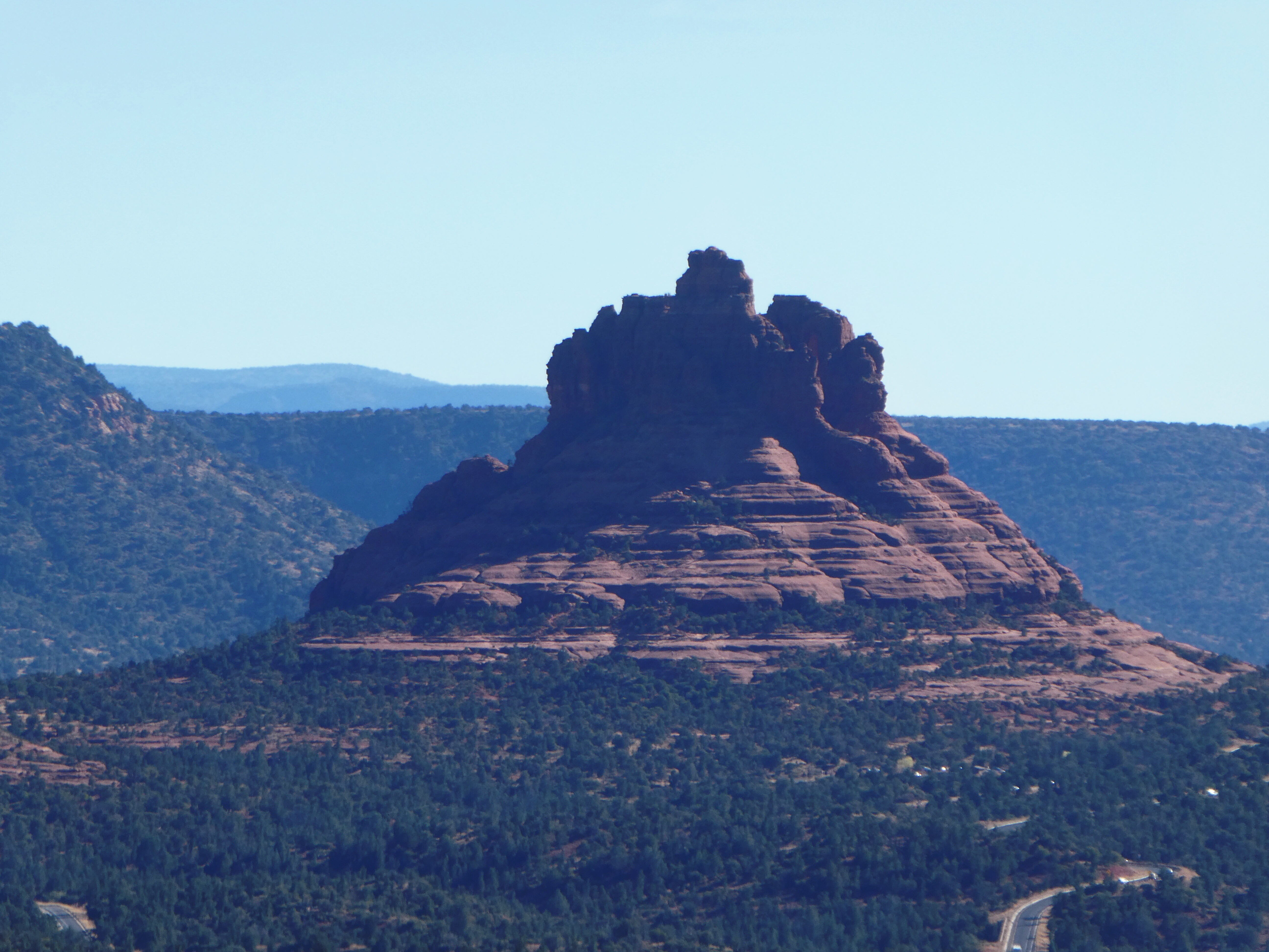
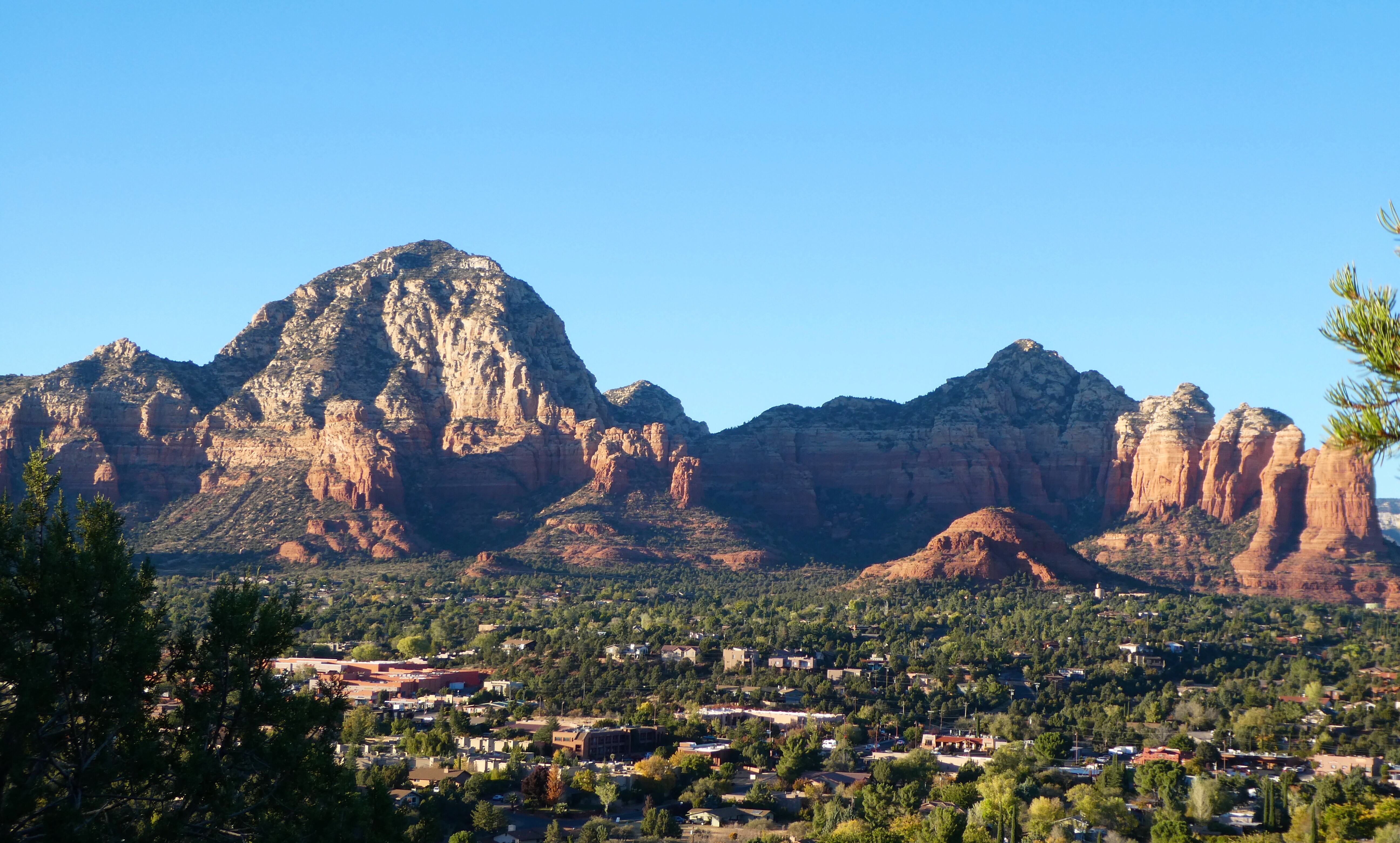
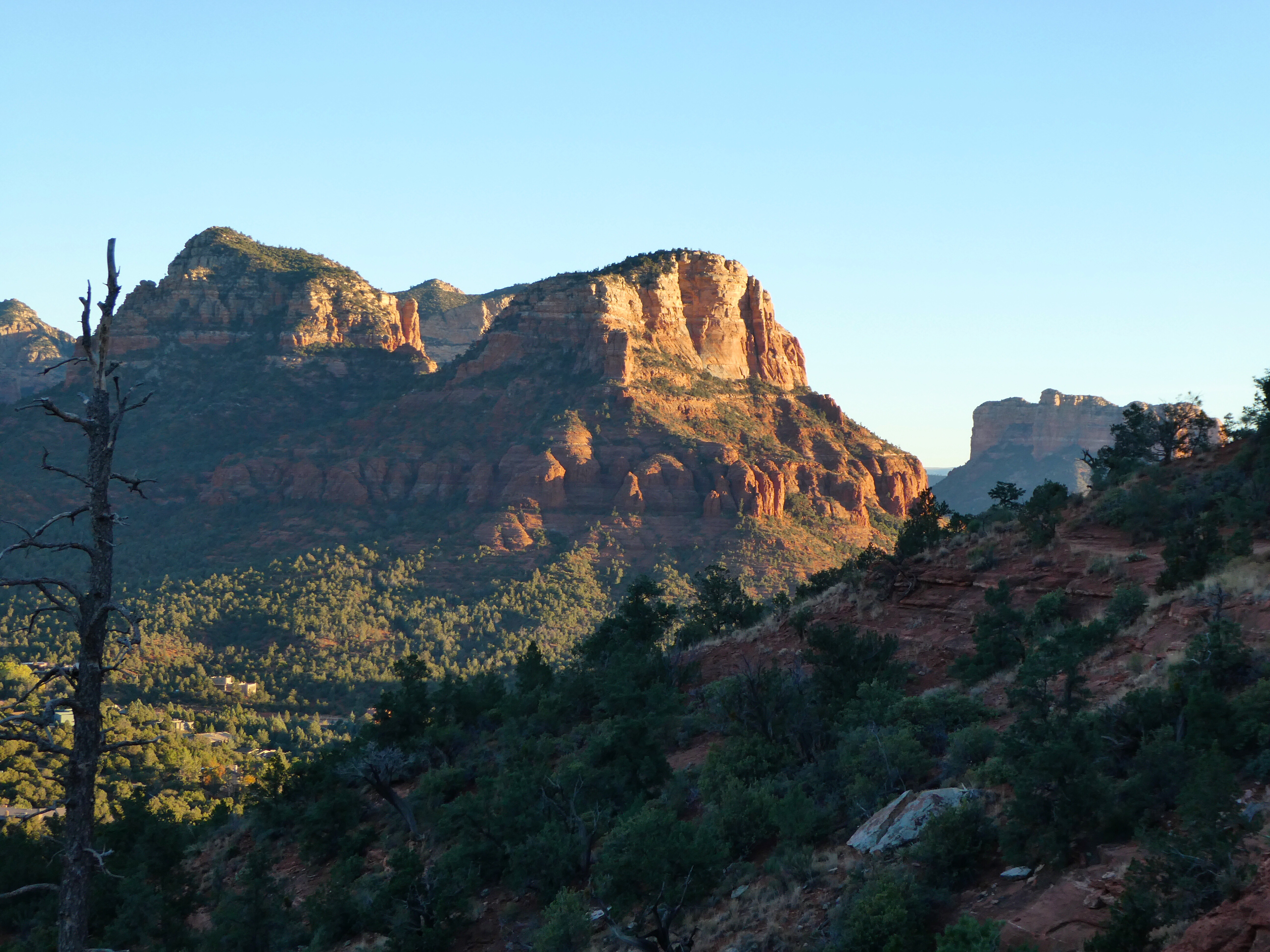
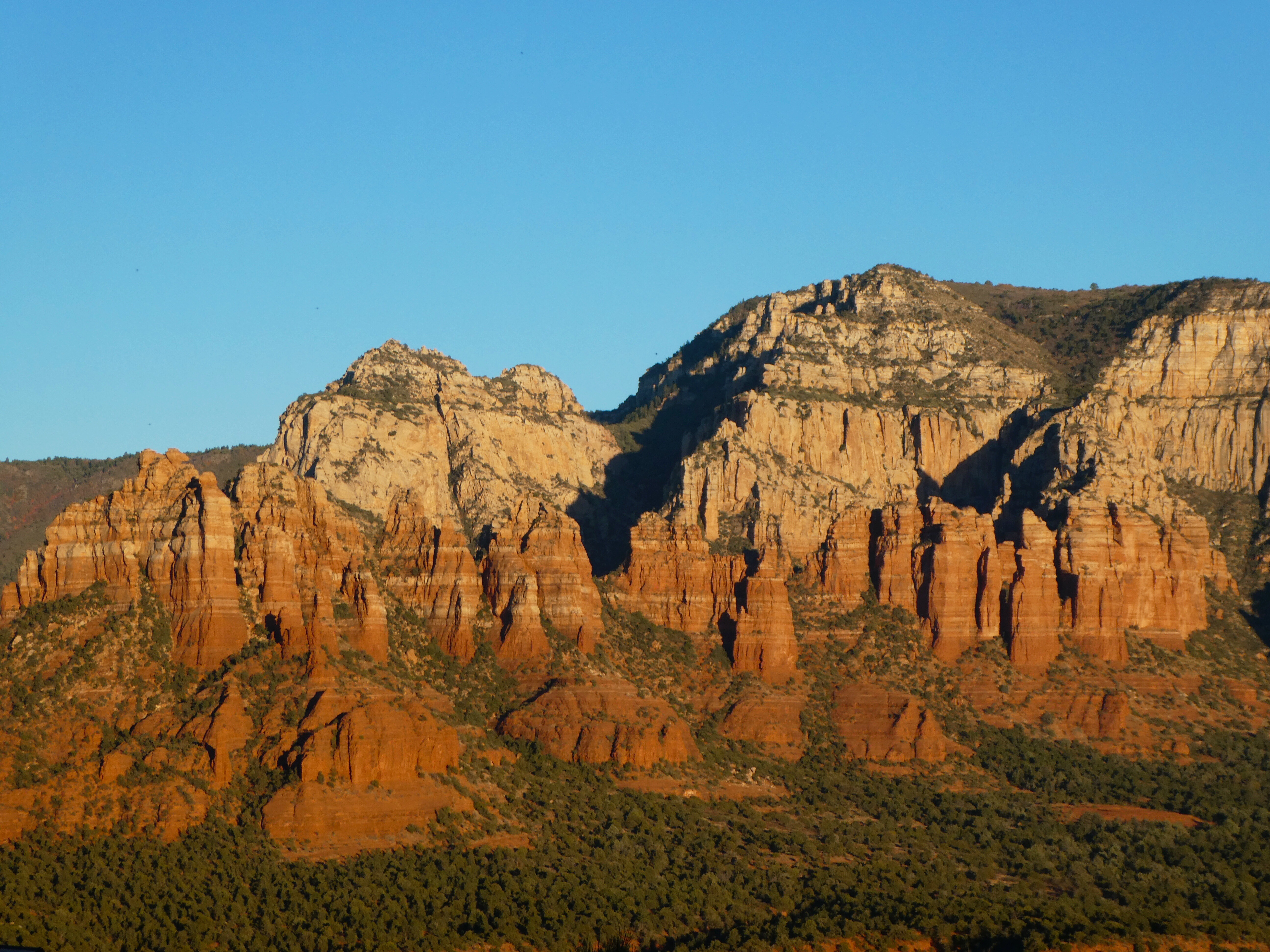
Sedona is an Arizona desert town near Flagstaff that’s surrounded by red-rock buttes, steep canyon walls and pine forests. It’s noted for its mild climate and vibrant arts community. Uptown Sedona is dense with New Age shops, spas and art galleries. On the town’s outskirts, numerous trailheads access Red Rock State Park, which offers bird-watching, hiking and picnicking spots.
Dramatic sandstone formations such as Cathedral Rock and Bell Rock appeal to photographers and enlightenment-seekers, as does the modernist Chapel of the Holy Cross, built into rust-colored rocks. Oak Creek Canyon has trails for hiking and mountain biking, plus sites for camping and fishing. Part of the canyon is home to Slide Rock State Park, named for its natural water chutes, popular for swimming. Native American petroglyphs can be seen in the Coconino National Forest heritage sites V Bar V, Palatki and Honanki (the latter 2 also feature cliff dwellings).
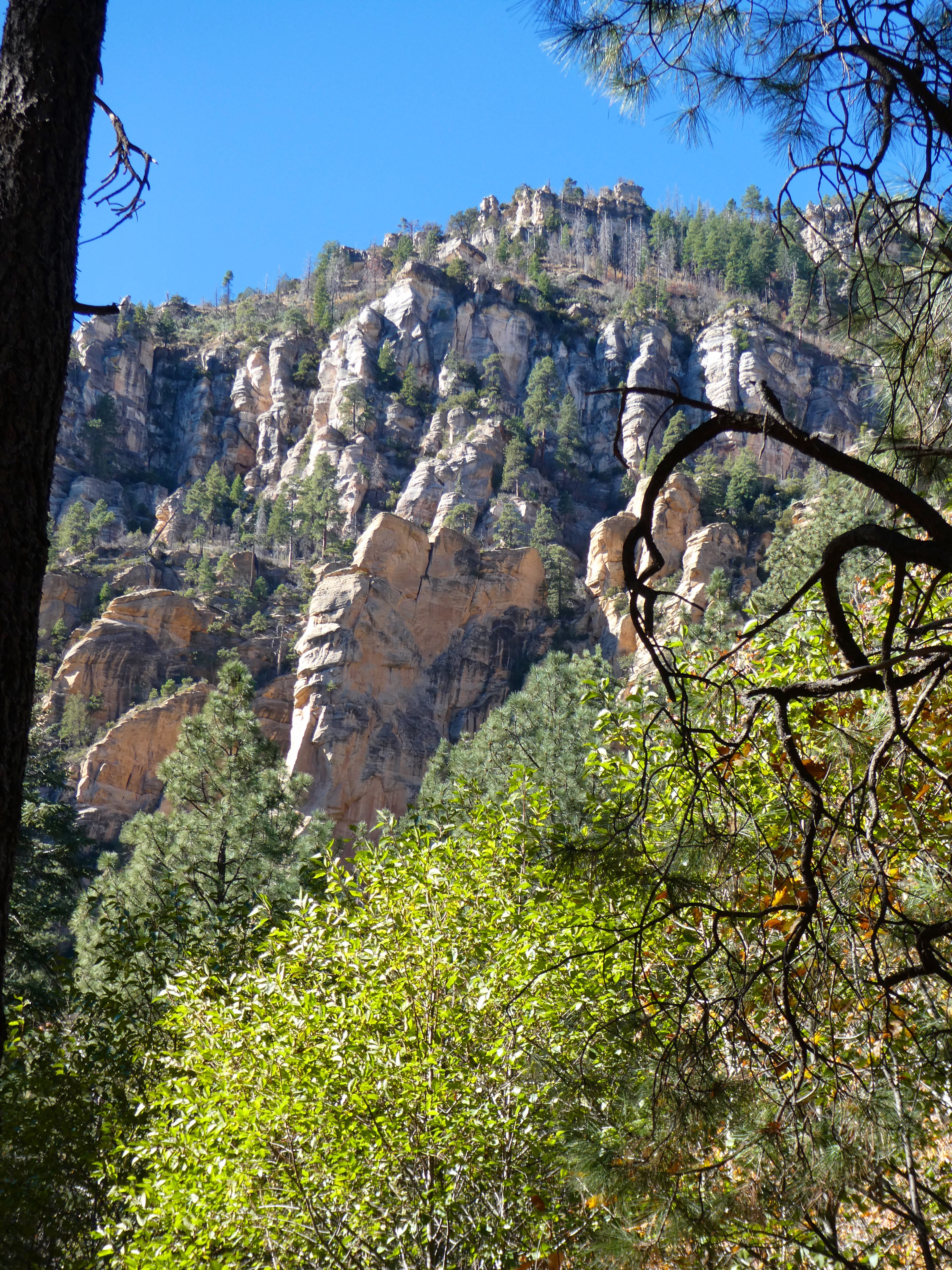
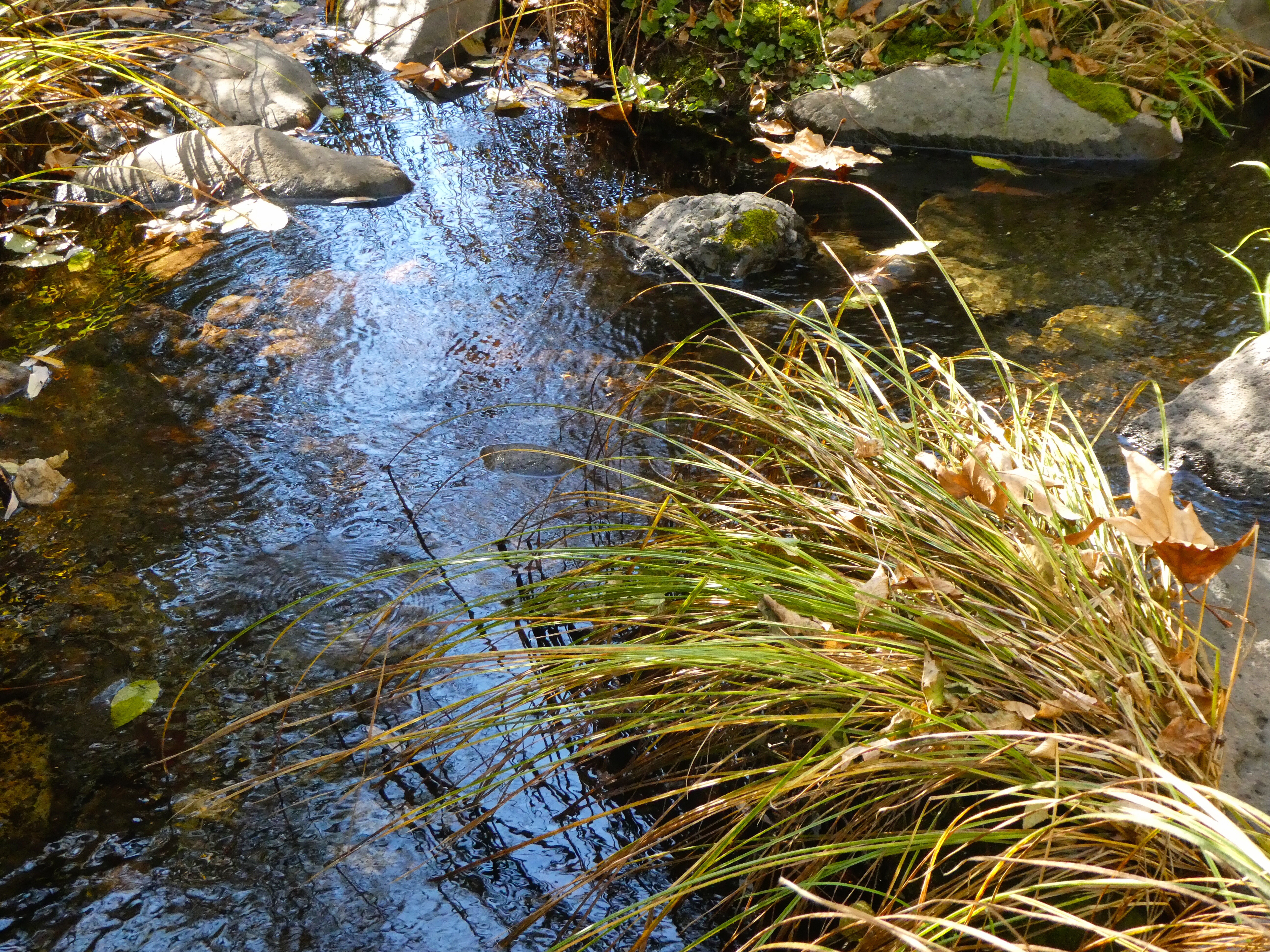
Oak Creek Canyon
Airport Mesa Loop Trail
After visiting one of the four famous Sedona vortexes, we enjoyed a beautiful 4.5 mile sunset hike around Tabletop Mesa.
There is no other hike in the Sedona area that offers such awe-inspiring views as the Sedona Airport Mesa Loop Trail. It offers hikers a 360-degree panorama with views of almost every major red-rock landmark along the perimeter at an elevation of 4,500 feet.


 Since our grandson’s family would not be with us during this Christmas holiday, Sally proposed a road trip to celebrate her birthday and Christmas with her twin sister Julie in Savannah, Georgia. When older sister Jo disclosed her intention to also join us in Savannah, the trip plan was locked in.