Wind Cave National Park
Hot Springs, South Dakota
Driving from the south into the Black Hills of South Dakota, we pass through the town of Hot Springs which was founded as a frontier health spa to capitalize on springs of warm mineral waters rising in Fall River Canyon. The town is set in a sandstone canyon with lovely turn-of-the-century style sandstone buildings. Six major thermal springs which emerge from the ground within the town of Hot Springs converge in a single canyon.
Wind Cave National Park
Wind Cave National Park is in the southwestern corner of South Dakota. It’s known for the vast, underground Wind Cave, with chambers like the Post Office and the Elks Room. Many of the cave’s walls are rich in honeycomb-shaped calcite formations known as boxwork. The park’s prairie and pine forests are home to bison, elk and pronghorn antelopes.
American Indians of the area have known about the opening to Wind Cave and the winds that move in and out of it for centuries. It is a sacred place for many tribes. In 1881 Jesse and Tom Bingham were also attracted to the cave by the whistling noise of the air coming out of the cave. As the story goes, wind was blowing out of the cave entrance with such force that it blew off Tom’s hat. A few days later when Jesse returned to show this phenomenon to some friends, he was surprised to find the wind had switched directions and his hat was sucked into the cave. Today, we understand that the movement of the wind is related to the difference in atmospheric pressure between the cave and the surface.

After touring Wind Cave, we returned to our campsite, and prepared a lovely dinner, featuring Ray’s grilling skills.

Custer State Park
Waking to a gentle rain, we drove north to Custer State Park Visitor Center.
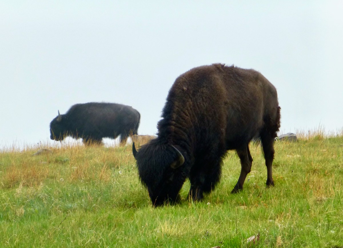
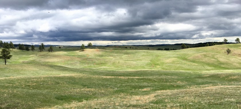
Custer State Park is a state park and wildlife reserve in the Black Hills of southwestern South Dakota, USA. The park covers an area of over 71,000 acres (287 km2) of hilly terrain and is home to a famous herd of 1500 free roaming bison. Elk, coyotes, mule deer, white tailed deer, mountain goats, prairie dogs, bighorn sheep, river otters, pronghorn, cougars, and feral burros also inhabit the park. The park is famous for its scenery, its scenic drives (Needles Highway and the wildlife loop), with views of the bison herd and prairie dog towns.
We encountered lots of Bison, even very near the road. A large herd grazed a few hundred yards away. Newborn calves ran and chased each other, running in and out among the adults.


Custer State Park has many absolutely beautiful campgrounds including at Sylvan and Stockade Lake. Sylvan was not yet open for the season, so we found campsites in the large, hilly, forested campsites above Stockade Lake.
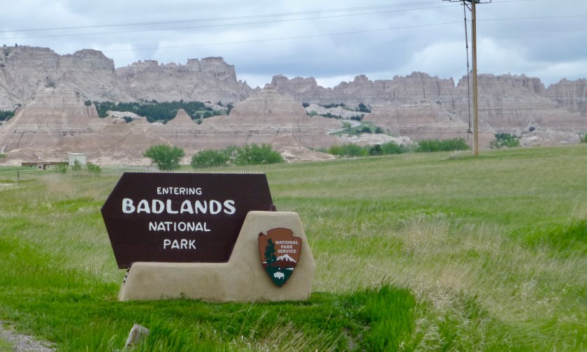
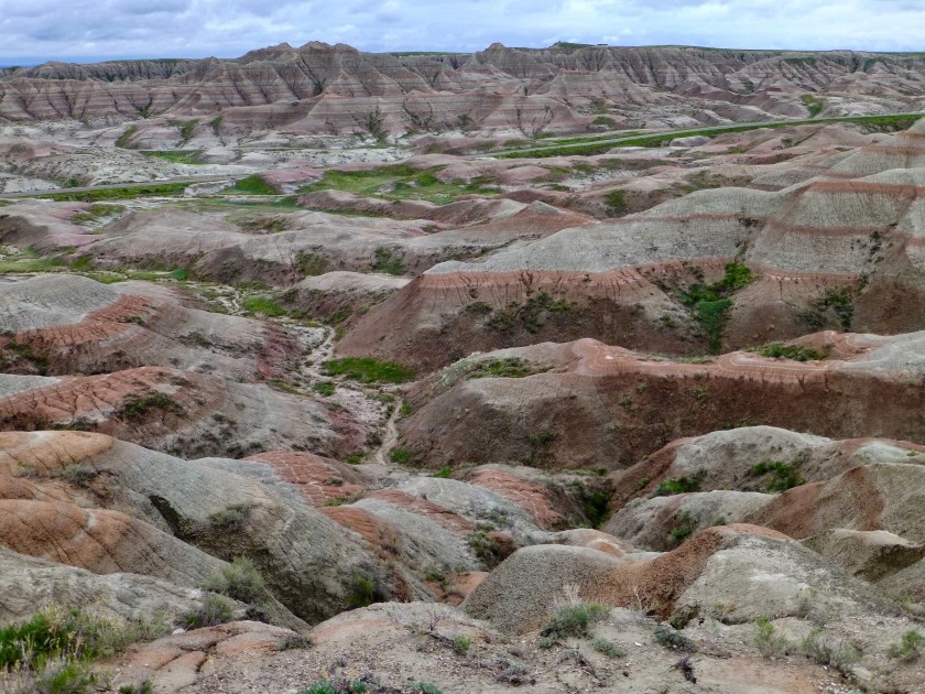
Badlands National Park
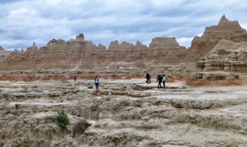
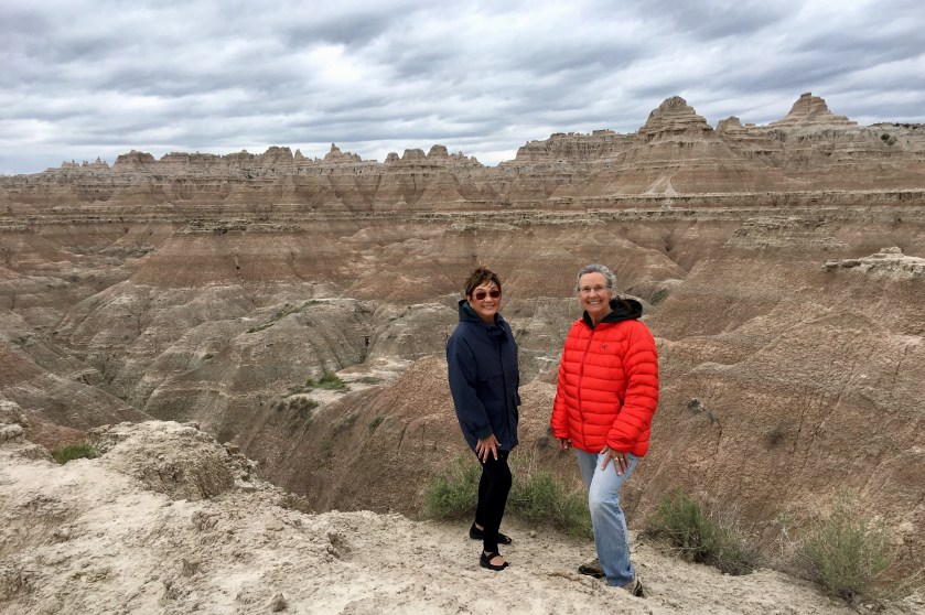
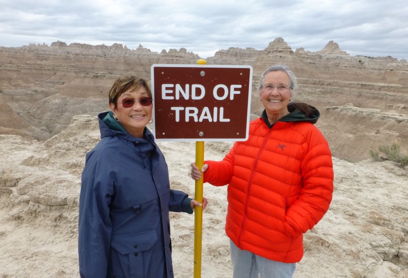
In the morning, we drove southeast to Badlands National Park. The weather remained cloudy and cold, but at least there was no rain. We found campsites at Cedar Pass Campground with views of the Badlands cliffs, stopped at visitor center for maps and orientation and then drove north along the Badlands Loop Road, where we stopped to hike the Cliff Shelf Nature Trail, Window Trail and Door Trails with amazing views of the Badlands formations.
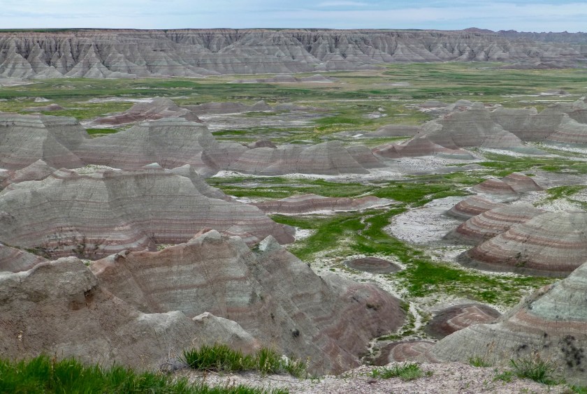
Badlands National Park is in South Dakota. Its dramatic landscapes span layered rock formations, steep canyons and towering spires. Bison, bighorn sheep and prairie dogs inhabit its sprawling grasslands. The Badlands Loop Road (Highway 240) winds past scenic lookouts. Several trails begin near the Ben Reifel Visitor Center. The Fossil Exhibit Trail is a boardwalk with displays on fossils uncovered in the park.
Short hikes, affording excellent views.

After our lovely hikes, we drove back for dinner and a walk around the campground. To our wonder and amazement we found a coin operated hot shower building in the other campground loop! Well in need of cleansing, we all took advantage of this luxurious amenity, then off to bed
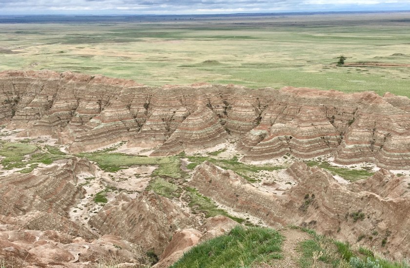
We had light rain and cool temperatures all night. Our plan was to head northwest on the Badlands Loop scenic road, stopping along the way at the lovely overlook pullouts and camp tonight in Sage Campground, having very primitive facilities, but also welcome isolation from other campers.
Highlights of our day included the unexpectedly beautiful, soils deposited near Homestead Overlook.

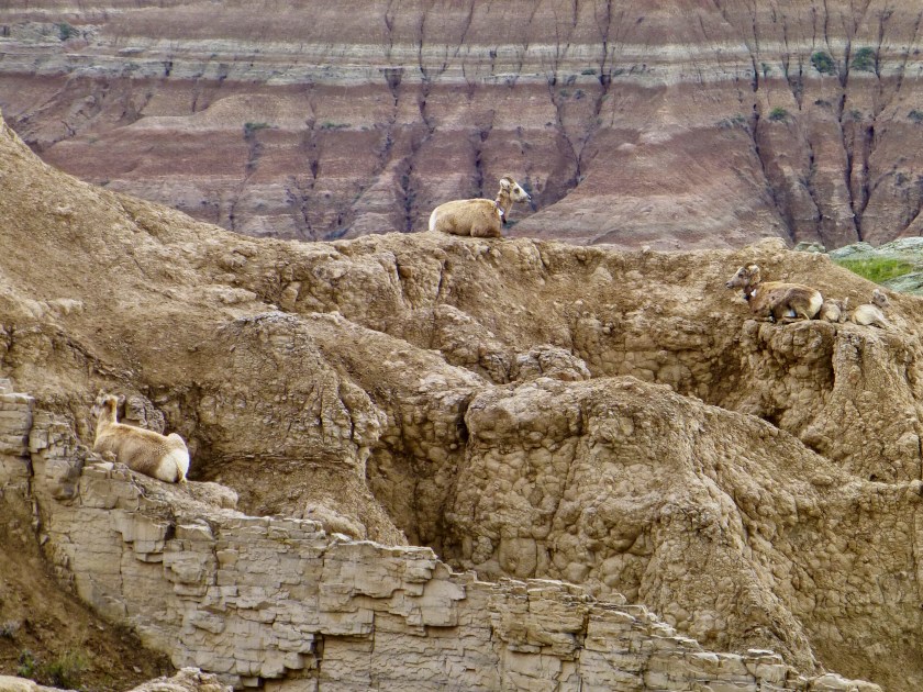
Another highlight was a herd of Bighorn Sheep ewes and lambs, at Pinnacles Overlook.


As it turned out, the shortest road to Sage Campground was closed due to very muddy conditions due to the constant rain. And since snow was forecast for the evening, we decided to press on the Devils Tower.
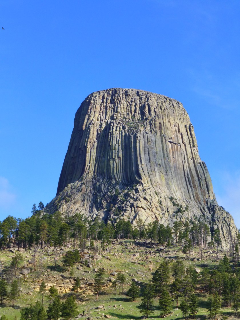
Just after turning off the interstate, the sun came out, temperatures soared into the mid 60’s and the spring scenery along the winding country road became more and more beautiful. Soon lovely views of Devil’s Tower appeared on the horizon. We found space at tree-shaded Belle Fourche Campground and enjoyed dinner, a cloudless sunset and a small campfire with beautiful view of Devil’s Tower.
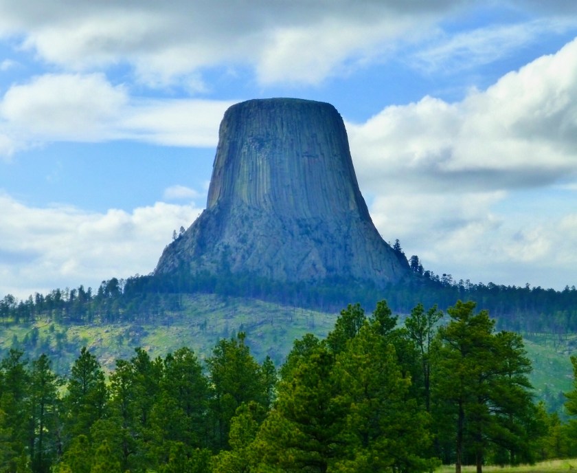
Devil’s Tower National Monument
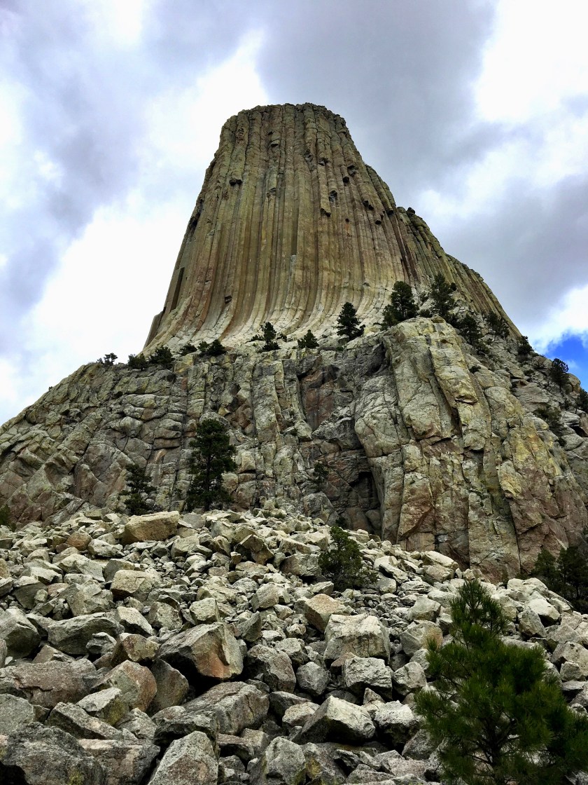
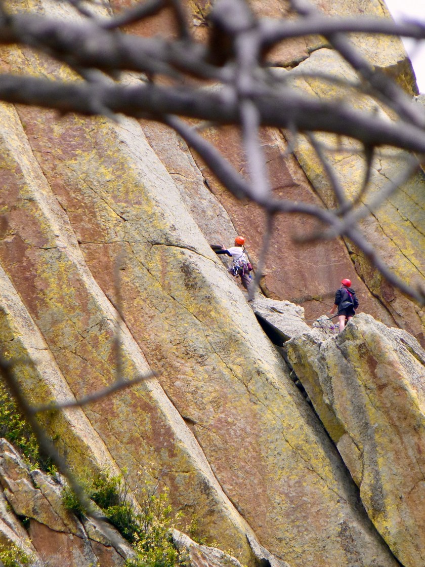
Devils Tower (also called Bear Lodge Butte) is a laccolithic butte composed of igneous rock in the Bear Lodge Mountains (part of the Black Hills) near Hulett, northeastern Wyoming, above the Belle Fourche River. It rises dramatically 1,267 feet (386 m) above the Belle Fourche River, standing 867 feet (265 m) from summit to base. The summit is 5,112 feet (1,559 m) above sea level, and is a mecca for rock climbers.
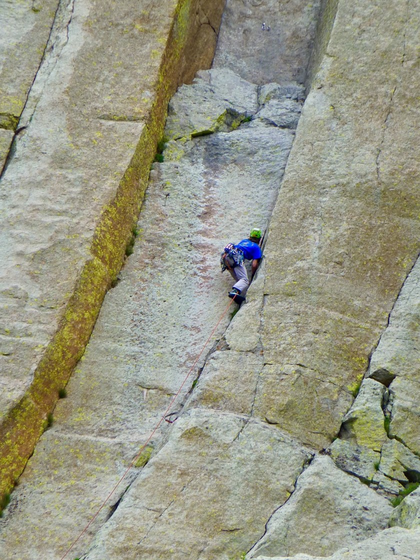
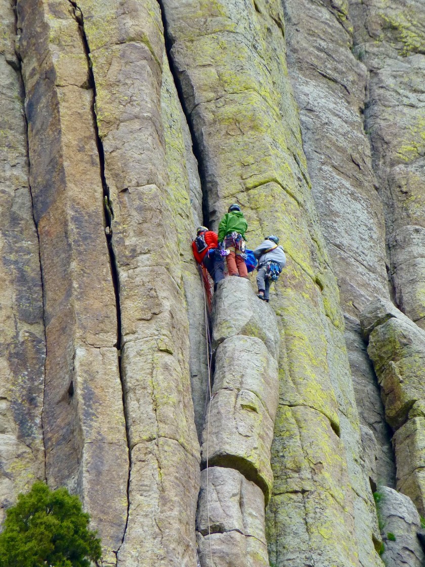
In recent years, climbing Devils Tower National Monument has increased in popularity. The first known ascent of Devils Tower by any method occurred on July 4, 1893, and is accredited to William Rogers and Willard Ripley, local ranchers in the area. They completed this first ascent after constructing a ladder of wooden pegs driven into cracks in the rock face. A few of these wooden pegs are still intact and are visible on the tower when hiking along the 1.3-mile (2.1 km) Tower Trail at Devils Tower National Monument.
Today, hundreds of climbers scale the sheer rock walls of Devils Tower each summer. There are many established and documented climbing routes covering every side of the tower, ascending the various vertical cracks and columns of the rock. The difficulty of these routes range from relatively easy to some of the hardest in the world.
The Tower is sacred to several Plains tribes, including the Lakota, Cheyenne and Kiowa. Because of this, many Indian leaders objected to climbers ascending the monument, considering this to be a desecration. The climbers argued that they had a right to climb the Tower, since it is on federal land. A compromise was eventually reached with a voluntary climbing ban during the month of June when the tribes are conducting ceremonies around the monument. Climbers are asked, but not required, to stay off the Tower in June. According to the PBS documentary In the Light of Reverence, approximately 85% of climbers honor the ban and voluntarily choose not to climb the Tower during the month of June.
We woke to a much appreciated sunny morning, featuring nice views of the rising sun illuminating Devil’s Tower. Sally got up at 6 a.m. to capture some nice photographs.
After breakfast we drove to the visitor center, the took the 1.3 mile hike around the tower, seeing lots of rock climbers scaling it. The quickest recorded ascent of the 900 ft tower is 18 minutes! Most ascents & descents take 6-10 hours.
After hiking (circumnavigating) Devil’s Tower, we returned to camp, ate lunch and drove to the one grocery store in Hulett, Wyoming to replenish our stocks of sparkling water and milk. A very sweet Amish girl was selling baked items outside the store. She said that her group had come from Iowa five years ago and she greatly preferred Wyoming for its less humid environment and milder winters. She sold eggs, unhomogenized milk, cute rabbits, an assortment of pies, cookies, bread, pickles, canned vegetables, jams and lots of other items.
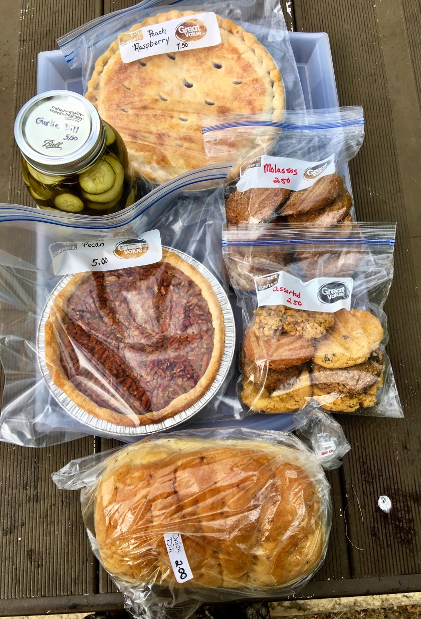
We purchased a raspberry/ peach and pecan pie, molasses and mixed bags of cookies, a loaf of bread and a jar of garlic dill pickles. I was totally unable to resist!
Buffalo Wyoming and Tensleep Canyon
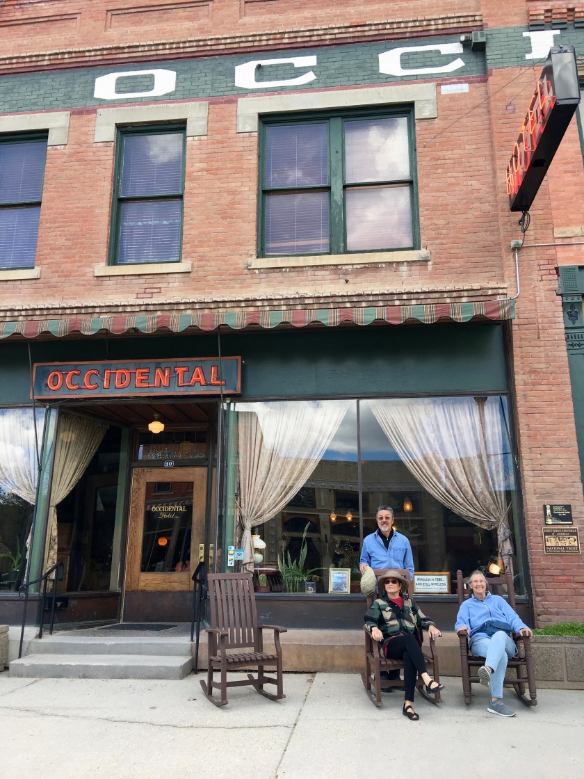
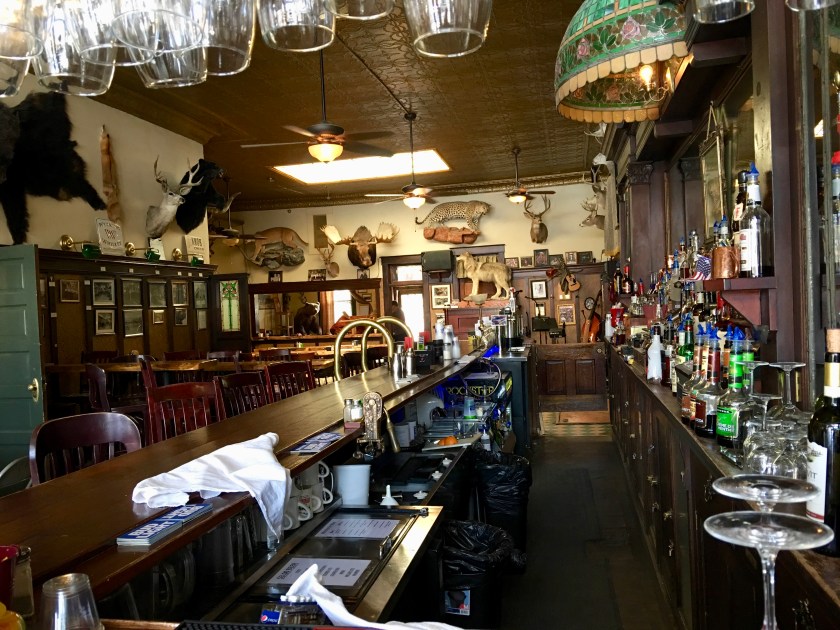
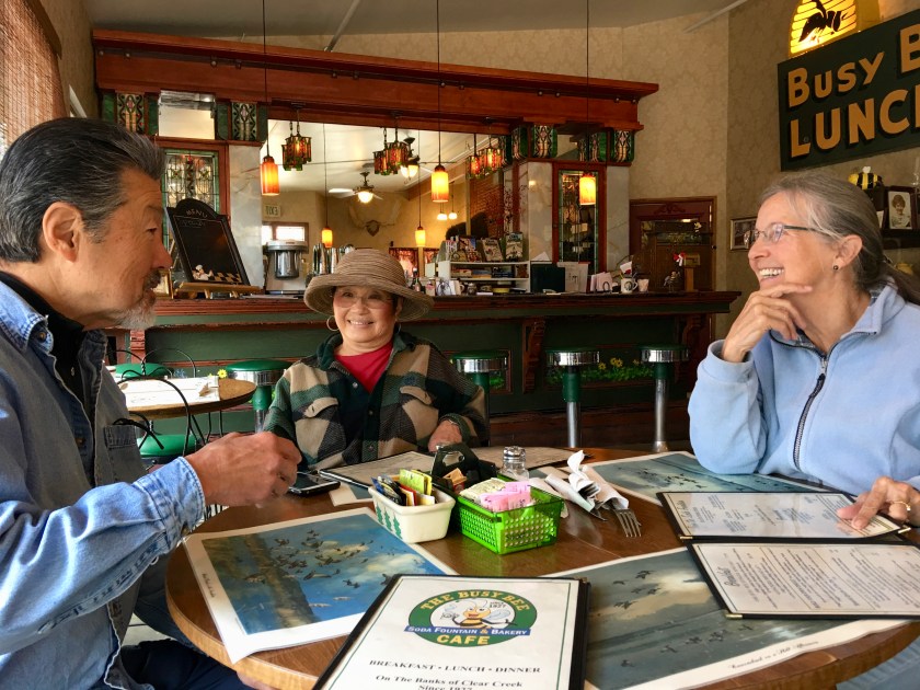
The next morning, we drove from Devil’s Tower to Buffalo, Wyoming. The sun came out, and we walked the main street of the town, toured the 1880’s Occidental Hotel, and ate lunch at the “Busy Bee” restaurant.
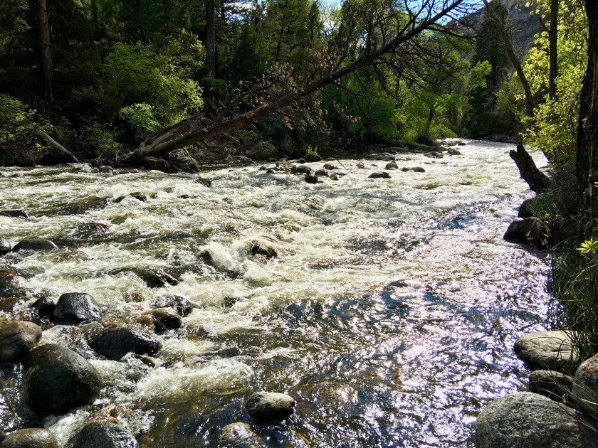
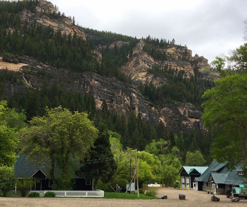
We had expected to stay at one of the many campgrounds in the Bighorn National Forest, but most were still closed this early in the season. Encountering snow at Powder River Pass, we dropped down into beautiful Tensleep Canyon and found the last two campsites at Leigh Creek campground which is on Tensleep Creek. Surrounded by pretty rock cliffs and on the lovely creek, the forested sites were dotted with early spring wildflowers. Most campsites were filled with rock climbers, who love to scale the canyon walls.
Hippies and hunters and cowboys and climbers—these strange bedfellows mingle in relative harmony in north-central Wyoming’s Ten Sleep. Rich in history, this ranching town was the halfway point—or ten “sleeps”—between two major Sioux Indian camps. Ten Sleep was an American Indian rest stop, so-called because it was 10 days’ travel, or “10 sleeps,” from Fort Laramie (southeast) and the Indian Agency on the Stillwater River in Montana (northwest). There are numerous archeological sites throughout the area, with frequent discoveries of artifacts such as arrowheads, pictographs and petroglyphs.


We had a lovely dinner outside in the sunlight, and slept really well, listening to the sound of the rushing creek.
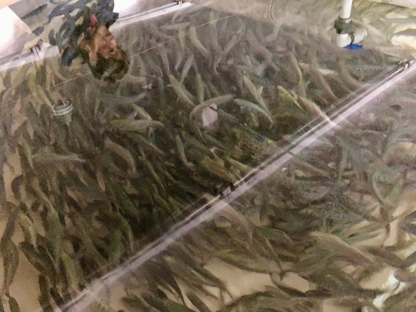
The morning dawned cloudy, cold and rainy, so we decided to make the seven hour drive home, first stopping for a tour of the Wyoming Game and Fish, Tensleep Fish Hatchery. The operations were nicely documented and the staff was friendly and helpful – a much appreciated learning experience.

Getting close to combing your adventures into a book. As always, well done!
I had the same thought, definitely a book someday! Looks like another fabulous trip. Thanks David.